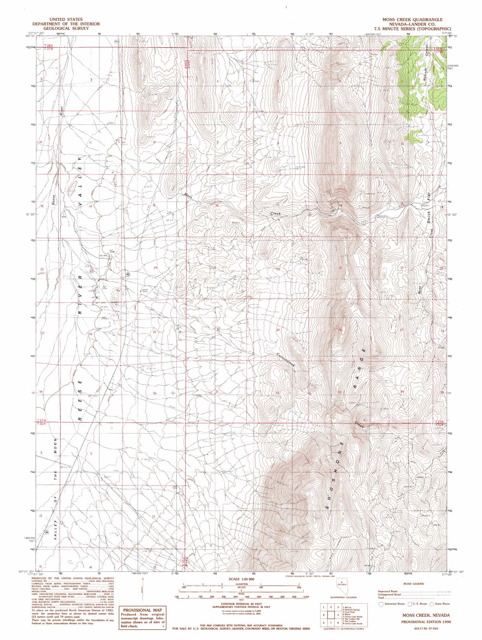
Moss Creek Topo Map Nevada
To zoom in, hover over the map of Moss Creek
USGS Topo Quad 40117b1 - 1:24,000 scale
| Topo Map Name: | Moss Creek |
| USGS Topo Quad ID: | 40117b1 |
| Print Size: | ca. 21 1/4" wide x 27" high |
| Southeast Coordinates: | 40.125° N latitude / 117° W longitude |
| Map Center Coordinates: | 40.1875° N latitude / 117.0625° W longitude |
| U.S. State: | NV |
| Filename: | o40117b1.jpg |
| Download Map JPG Image: | Moss Creek topo map 1:24,000 scale |
| Map Type: | Topographic |
| Topo Series: | 7.5´ |
| Map Scale: | 1:24,000 |
| Source of Map Images: | United States Geological Survey (USGS) |
| Alternate Map Versions: |
Moss Creek NV 1990, updated 1990 Download PDF Buy paper map Moss Creek NV 2011 Download PDF Buy paper map Moss Creek NV 2014 Download PDF Buy paper map |
1:24,000 Topo Quads surrounding Moss Creek
Buffalo Springs Ne |
Mccoy Nw |
Mccoy Ne |
Crippen Canyon |
Mount Lewis |
Wild Range Canyon |
Mccoy |
Redrock Spring |
Goat Peak |
Ferris Creek |
Fish Creek Basin |
Fish Creek Ranch |
Moss Creek |
Carico Lake North |
Rocky Pass |
Mount Moses Se |
The Cedars Sw |
The Cedars |
Carico Lake South |
Wood Spring Canyon |
Gilbert Creek Ne |
Manhattan Mountain Nw |
Manhattan Mountain Ne |
Hall Creek North |
Corral Canyon |
> Back to 40117a1 at 1:100,000 scale
> Back to 40116a1 at 1:250,000 scale
> Back to U.S. Topo Maps home
Moss Creek topo map: Gazetteer
Moss Creek: Areas
Warm Springs Mining Area elevation 1464m 4803′Moss Creek: Flats
Smith Flat elevation 1758m 5767′Moss Creek: Mines
Warm Springs Mine elevation 1460m 4790′Moss Creek: Springs
Cottonwood Spring elevation 2166m 7106′Lake Spring elevation 2205m 7234′
Moss Creek: Streams
Cottonwood Creek elevation 1452m 4763′Moss Creek elevation 1452m 4763′
Moss Creek digital topo map on disk
Buy this Moss Creek topo map showing relief, roads, GPS coordinates and other geographical features, as a high-resolution digital map file on DVD: