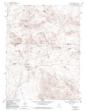
Quartz Mountain Topo Map Nevada
To zoom in, hover over the map of Quartz Mountain
USGS Topo Quad 39117a8 - 1:24,000 scale
| Topo Map Name: | Quartz Mountain |
| USGS Topo Quad ID: | 39117a8 |
| Print Size: | ca. 21 1/4" wide x 27" high |
| Southeast Coordinates: | 39° N latitude / 117.875° W longitude |
| Map Center Coordinates: | 39.0625° N latitude / 117.9375° W longitude |
| U.S. State: | NV |
| Filename: | o39117a8.jpg |
| Download Map JPG Image: | Quartz Mountain topo map 1:24,000 scale |
| Map Type: | Topographic |
| Topo Series: | 7.5´ |
| Map Scale: | 1:24,000 |
| Source of Map Images: | United States Geological Survey (USGS) |
| Alternate Map Versions: |
Quartz Mtn NV 1969, updated 1971 Download PDF Buy paper map Quartz Mtn NV 1969, updated 1980 Download PDF Buy paper map Quartz Mtn. NV 1969, updated 1991 Download PDF Buy paper map Quartz Mountain NV 2011 Download PDF Buy paper map Quartz Mountain NV 2015 Download PDF Buy paper map |
1:24,000 Topo Quads surrounding Quartz Mountain
> Back to 39117a1 at 1:100,000 scale
> Back to 39116a1 at 1:250,000 scale
> Back to U.S. Topo Maps home
Quartz Mountain topo map: Gazetteer
Quartz Mountain: Mines
Arentz Shaft elevation 1624m 5328′Calico Shaft elevation 1617m 5305′
Exchequer Mine elevation 1611m 5285′
Franklin Shaft elevation 1615m 5298′
Gordon Shaft elevation 1627m 5337′
Hasbrouck Mine elevation 1609m 5278′
Huntley Mine elevation 1745m 5725′
Kernick Mine elevation 1597m 5239′
Quartz Mountain Metals Mine elevation 1613m 5291′
San Felipe Mine elevation 1641m 5383′
San Rafael Mine elevation 1624m 5328′
West Mines Corporation Mine elevation 1719m 5639′
White Pine Mine elevation 1726m 5662′
Quartz Mountain: Populated Places
Quartz Mountain (historical) elevation 1621m 5318′Quartz Mountain: Post Offices
Quartz Mountain Post Office (historical) elevation 1621m 5318′Quartz Mountain: Summits
Broken Hills elevation 1953m 6407′Quartz Mountain elevation 1654m 5426′
Quartz Mountain digital topo map on disk
Buy this Quartz Mountain topo map showing relief, roads, GPS coordinates and other geographical features, as a high-resolution digital map file on DVD:


