Dixie Hot Springs Ne Topo Map Nevada
To zoom in, hover over the map of Dixie Hot Springs Ne
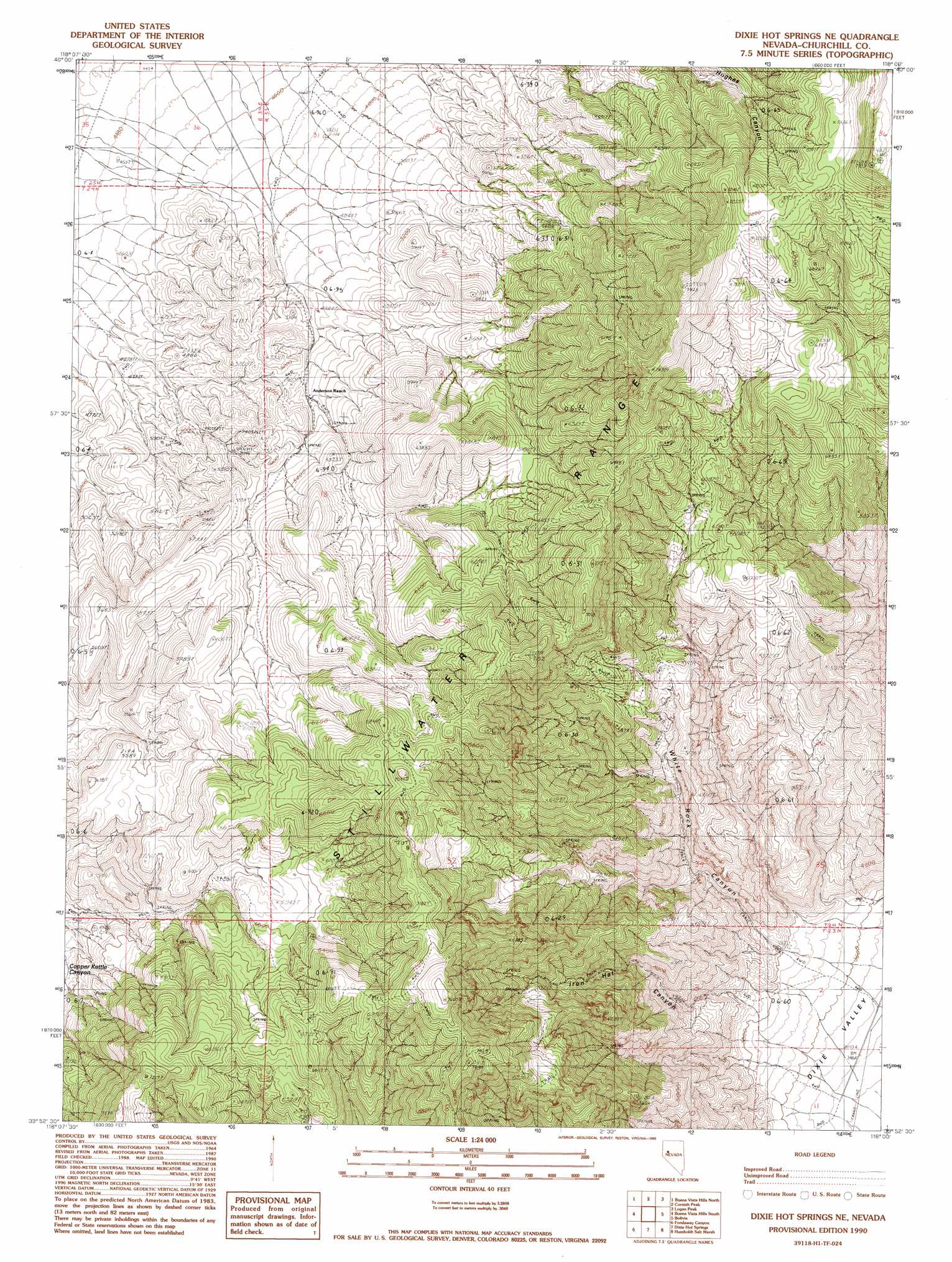
USGS Topo Quad 39118h1 - 1:24,000 scale
| Topo Map Name: | Dixie Hot Springs Ne |
| USGS Topo Quad ID: | 39118h1 |
| Print Size: | ca. 21 1/4" wide x 27" high |
| Southeast Coordinates: | 39.875° N latitude / 118° W longitude |
| Map Center Coordinates: | 39.9375° N latitude / 118.0625° W longitude |
| U.S. State: | NV |
| Filename: | o39118h1.jpg |
| Download Map JPG Image: | Dixie Hot Springs Ne topo map 1:24,000 scale |
| Map Type: | Topographic |
| Topo Series: | 7.5´ |
| Map Scale: | 1:24,000 |
| Source of Map Images: | United States Geological Survey (USGS) |
| Alternate Map Versions: |
Dixie Hot Springs NE NV 1990, updated 1990 Download PDF Buy paper map Dixie Hot Springs NE NV 2011 Download PDF Buy paper map Dixie Hot Springs NE NV 2014 Download PDF Buy paper map |
1:24,000 Topo Quads surrounding Dixie Hot Springs Ne
Coal Canyon |
Buffalo Mountain |
Fisher Canyon |
West Of Mckinney Pass |
Mckinney Pass |
Wildhorse Spring |
Buena Vista Hills North |
Cornish Peak |
Logan Peak |
Fencemaker Pass |
Lone Rock |
Buena Vista Hills South |
Dixie Hot Springs Ne |
Bolivia |
Boyer Ranch |
Lone Rock Se |
Fondaway Canyon |
Dixie Hot Springs |
Humboldt Salt Marsh |
Bernice Canyon |
Cox Canyon |
I X L Canyon |
Dixie Valley |
Cow Canyon |
Byers Canyon |
> Back to 39118e1 at 1:100,000 scale
> Back to 39118a1 at 1:250,000 scale
> Back to U.S. Topo Maps home
Dixie Hot Springs Ne topo map: Gazetteer
Dixie Hot Springs Ne: Mines
Bradshaw Copper Mine elevation 1785m 5856′Dixie Hot Springs Ne: Valleys
Iron Hat Canyon elevation 1156m 3792′Dixie Hot Springs Ne digital topo map on disk
Buy this Dixie Hot Springs Ne topo map showing relief, roads, GPS coordinates and other geographical features, as a high-resolution digital map file on DVD: