Industry Topo Map Illinois
To zoom in, hover over the map of Industry
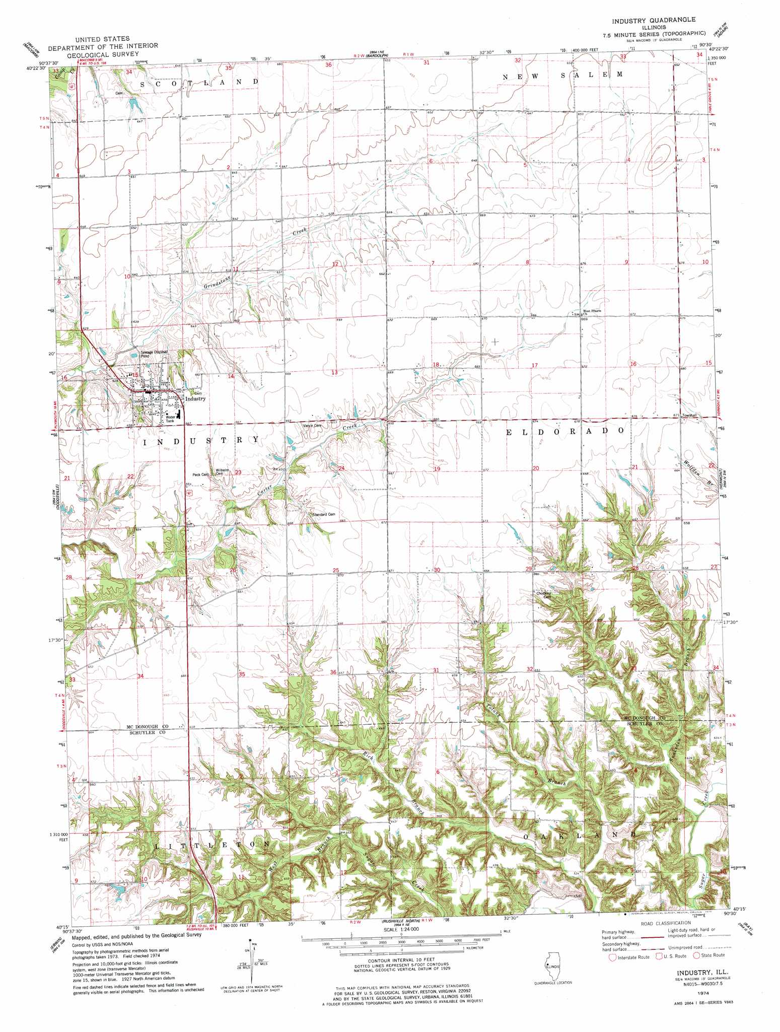
USGS Topo Quad 40090c5 - 1:24,000 scale
| Topo Map Name: | Industry |
| USGS Topo Quad ID: | 40090c5 |
| Print Size: | ca. 21 1/4" wide x 27" high |
| Southeast Coordinates: | 40.25° N latitude / 90.5° W longitude |
| Map Center Coordinates: | 40.3125° N latitude / 90.5625° W longitude |
| U.S. State: | IL |
| Filename: | o40090c5.jpg |
| Download Map JPG Image: | Industry topo map 1:24,000 scale |
| Map Type: | Topographic |
| Topo Series: | 7.5´ |
| Map Scale: | 1:24,000 |
| Source of Map Images: | United States Geological Survey (USGS) |
| Alternate Map Versions: |
Industry IL 1974, updated 1977 Download PDF Buy paper map Industry IL 2012 Download PDF Buy paper map Industry IL 2015 Download PDF Buy paper map |
1:24,000 Topo Quads surrounding Industry
Blandinsville |
Good Hope |
Bushnell West |
Bushnell East |
Blyton |
Colchester |
Macomb |
Bardolph |
Adair |
Smithfield |
Fandon |
Doddsville |
Industry |
Vermont |
Ipava |
Camden |
Erwin |
Rushville North |
Ray |
Astoria |
Lake Mount Sterling |
Ripley |
Rushville South |
Beardstown |
Clear Lake |
> Back to 40090a1 at 1:100,000 scale
> Back to 40090a1 at 1:250,000 scale
> Back to U.S. Topo Maps home
Industry topo map: Gazetteer
Industry: Populated Places
Industry elevation 201m 659′Stewardsville (historical) elevation 203m 666′
Industry: Streams
Rich Branch elevation 165m 541′Snakeden Branch elevation 161m 528′
Industry digital topo map on disk
Buy this Industry topo map showing relief, roads, GPS coordinates and other geographical features, as a high-resolution digital map file on DVD: