Rushville North Topo Map Illinois
To zoom in, hover over the map of Rushville North
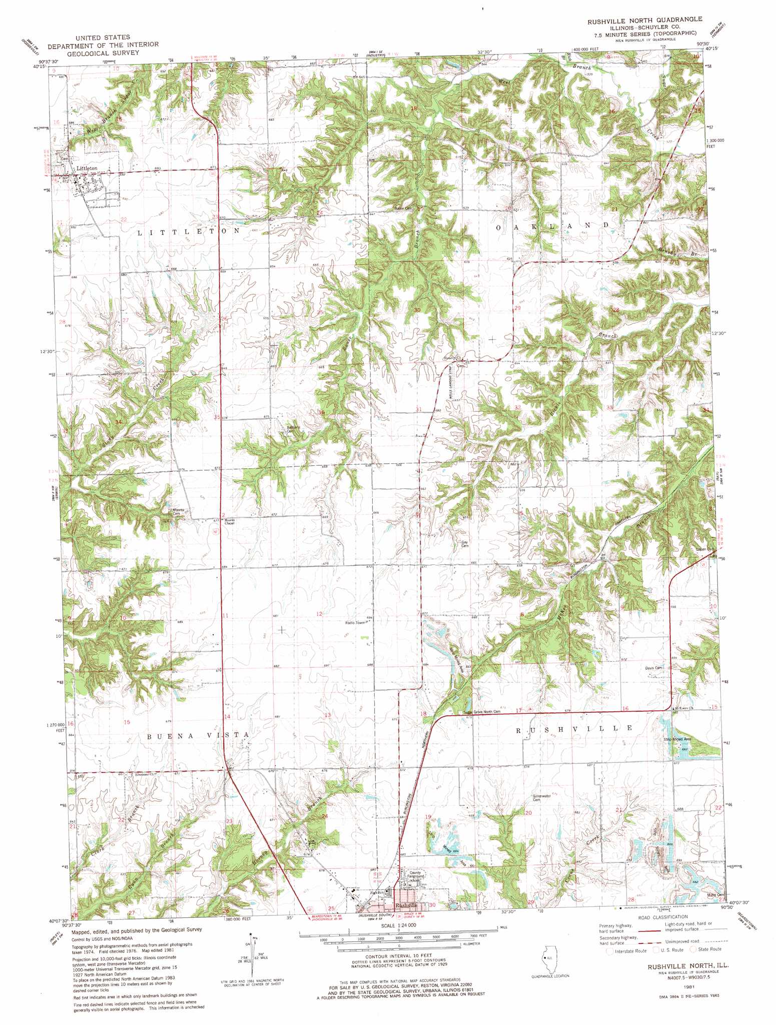
USGS Topo Quad 40090b5 - 1:24,000 scale
| Topo Map Name: | Rushville North |
| USGS Topo Quad ID: | 40090b5 |
| Print Size: | ca. 21 1/4" wide x 27" high |
| Southeast Coordinates: | 40.125° N latitude / 90.5° W longitude |
| Map Center Coordinates: | 40.1875° N latitude / 90.5625° W longitude |
| U.S. State: | IL |
| Filename: | o40090b5.jpg |
| Download Map JPG Image: | Rushville North topo map 1:24,000 scale |
| Map Type: | Topographic |
| Topo Series: | 7.5´ |
| Map Scale: | 1:24,000 |
| Source of Map Images: | United States Geological Survey (USGS) |
| Alternate Map Versions: |
Rushville NE IL 1975, updated 1976 Download PDF Buy paper map Rushville North IL 1981, updated 1981 Download PDF Buy paper map Rushville North IL 2012 Download PDF Buy paper map Rushville North IL 2015 Download PDF Buy paper map |
1:24,000 Topo Quads surrounding Rushville North
Colchester |
Macomb |
Bardolph |
Adair |
Smithfield |
Fandon |
Doddsville |
Industry |
Vermont |
Ipava |
Camden |
Erwin |
Rushville North |
Ray |
Astoria |
Lake Mount Sterling |
Ripley |
Rushville South |
Beardstown |
Clear Lake |
Mount Sterling |
Versailles |
Cooperstown |
Arenzville West |
Arenzville East |
> Back to 40090a1 at 1:100,000 scale
> Back to 40090a1 at 1:250,000 scale
> Back to U.S. Topo Maps home
Rushville North topo map: Gazetteer
Rushville North: Airports
Randolph M Wells Airport elevation 182m 597′Rushville North: Dams
Gill Lake Dam elevation 178m 583′Rushville North: Parks
Schuyler County Fairground elevation 207m 679′Rushville North: Populated Places
Littleton elevation 207m 679′Oakland Center elevation 174m 570′
Rushville North: Reservoirs
Gill Lake elevation 178m 583′Rushville North: Streams
Bauer Branch elevation 165m 541′Tolans Branch elevation 163m 534′
West Branch Sugar Creek elevation 159m 521′
Rushville North digital topo map on disk
Buy this Rushville North topo map showing relief, roads, GPS coordinates and other geographical features, as a high-resolution digital map file on DVD: