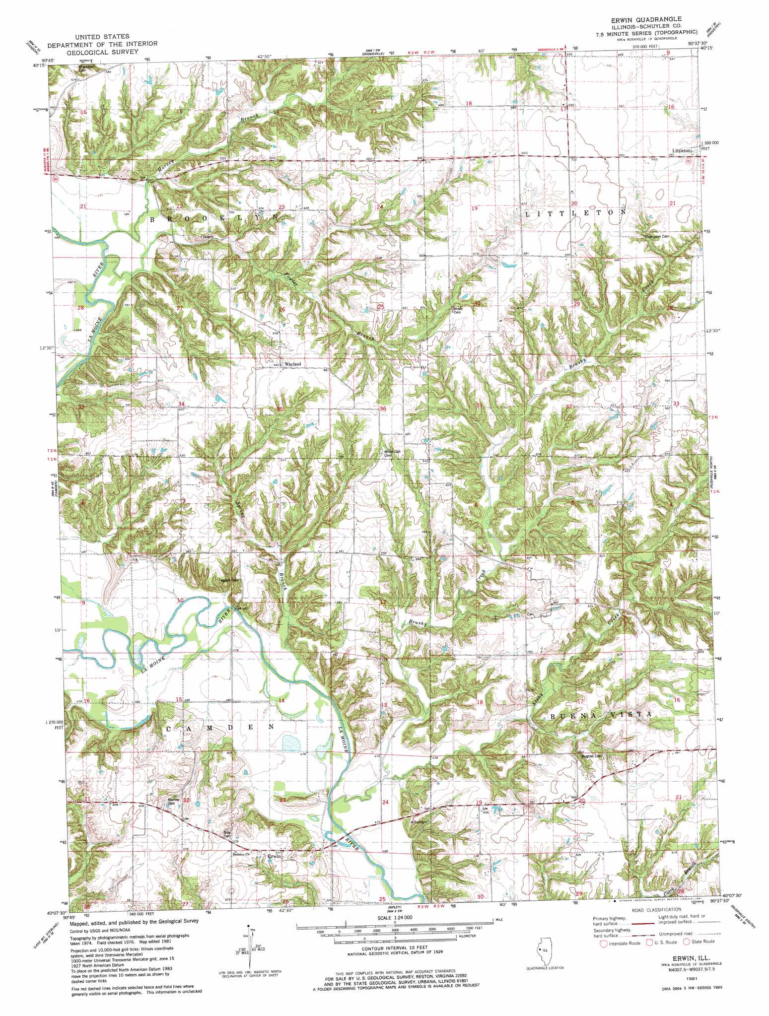
Erwin Topo Map Illinois
To zoom in, hover over the map of Erwin
USGS Topo Quad 40090b6 - 1:24,000 scale
| Topo Map Name: | Erwin |
| USGS Topo Quad ID: | 40090b6 |
| Print Size: | ca. 21 1/4" wide x 27" high |
| Southeast Coordinates: | 40.125° N latitude / 90.625° W longitude |
| Map Center Coordinates: | 40.1875° N latitude / 90.6875° W longitude |
| U.S. State: | IL |
| Filename: | o40090b6.jpg |
| Download Map JPG Image: | Erwin topo map 1:24,000 scale |
| Map Type: | Topographic |
| Topo Series: | 7.5´ |
| Map Scale: | 1:24,000 |
| Source of Map Images: | United States Geological Survey (USGS) |
| Alternate Map Versions: |
Erwin IL 1981, updated 1981 Download PDF Buy paper map Erwin IL 2012 Download PDF Buy paper map Erwin IL 2015 Download PDF Buy paper map |
1:24,000 Topo Quads surrounding Erwin
Fountain Green |
Colchester |
Macomb |
Bardolph |
Adair |
Plymouth |
Fandon |
Doddsville |
Industry |
Vermont |
Augusta |
Camden |
Erwin |
Rushville North |
Ray |
Clayton |
Lake Mount Sterling |
Ripley |
Rushville South |
Beardstown |
Kellerville |
Mount Sterling |
Versailles |
Cooperstown |
Arenzville West |
> Back to 40090a1 at 1:100,000 scale
> Back to 40090a1 at 1:250,000 scale
> Back to U.S. Topo Maps home
Erwin topo map: Gazetteer
Erwin: Mines
Pit 1 Cedar Creek Mine elevation 189m 620′Pit 5 Cedar Creek Mine elevation 183m 600′
Pit 7 Cedar Creek Mine elevation 181m 593′
Erwin: Populated Places
Erwin elevation 170m 557′Hale Ridge (historical) elevation 191m 626′
Wayland elevation 203m 666′
Erwin: Streams
Brushy Creek elevation 142m 465′Fowler Branch elevation 149m 488′
Honey Branch elevation 147m 482′
Spring Creek elevation 140m 459′
Stony Creek elevation 143m 469′
Erwin digital topo map on disk
Buy this Erwin topo map showing relief, roads, GPS coordinates and other geographical features, as a high-resolution digital map file on DVD: