Tingley Ne Topo Map Iowa
To zoom in, hover over the map of Tingley Ne
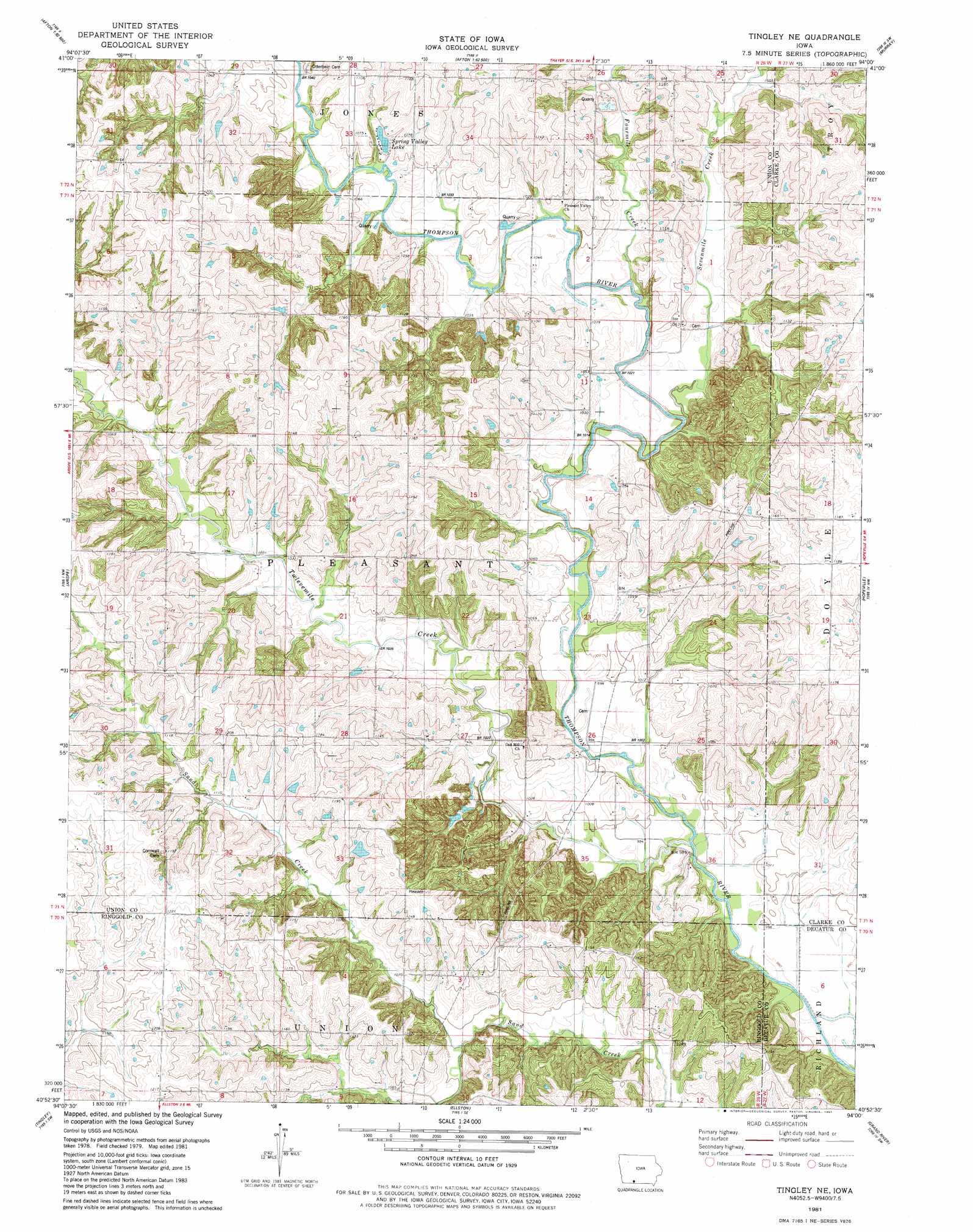
USGS Topo Quad 40094h1 - 1:24,000 scale
| Topo Map Name: | Tingley Ne |
| USGS Topo Quad ID: | 40094h1 |
| Print Size: | ca. 21 1/4" wide x 27" high |
| Southeast Coordinates: | 40.875° N latitude / 94° W longitude |
| Map Center Coordinates: | 40.9375° N latitude / 94.0625° W longitude |
| U.S. State: | IA |
| Filename: | o40094h1.jpg |
| Download Map JPG Image: | Tingley Ne topo map 1:24,000 scale |
| Map Type: | Topographic |
| Topo Series: | 7.5´ |
| Map Scale: | 1:24,000 |
| Source of Map Images: | United States Geological Survey (USGS) |
| Alternate Map Versions: |
Tingley NE IA 1981, updated 1981 Download PDF Buy paper map Tingley NE IA 2010 Download PDF Buy paper map Tingley NE IA 2013 Download PDF Buy paper map Tingley NE IA 2015 Download PDF Buy paper map |
1:24,000 Topo Quads surrounding Tingley Ne
Zion |
Macksburg |
Lorimor North |
East Peru |
Truro |
Creston East |
Afton |
Lorimor South |
Murray |
Osceola |
Shannon City |
Arispe |
Tingley Ne |
Hopeville |
Lacelle |
Diagonal |
Tingley |
Ellston |
Grand River |
Van Wert |
Benton |
Mount Ayr |
Kellerton |
Lamoni North |
Davis City |
> Back to 40094e1 at 1:100,000 scale
> Back to 40094a1 at 1:250,000 scale
> Back to U.S. Topo Maps home
Tingley Ne topo map: Gazetteer
Tingley Ne: Bridges
Grand River Bridge elevation 310m 1017′Tingley Ne: Mines
Thayer Quarry elevation 311m 1020′Tingley Ne: Post Offices
Olio Post Office (historical) elevation 311m 1020′Silver Street Post Office (historical) elevation 366m 1200′
Tingley Ne: Reservoirs
Spring Valley Lake elevation 314m 1030′Tingley Ne: Streams
Fourmile Creek elevation 303m 994′Sevenmile Creek elevation 301m 987′
Twelvemile Creek elevation 297m 974′
Tingley Ne digital topo map on disk
Buy this Tingley Ne topo map showing relief, roads, GPS coordinates and other geographical features, as a high-resolution digital map file on DVD: