Swanton Topo Map Nebraska
To zoom in, hover over the map of Swanton
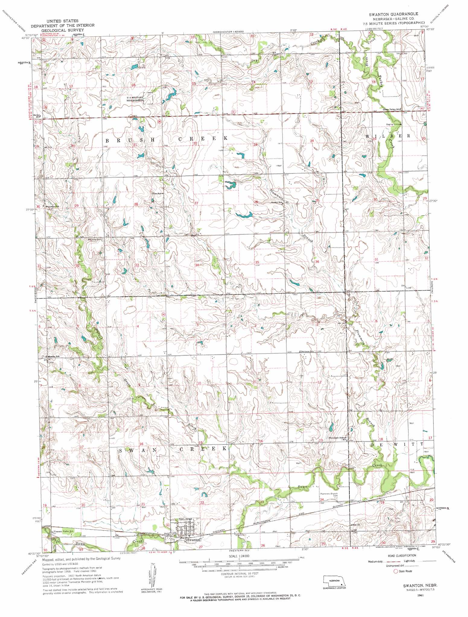
USGS Topo Quad 40097d1 - 1:24,000 scale
| Topo Map Name: | Swanton |
| USGS Topo Quad ID: | 40097d1 |
| Print Size: | ca. 21 1/4" wide x 27" high |
| Southeast Coordinates: | 40.375° N latitude / 97° W longitude |
| Map Center Coordinates: | 40.4375° N latitude / 97.0625° W longitude |
| U.S. State: | NE |
| Filename: | O40097d1.jpg |
| Download Map JPG Image: | Swanton topo map 1:24,000 scale |
| Map Type: | Topographic |
| Topo Series: | 7.5´ |
| Map Scale: | 1:24,000 |
| Source of Map Images: | United States Geological Survey (USGS) |
| Alternate Map Versions: |
Swanton NE 1961, updated 1963 Download PDF Buy paper map Swanton NE 2011 Download PDF Buy paper map Swanton NE 2014 Download PDF Buy paper map |
1:24,000 Topo Quads surrounding Swanton
Friend |
Dorchester Nw |
Dorchester |
Crete North |
Denton |
Friend Se |
Dorchester Sw |
Pleasant Hill |
Crete South |
Hallam |
Tobias |
Western |
Swanton |
Wilber |
Clatonia |
Daykin |
Western Sw |
Western Se |
Plymouth |
Beatrice West |
Gladstone |
Fairbury |
Jansen |
Harbine |
Odell Ne |
> Back to 40097a1 at 1:100,000 scale
> Back to 40096a1 at 1:250,000 scale
> Back to U.S. Topo Maps home
Swanton topo map: Gazetteer
Swanton: Parks
Swanton City Park elevation 415m 1361′Swanton: Populated Places
Swanton elevation 412m 1351′Swanton: Post Offices
Swanton Post Office elevation 413m 1354′Swanton: Streams
Brush Creek elevation 406m 1332′Dry Creek elevation 406m 1332′
North Fork Swan Creek elevation 412m 1351′
Plummers Branch elevation 398m 1305′
South Fork Swan Creek elevation 412m 1351′
Walnut Grove Creek elevation 402m 1318′
Swanton digital topo map on disk
Buy this Swanton topo map showing relief, roads, GPS coordinates and other geographical features, as a high-resolution digital map file on DVD: