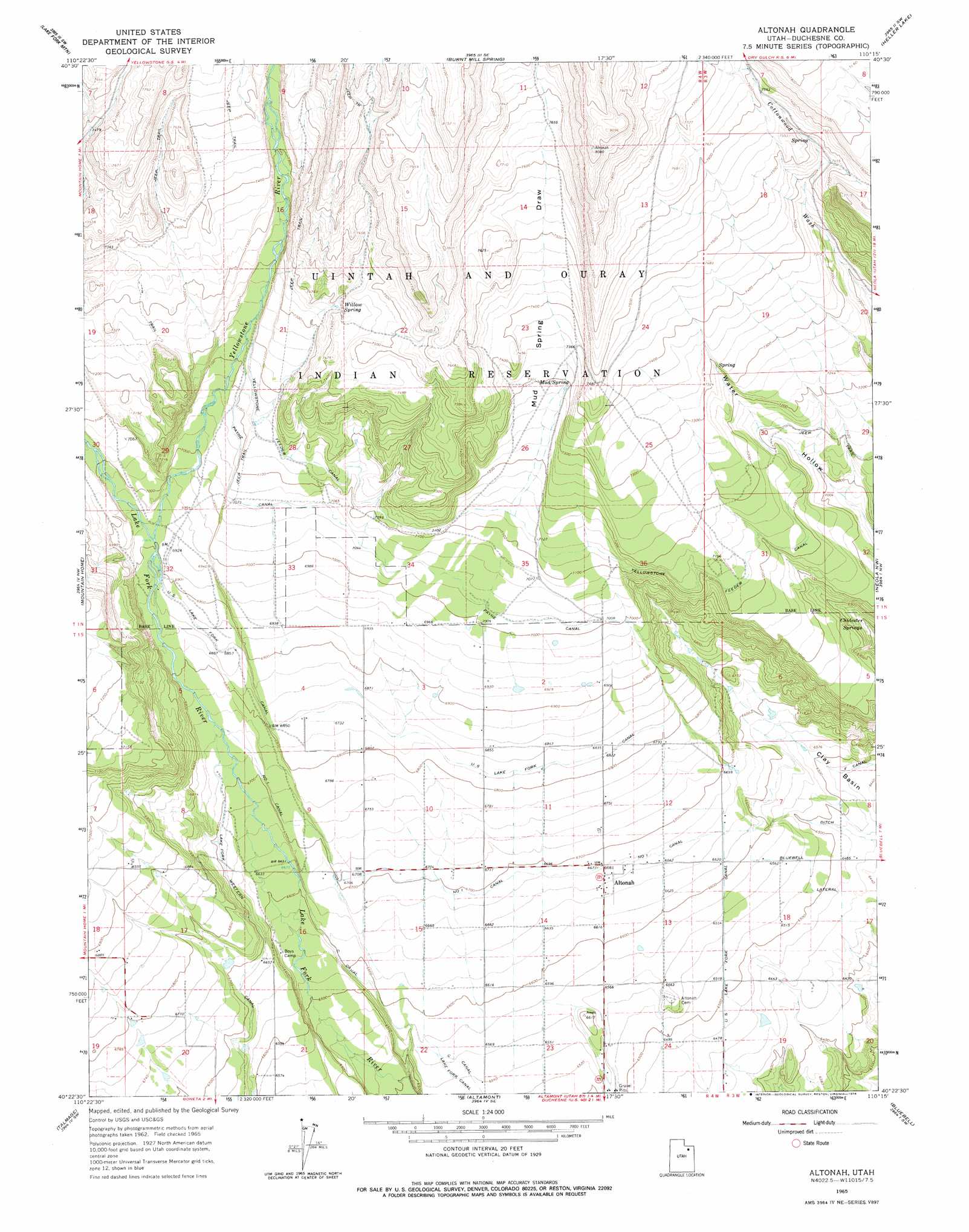
Altonah Topo Map Utah
To zoom in, hover over the map of Altonah
USGS Topo Quad 40110d3 - 1:24,000 scale
| Topo Map Name: | Altonah |
| USGS Topo Quad ID: | 40110d3 |
| Print Size: | ca. 21 1/4" wide x 27" high |
| Southeast Coordinates: | 40.375° N latitude / 110.25° W longitude |
| Map Center Coordinates: | 40.4375° N latitude / 110.3125° W longitude |
| U.S. State: | UT |
| Filename: | o40110d3.jpg |
| Download Map JPG Image: | Altonah topo map 1:24,000 scale |
| Map Type: | Topographic |
| Topo Series: | 7.5´ |
| Map Scale: | 1:24,000 |
| Source of Map Images: | United States Geological Survey (USGS) |
| Alternate Map Versions: |
Altonah UT 1965, updated 1967 Download PDF Buy paper map Altonah UT 1965, updated 1978 Download PDF Buy paper map Altonah UT 2010 Download PDF Buy paper map Altonah UT 2014 Download PDF Buy paper map |
1:24,000 Topo Quads surrounding Altonah
Oweep Creek |
Garfield Basin |
Mount Emmons |
Bollie Lake |
Rasmussen Lakes |
Kidney Lake |
Lake Fork Mountain |
Burnt Mill Spring |
Heller Lake |
Pole Creek Cave |
Dry Mountain |
Mountain Home |
Altonah |
Neola Nw |
Neola |
Blacktail Mountain |
Talmage |
Altamont |
Bluebell |
Hancock Cove |
Rabbit Gulch |
Duchesne |
Duchesne Ne |
Bridgeland |
Myton |
> Back to 40110a1 at 1:100,000 scale
> Back to 40110a1 at 1:250,000 scale
> Back to U.S. Topo Maps home
Altonah topo map: Gazetteer
Altonah: Canals
Lake Fork Western Canal elevation 2033m 6669′Number 1 Canal elevation 2042m 6699′
Payne Canal elevation 2144m 7034′
United States Lake Fork Canal elevation 2019m 6624′
Altonah: Populated Places
Altonah elevation 2034m 6673′Altonah: Springs
Chidester Springs elevation 2078m 6817′Mud Spring elevation 2224m 7296′
Willow Spring elevation 2251m 7385′
Altonah: Streams
Yellowstone River elevation 2106m 6909′Altonah: Valleys
Mud Spring Draw elevation 2177m 7142′Altonah digital topo map on disk
Buy this Altonah topo map showing relief, roads, GPS coordinates and other geographical features, as a high-resolution digital map file on DVD: