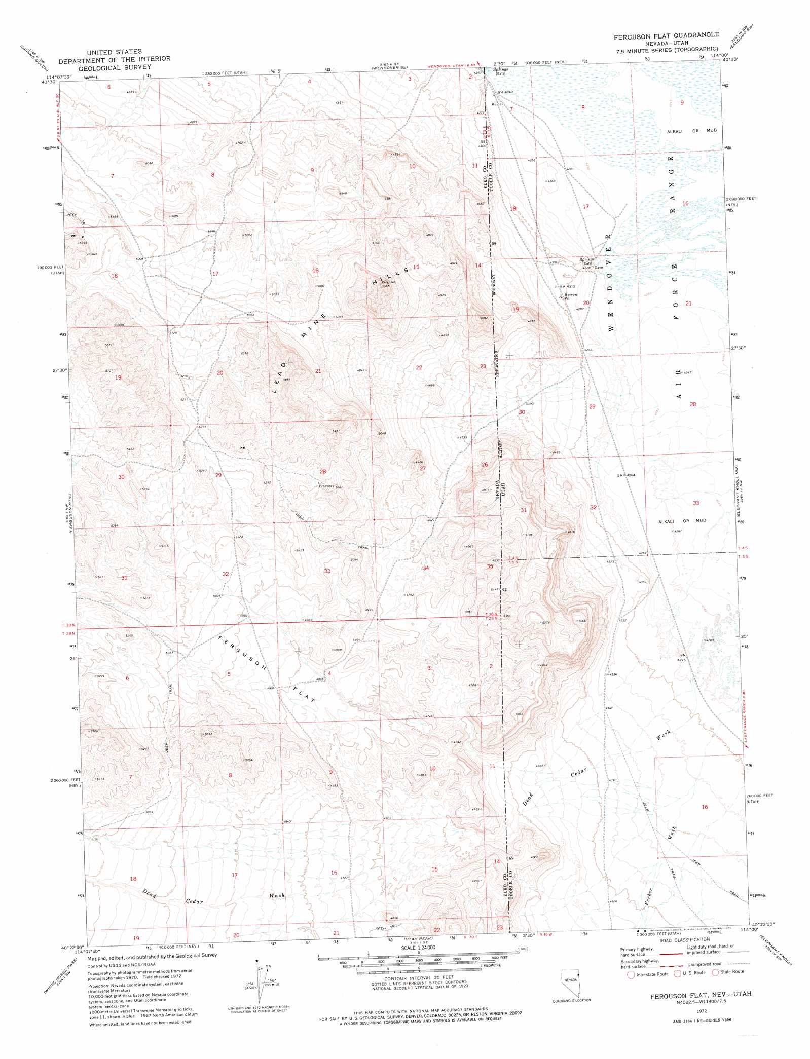
Ferguson Flat Topo Map Nevada
To zoom in, hover over the map of Ferguson Flat
USGS Topo Quad 40114d1 - 1:24,000 scale
| Topo Map Name: | Ferguson Flat |
| USGS Topo Quad ID: | 40114d1 |
| Print Size: | ca. 21 1/4" wide x 27" high |
| Southeast Coordinates: | 40.375° N latitude / 114° W longitude |
| Map Center Coordinates: | 40.4375° N latitude / 114.0625° W longitude |
| U.S. States: | NV, UT |
| Filename: | o40114d1.jpg |
| Download Map JPG Image: | Ferguson Flat topo map 1:24,000 scale |
| Map Type: | Topographic |
| Topo Series: | 7.5´ |
| Map Scale: | 1:24,000 |
| Source of Map Images: | United States Geological Survey (USGS) |
| Alternate Map Versions: |
Ferguson Flat NV 1972, updated 1975 Download PDF Buy paper map Ferguson Flat NV 2011 Download PDF Buy paper map Ferguson Flat NV 2012 Download PDF Buy paper map Ferguson Flat NV 2014 Download PDF Buy paper map |
1:24,000 Topo Quads surrounding Ferguson Flat
Morgan Pass |
Ola |
Wendover |
Silsbee |
Salduro |
Lion Spring |
Spring Gulch |
Wendover Se |
Salduro Sw |
Salduro Se |
Goshute Peak |
Ferguson Mountain |
Ferguson Flat |
Elephant Knoll Nw |
Elephant Knoll Ne |
White Horse Mountain |
White Horse Pass |
Utah Peak |
Elephant Knoll |
Elephant Knoll Se |
Kinsley Mountain |
Ferber Peak Nw |
Ferber Peak |
Ochre Mountain |
Gold Hill |
> Back to 40114a1 at 1:100,000 scale
> Back to 40114a1 at 1:250,000 scale
> Back to U.S. Topo Maps home
Ferguson Flat topo map: Gazetteer
Ferguson Flat: Flats
Ferguson Flat elevation 1500m 4921′Ferguson Flat: Ranges
Lead Mine Hills elevation 1639m 5377′Ferguson Flat: Streams
Dead Cedar Wash elevation 1305m 4281′Ferber Wash elevation 1304m 4278′
Ferguson Creek elevation 1388m 4553′
Ferguson Flat: Valleys
Dead Cedar Wash elevation 1305m 4281′Ferber Wash elevation 1304m 4278′
Ferguson Flat digital topo map on disk
Buy this Ferguson Flat topo map showing relief, roads, GPS coordinates and other geographical features, as a high-resolution digital map file on DVD: