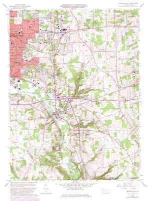
Sharon East Topo Map Pennsylvania
To zoom in, hover over the map of Sharon East
USGS Topo Quad 41080b4 - 1:24,000 scale
| Topo Map Name: | Sharon East |
| USGS Topo Quad ID: | 41080b4 |
| Print Size: | ca. 21 1/4" wide x 27" high |
| Southeast Coordinates: | 41.125° N latitude / 80.375° W longitude |
| Map Center Coordinates: | 41.1875° N latitude / 80.4375° W longitude |
| U.S. State: | PA |
| Filename: | o41080b4.jpg |
| Download Map JPG Image: | Sharon East topo map 1:24,000 scale |
| Map Type: | Topographic |
| Topo Series: | 7.5´ |
| Map Scale: | 1:24,000 |
| Source of Map Images: | United States Geological Survey (USGS) |
| Alternate Map Versions: |
Sharon East PA 1958, updated 1960 Download PDF Buy paper map Sharon East PA 1958, updated 1972 Download PDF Buy paper map Sharon East PA 1958, updated 1981 Download PDF Buy paper map Sharon East PA 1958, updated 1982 Download PDF Buy paper map Sharon East PA 1958, updated 1982 Download PDF Buy paper map Sharon East PA 2010 Download PDF Buy paper map Sharon East PA 2013 Download PDF Buy paper map Sharon East PA 2016 Download PDF Buy paper map |
1:24,000 Topo Quads surrounding Sharon East
> Back to 41080a1 at 1:100,000 scale
> Back to 41080a1 at 1:250,000 scale
> Back to U.S. Topo Maps home
Sharon East topo map: Gazetteer
Sharon East: Airports
Hermitage Airport elevation 339m 1112′Sharon Airport elevation 356m 1167′
Sharon East: Lakes
Buhl Lake elevation 316m 1036′Sharon East: Parks
Buhl Park elevation 331m 1085′Sharon East: Populated Places
Bethel elevation 330m 1082′Bobbys Corners elevation 295m 967′
Carbon elevation 317m 1040′
Dutch Hill elevation 357m 1171′
F M Corners elevation 309m 1013′
Farrell elevation 298m 977′
Five Points elevation 356m 1167′
Furnace Hill elevation 295m 967′
Hann Hill elevation 357m 1171′
Hermitage elevation 328m 1076′
Hickory Corners elevation 331m 1085′
Neshannock elevation 343m 1125′
New Virginia elevation 363m 1190′
Sharon elevation 305m 1000′
Trouts Corners elevation 353m 1158′
West Middlesex elevation 265m 869′
Wheatland elevation 265m 869′
Sharon East: Ridges
Keel Ridge elevation 389m 1276′Sharon East: Streams
Bobby Run elevation 258m 846′Hogback Run elevation 255m 836′
Turkey Run elevation 248m 813′
Sharon East: Summits
Stony Hill elevation 352m 1154′Sharon East digital topo map on disk
Buy this Sharon East topo map showing relief, roads, GPS coordinates and other geographical features, as a high-resolution digital map file on DVD:


