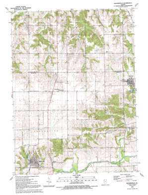
Matherville Topo Map Illinois
To zoom in, hover over the map of Matherville
USGS Topo Quad 41090c5 - 1:24,000 scale
| Topo Map Name: | Matherville |
| USGS Topo Quad ID: | 41090c5 |
| Print Size: | ca. 21 1/4" wide x 27" high |
| Southeast Coordinates: | 41.25° N latitude / 90.5° W longitude |
| Map Center Coordinates: | 41.3125° N latitude / 90.5625° W longitude |
| U.S. State: | IL |
| Filename: | o41090c5.jpg |
| Download Map JPG Image: | Matherville topo map 1:24,000 scale |
| Map Type: | Topographic |
| Topo Series: | 7.5´ |
| Map Scale: | 1:24,000 |
| Source of Map Images: | United States Geological Survey (USGS) |
| Alternate Map Versions: |
Matherville IL 1953, updated 1957 Download PDF Buy paper map Matherville IL 1953, updated 1977 Download PDF Buy paper map Matherville IL 1991, updated 1992 Download PDF Buy paper map Matherville IL 2012 Download PDF Buy paper map Matherville IL 2015 Download PDF Buy paper map |
1:24,000 Topo Quads surrounding Matherville
> Back to 41090a1 at 1:100,000 scale
> Back to 41090a1 at 1:250,000 scale
> Back to U.S. Topo Maps home
Matherville topo map: Gazetteer
Matherville: Airports
Weihler Airport elevation 245m 803′Matherville: Dams
Lake Matherville Dam elevation 220m 721′Matherville: Mines
Coal Valley Mine elevation 244m 800′Gilchrist Mine elevation 212m 695′
Matherville: Populated Places
Boden elevation 199m 652′Cable elevation 203m 666′
Matherville elevation 228m 748′
Orangemans Hall elevation 247m 810′
Preemption elevation 247m 810′
Sherrard elevation 244m 800′
Matherville: Post Offices
Matherville Post Office elevation 228m 748′Preemption Post Office elevation 246m 807′
Matherville: Reservoirs
Lake Matherville elevation 220m 721′Matherville: Streams
Camp Creek elevation 194m 636′Coal Creek elevation 192m 629′
Matherville digital topo map on disk
Buy this Matherville topo map showing relief, roads, GPS coordinates and other geographical features, as a high-resolution digital map file on DVD:


