Alexis Topo Map Illinois
To zoom in, hover over the map of Alexis
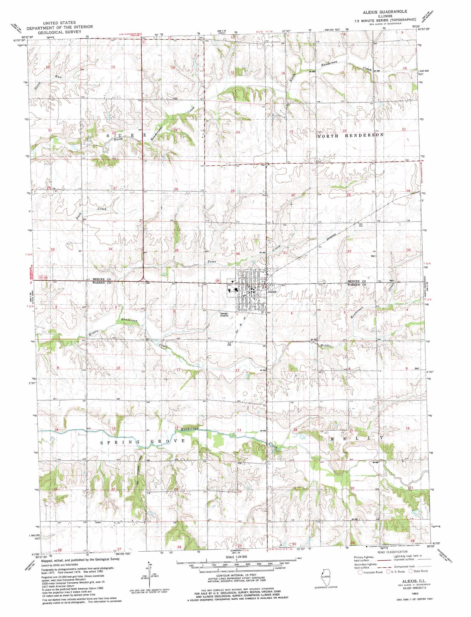
USGS Topo Quad 41090a5 - 1:24,000 scale
| Topo Map Name: | Alexis |
| USGS Topo Quad ID: | 41090a5 |
| Print Size: | ca. 21 1/4" wide x 27" high |
| Southeast Coordinates: | 41° N latitude / 90.5° W longitude |
| Map Center Coordinates: | 41.0625° N latitude / 90.5625° W longitude |
| U.S. State: | IL |
| Filename: | o41090a5.jpg |
| Download Map JPG Image: | Alexis topo map 1:24,000 scale |
| Map Type: | Topographic |
| Topo Series: | 7.5´ |
| Map Scale: | 1:24,000 |
| Source of Map Images: | United States Geological Survey (USGS) |
| Alternate Map Versions: |
Alexis IL 1982, updated 1984 Download PDF Buy paper map Alexis IL 2012 Download PDF Buy paper map Alexis IL 2015 Download PDF Buy paper map |
1:24,000 Topo Quads surrounding Alexis
Buffalo Prairie |
Reynolds |
Matherville |
Orion |
Andover |
Aledo West |
Aledo East |
Viola |
New Windsor |
Woodhull |
Seaton |
Little York |
Alexis |
North Henderson |
Wataga |
Rozetta |
Monmouth |
Cameron |
Galesburg West |
Galesburg East |
Kirkwood West |
Kirkwood East |
Berwick |
Abingdon |
De Long |
> Back to 41090a1 at 1:100,000 scale
> Back to 41090a1 at 1:250,000 scale
> Back to U.S. Topo Maps home
Alexis topo map: Gazetteer
Alexis: Populated Places
Alexis elevation 213m 698′Alexis: Streams
Toms Creek elevation 191m 626′Alexis digital topo map on disk
Buy this Alexis topo map showing relief, roads, GPS coordinates and other geographical features, as a high-resolution digital map file on DVD: