Portsmouth Topo Map Iowa
To zoom in, hover over the map of Portsmouth
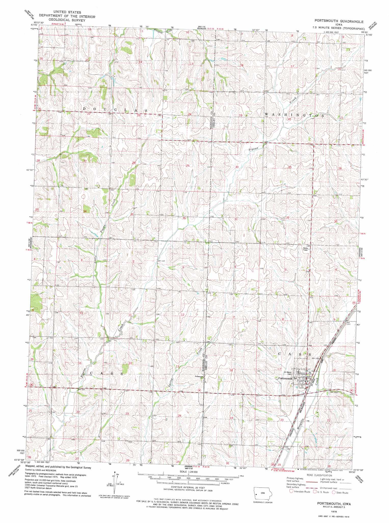
USGS Topo Quad 41095f5 - 1:24,000 scale
| Topo Map Name: | Portsmouth |
| USGS Topo Quad ID: | 41095f5 |
| Print Size: | ca. 21 1/4" wide x 27" high |
| Southeast Coordinates: | 41.625° N latitude / 95.5° W longitude |
| Map Center Coordinates: | 41.6875° N latitude / 95.5625° W longitude |
| U.S. State: | IA |
| Filename: | o41095f5.jpg |
| Download Map JPG Image: | Portsmouth topo map 1:24,000 scale |
| Map Type: | Topographic |
| Topo Series: | 7.5´ |
| Map Scale: | 1:24,000 |
| Source of Map Images: | United States Geological Survey (USGS) |
| Alternate Map Versions: |
Portsmouth IA 1978, updated 1978 Download PDF Buy paper map Portsmouth IA 2010 Download PDF Buy paper map Portsmouth IA 2013 Download PDF Buy paper map Portsmouth IA 2015 Download PDF Buy paper map |
1:24,000 Topo Quads surrounding Portsmouth
Moorhead |
Dunlap Nw |
Dunlap Ne |
Dow City |
Earling Ne |
Moorhead Se |
Dunlap Sw |
Dunlap |
Earling |
Defiance |
Logan |
Woodbine |
Portsmouth |
Panama |
Harlan |
Beebeetown |
Hard Scratch |
Persia |
Shelby |
Corley |
Honey Creek |
Underwood |
Neola |
Avoca Nw |
Avoca |
> Back to 41095e1 at 1:100,000 scale
> Back to 41094a1 at 1:250,000 scale
> Back to U.S. Topo Maps home
Portsmouth topo map: Gazetteer
Portsmouth: Populated Places
Portsmouth elevation 373m 1223′Portsmouth: Post Offices
Portsmouth Post Office elevation 373m 1223′Portsmouth: Streams
Little Pigeon Creek elevation 366m 1200′Portsmouth digital topo map on disk
Buy this Portsmouth topo map showing relief, roads, GPS coordinates and other geographical features, as a high-resolution digital map file on DVD: