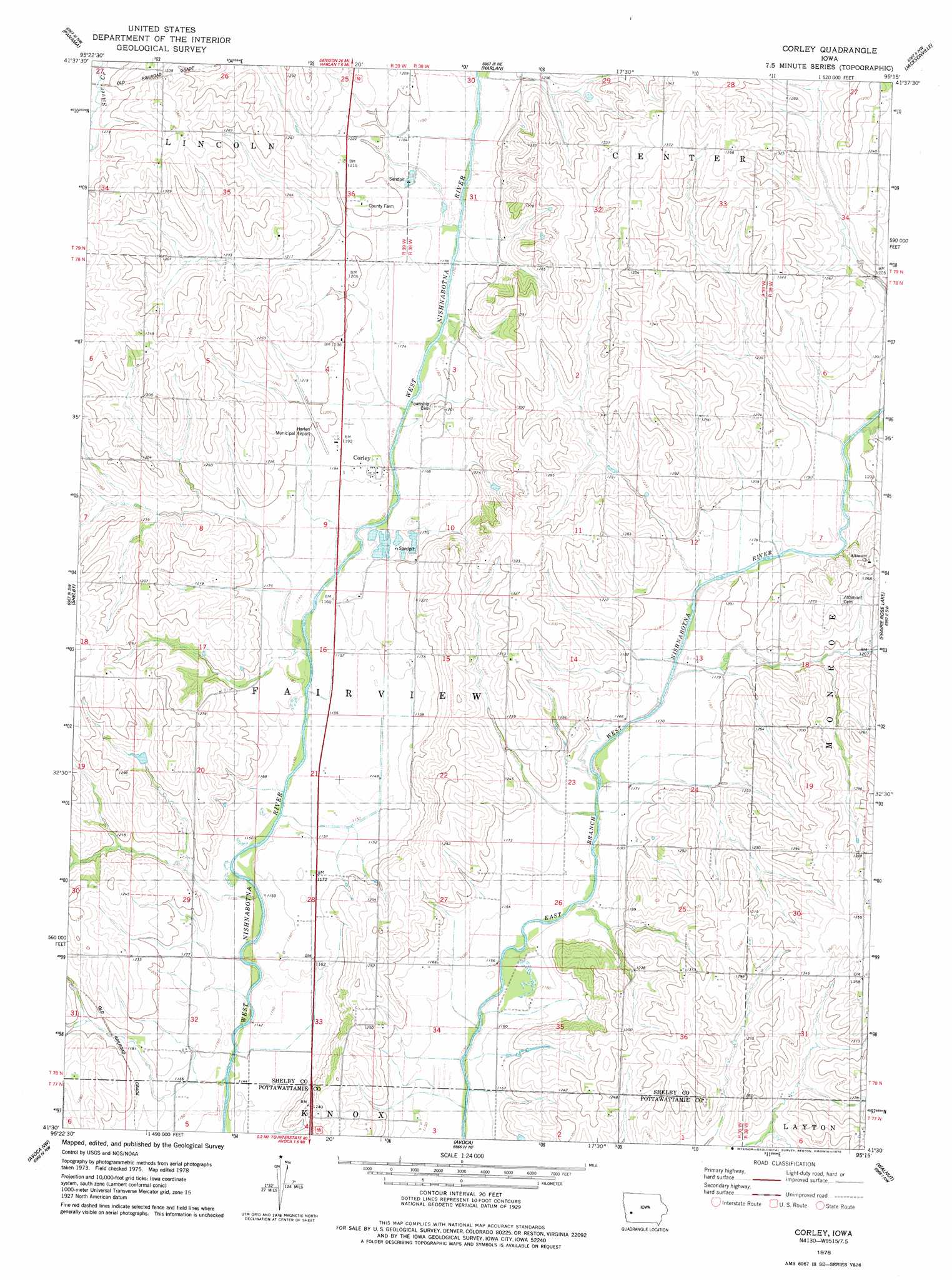
Corley Topo Map Iowa
To zoom in, hover over the map of Corley
USGS Topo Quad 41095e3 - 1:24,000 scale
| Topo Map Name: | Corley |
| USGS Topo Quad ID: | 41095e3 |
| Print Size: | ca. 21 1/4" wide x 27" high |
| Southeast Coordinates: | 41.5° N latitude / 95.25° W longitude |
| Map Center Coordinates: | 41.5625° N latitude / 95.3125° W longitude |
| U.S. State: | IA |
| Filename: | o41095e3.jpg |
| Download Map JPG Image: | Corley topo map 1:24,000 scale |
| Map Type: | Topographic |
| Topo Series: | 7.5´ |
| Map Scale: | 1:24,000 |
| Source of Map Images: | United States Geological Survey (USGS) |
| Alternate Map Versions: |
Corley IA 2010 Download PDF Buy paper map Corley IA 2013 Download PDF Buy paper map Corley IA 2015 Download PDF Buy paper map |
1:24,000 Topo Quads surrounding Corley
Dunlap |
Earling |
Defiance |
Irwin |
Manning Se |
Portsmouth |
Panama |
Harlan |
Jacksonville |
Kimballton |
Persia |
Shelby |
Corley |
Prairie Rose Lake |
Elk Horn |
Neola |
Avoca Nw |
Avoca |
Walnut |
Atlantic |
Taylor |
Oakland |
Avoca Se |
Atlantic Sw |
Lewis |
> Back to 41095e1 at 1:100,000 scale
> Back to 41094a1 at 1:250,000 scale
> Back to U.S. Topo Maps home
Corley topo map: Gazetteer
Corley: Airports
Harlan Municipal Airport elevation 366m 1200′Corley: Bridges
Nishnabotna River Bridge elevation 358m 1174′Corley: Parks
Nishna Bend Recreation Area elevation 353m 1158′Corley: Populated Places
Corley elevation 361m 1184′Corley: Post Offices
Altamont Post Office (historical) elevation 362m 1187′Corley Post Office (historical) elevation 361m 1184′
Corley: Streams
Dutch Branch elevation 353m 1158′Corley digital topo map on disk
Buy this Corley topo map showing relief, roads, GPS coordinates and other geographical features, as a high-resolution digital map file on DVD: