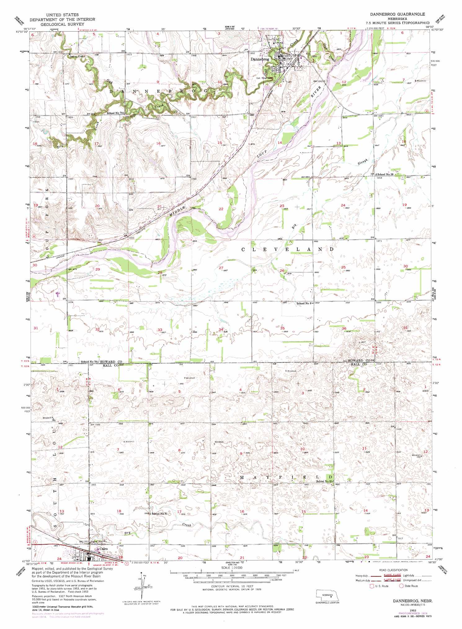
Dannebrog Topo Map Nebraska
To zoom in, hover over the map of Dannebrog
USGS Topo Quad 41098a5 - 1:24,000 scale
| Topo Map Name: | Dannebrog |
| USGS Topo Quad ID: | 41098a5 |
| Print Size: | ca. 21 1/4" wide x 27" high |
| Southeast Coordinates: | 41° N latitude / 98.5° W longitude |
| Map Center Coordinates: | 41.0625° N latitude / 98.5625° W longitude |
| U.S. State: | NE |
| Filename: | O41098A5.jpg |
| Download Map JPG Image: | Dannebrog topo map 1:24,000 scale |
| Map Type: | Topographic |
| Topo Series: | 7.5´ |
| Map Scale: | 1:24,000 |
| Source of Map Images: | United States Geological Survey (USGS) |
| Alternate Map Versions: |
Dannebrog NE 1953, updated 1953 Download PDF Buy paper map Dannebrog NE 1953, updated 1977 Download PDF Buy paper map Dannebrog NE 2011 Download PDF Buy paper map Dannebrog NE 2014 Download PDF Buy paper map |
1:24,000 Topo Quads surrounding Dannebrog
Loup City Se |
Cotesfield |
Elba |
Wolbach Sw |
Cushing |
Ashton |
Farwell |
Nysted |
Saint Paul |
Palmer |
Rockville |
Boelus |
Dannebrog |
Saint Paul Sw |
Saint Lebory |
Poole Ne |
Cameron |
Shelton Ne |
Abbott |
Grand Island |
Gibbon North |
Shelton |
Wood River |
Alda |
Doniphan |
> Back to 41098a1 at 1:100,000 scale
> Back to 41098a1 at 1:250,000 scale
> Back to U.S. Topo Maps home
Dannebrog topo map: Gazetteer
Dannebrog: Dams
Fries Dam elevation 585m 1919′Dannebrog: Parks
Dannebrog Park elevation 565m 1853′Dannebrog: Populated Places
Cairo elevation 595m 1952′Dannebrog elevation 565m 1853′
Dannebrog: Post Offices
Cairo Post Office elevation 594m 1948′Dannebrog Post Office elevation 565m 1853′
Dannebrog: Reservoirs
Fries Reservoir elevation 585m 1919′Dannebrog: Streams
Dry Creek elevation 573m 1879′Oak Creek elevation 560m 1837′
Dannebrog: Trails
Dannebrog Trails elevation 569m 1866′Dannebrog digital topo map on disk
Buy this Dannebrog topo map showing relief, roads, GPS coordinates and other geographical features, as a high-resolution digital map file on DVD: