Potter 2 Ne Topo Map Nebraska
To zoom in, hover over the map of Potter 2 Ne
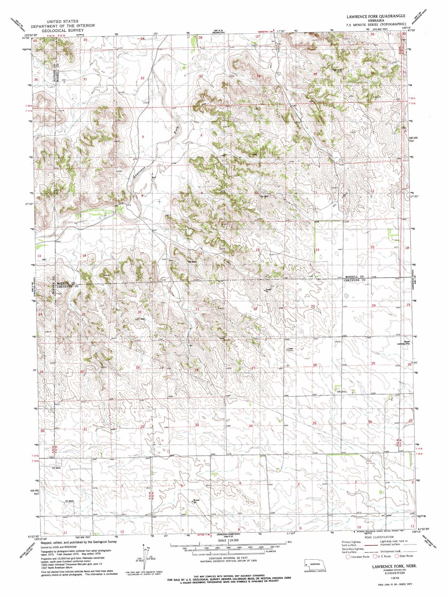
USGS Topo Quad 41103d3 - 1:24,000 scale
| Topo Map Name: | Potter 2 Ne |
| USGS Topo Quad ID: | 41103d3 |
| Print Size: | ca. 21 1/4" wide x 27" high |
| Southeast Coordinates: | 41.375° N latitude / 103.25° W longitude |
| Map Center Coordinates: | 41.4375° N latitude / 103.3125° W longitude |
| U.S. State: | NE |
| Filename: | O41103D3.jpg |
| Download Map JPG Image: | Potter 2 Ne topo map 1:24,000 scale |
| Map Type: | Topographic |
| Topo Series: | 7.5´ |
| Map Scale: | 1:24,000 |
| Source of Map Images: | United States Geological Survey (USGS) |
| Alternate Map Versions: |
Potter 2 NE NE 1973, updated 1975 Download PDF Buy paper map Lawrence Fork NE 1979, updated 1993 Download PDF Buy paper map Lawrence Fork NE 2011 Download PDF Buy paper map Lawrence Fork NE 2014 Download PDF Buy paper map |
1:24,000 Topo Quads surrounding Potter 2 Ne
Wright Gap |
Mcgrew |
South Bayard |
Bridgeport Nw |
Bridgeport |
Indian Springs |
Hackberry Creek |
Redington |
Roundhouse Rock |
Courthouse Rock |
Lone Pine Butte |
Singleton Ranch |
Potter 2 Ne |
Horsehead Ranch |
Mud Springs |
Bennett Reservoir East |
Potter 2 Sw |
Potter 2 Se |
Mud Springs Sw |
Mud Springs Se |
Owasco |
Dix |
Potter |
Point Of Rocks |
Brownson |
> Back to 41103a1 at 1:100,000 scale
> Back to 41102a1 at 1:250,000 scale
> Back to U.S. Topo Maps home
Potter 2 Ne topo map: Gazetteer
Potter 2 Ne: Dams
Dvorak Dam elevation 1389m 4557′Potter 2 Ne: Reservoirs
Dvorak Reservoir elevation 1389m 4557′Potter 2 Ne digital topo map on disk
Buy this Potter 2 Ne topo map showing relief, roads, GPS coordinates and other geographical features, as a high-resolution digital map file on DVD:
Eastern Wyoming & Western South Dakota
Buy digital topo maps: Eastern Wyoming & Western South Dakota