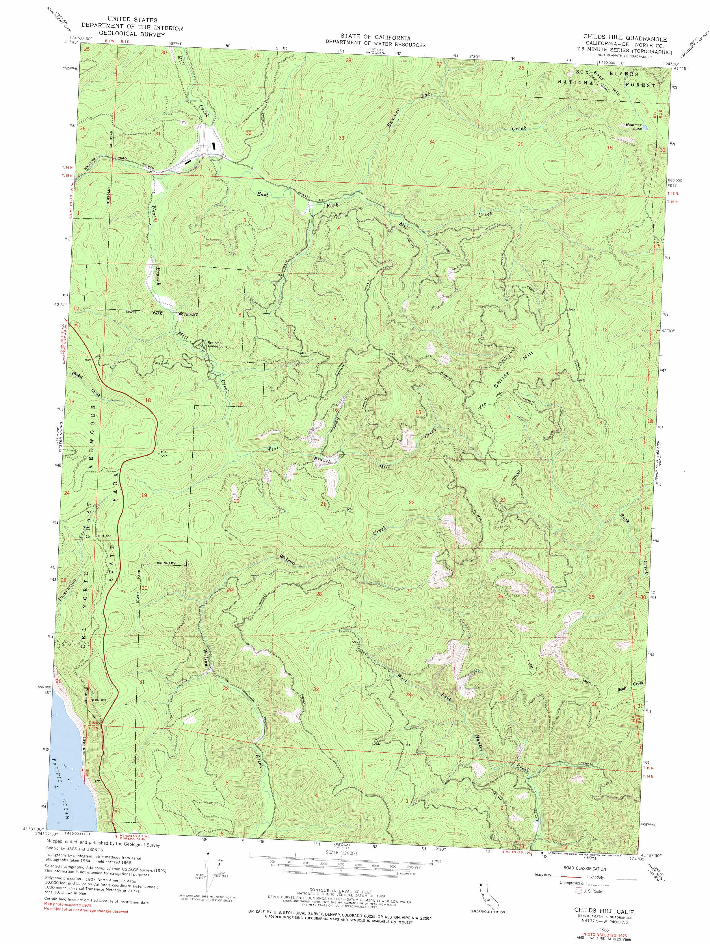
Childs Hill Topo Map California
To zoom in, hover over the map of Childs Hill
USGS Topo Quad 41124f1 - 1:24,000 scale
| Topo Map Name: | Childs Hill |
| USGS Topo Quad ID: | 41124f1 |
| Print Size: | ca. 21 1/4" wide x 27" high |
| Southeast Coordinates: | 41.625° N latitude / 124° W longitude |
| Map Center Coordinates: | 41.6875° N latitude / 124.0625° W longitude |
| U.S. State: | CA |
| Filename: | o41124f1.jpg |
| Download Map JPG Image: | Childs Hill topo map 1:24,000 scale |
| Map Type: | Topographic |
| Topo Series: | 7.5´ |
| Map Scale: | 1:24,000 |
| Source of Map Images: | United States Geological Survey (USGS) |
| Alternate Map Versions: |
Childs Hill CA 1966 Download PDF Buy paper map Childs Hill CA 1966, updated 1968 Download PDF Buy paper map Childs Hill CA 1966, updated 1968 Download PDF Buy paper map Childs Hill CA 1966, updated 1977 Download PDF Buy paper map Childs Hill CA 1997, updated 2001 Download PDF Buy paper map Childs Hill CA 2012 Download PDF Buy paper map Childs Hill CA 2015 Download PDF Buy paper map |
| FStopo: | US Forest Service topo Childs Hill is available: Download FStopo PDF Download FStopo TIF |
1:24,000 Topo Quads surrounding Childs Hill
Smith River |
High Divide |
High Plateau Mountain |
Shelly Creek Ridge |
|
Crescent City |
Hiouchi |
Gasquet |
Hurdygurdy Butte |
|
Sister Rocks |
Childs Hill |
Cant Hook Mountain |
Ship Mountain |
|
Requa |
Klamath Glen |
Summit Valley |
||
Fern Canyon |
Ah Pah Ridge |
Blue Creek Mountain |
> Back to 41124e1 at 1:100,000 scale
> Back to 41124a1 at 1:250,000 scale
> Back to U.S. Topo Maps home
Childs Hill topo map: Gazetteer
Childs Hill: Lakes
Bummer Lake elevation 633m 2076′Childs Hill: Parks
Del Norte Coast Redwoods State Park elevation 247m 810′Childs Hill: Streams
Bummer Lake Creek elevation 99m 324′East Fork Mill Creek elevation 82m 269′
West Branch Mill Creek elevation 82m 269′
Childs Hill: Summits
Childs Hill elevation 713m 2339′Childs Hill digital topo map on disk
Buy this Childs Hill topo map showing relief, roads, GPS coordinates and other geographical features, as a high-resolution digital map file on DVD: