Gilletts Lake Topo Map Michigan
To zoom in, hover over the map of Gilletts Lake
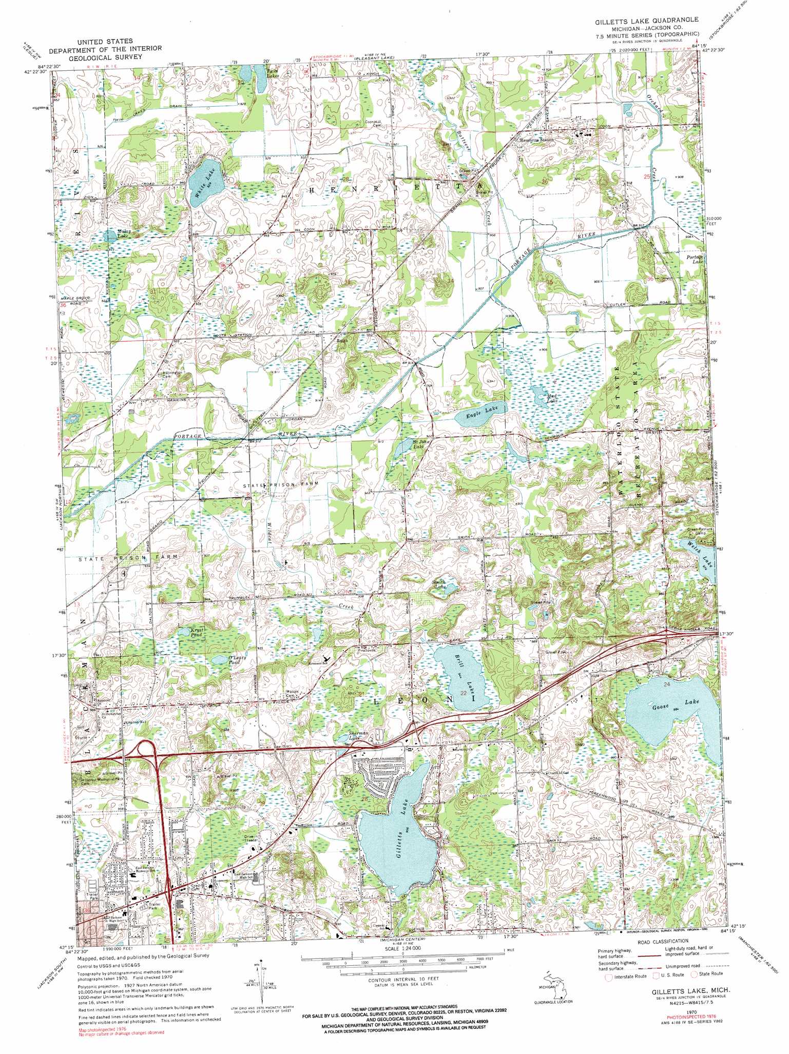
USGS Topo Quad 42084c3 - 1:24,000 scale
| Topo Map Name: | Gilletts Lake |
| USGS Topo Quad ID: | 42084c3 |
| Print Size: | ca. 21 1/4" wide x 27" high |
| Southeast Coordinates: | 42.25° N latitude / 84.25° W longitude |
| Map Center Coordinates: | 42.3125° N latitude / 84.3125° W longitude |
| U.S. State: | MI |
| Filename: | o42084c3.jpg |
| Download Map JPG Image: | Gilletts Lake topo map 1:24,000 scale |
| Map Type: | Topographic |
| Topo Series: | 7.5´ |
| Map Scale: | 1:24,000 |
| Source of Map Images: | United States Geological Survey (USGS) |
| Alternate Map Versions: |
Gilletts Lake MI 1970, updated 1973 Download PDF Buy paper map Gilletts Lake MI 1970, updated 1990 Download PDF Buy paper map Gilletts Lake MI 2011 Download PDF Buy paper map Gilletts Lake MI 2014 Download PDF Buy paper map Gilletts Lake MI 2017 Download PDF Buy paper map |
1:24,000 Topo Quads surrounding Gilletts Lake
Aurelius |
Mason |
Dansville |
Millville |
Parkers Corners |
Onondaga |
Leslie |
Pleasant Lake |
Stockbridge |
Gregory |
Parma |
Jackson North |
Gilletts Lake |
Grass Lake |
Chelsea |
Spring Arbor |
Jackson South |
Michigan Center |
Norvell |
Manchester |
Hanover |
Somerset Center |
Cement City |
Onsted |
Tipton |
> Back to 42084a1 at 1:100,000 scale
> Back to 42084a1 at 1:250,000 scale
> Back to U.S. Topo Maps home
Gilletts Lake topo map: Gazetteer
Gilletts Lake: Canals
Twin Lakes Drain elevation 282m 925′Gilletts Lake: Lakes
Brill Lake elevation 288m 944′Eagle Lake elevation 275m 902′
Gilletts Lake elevation 291m 954′
Goose Lake elevation 300m 984′
Kryst Pond elevation 282m 925′
Malay Lake elevation 282m 925′
Mud Lake elevation 275m 902′
O'Leary Pond elevation 283m 928′
Saint John Lake elevation 275m 902′
Sherman Lake elevation 291m 954′
Smith Lake elevation 288m 944′
Twin Lakes elevation 281m 921′
White Lake elevation 283m 928′
Gilletts Lake: Populated Places
Roots elevation 284m 931′Gilletts Lake: Streams
Batteese Creek elevation 277m 908′Orchard Creek elevation 276m 905′
Wildcat Creek elevation 277m 908′
Gilletts Lake digital topo map on disk
Buy this Gilletts Lake topo map showing relief, roads, GPS coordinates and other geographical features, as a high-resolution digital map file on DVD:
Northern Illinois, Northern Indiana & Southwestern Michigan
Buy digital topo maps: Northern Illinois, Northern Indiana & Southwestern Michigan