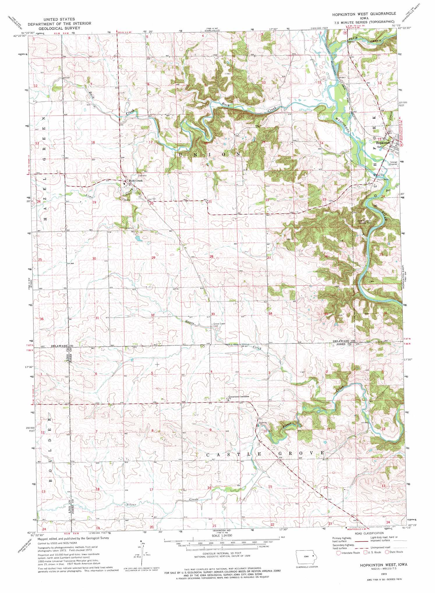
Hopkinton West Topo Map Iowa
To zoom in, hover over the map of Hopkinton West
USGS Topo Quad 42091c3 - 1:24,000 scale
| Topo Map Name: | Hopkinton West |
| USGS Topo Quad ID: | 42091c3 |
| Print Size: | ca. 21 1/4" wide x 27" high |
| Southeast Coordinates: | 42.25° N latitude / 91.25° W longitude |
| Map Center Coordinates: | 42.3125° N latitude / 91.3125° W longitude |
| U.S. State: | IA |
| Filename: | o42091c3.jpg |
| Download Map JPG Image: | Hopkinton West topo map 1:24,000 scale |
| Map Type: | Topographic |
| Topo Series: | 7.5´ |
| Map Scale: | 1:24,000 |
| Source of Map Images: | United States Geological Survey (USGS) |
| Alternate Map Versions: |
Hopkinton West IA 1973, updated 1977 Download PDF Buy paper map Hopkinton West IA 2010 Download PDF Buy paper map Hopkinton West IA 2013 Download PDF Buy paper map Hopkinton West IA 2015 Download PDF Buy paper map |
1:24,000 Topo Quads surrounding Hopkinton West
Dundee |
Thorpe |
Greeley |
Petersburg |
New Vienna |
Masonville |
Manchester |
Earlville |
Dyersville West |
Dyersville East |
Coggon |
Ryan |
Hopkinton West |
Hopkinton East |
Cascade |
Central City |
Prairieburg |
Anamosa Ne |
Monticello |
Scotch Grove |
Marion |
Springville |
Anamosa |
Morley |
Wyoming West |
> Back to 42091a1 at 1:100,000 scale
> Back to 42090a1 at 1:250,000 scale
> Back to U.S. Topo Maps home
Hopkinton West topo map: Gazetteer
Hopkinton West: Parks
Hard Scrabble County Park elevation 285m 935′Hopkinton West: Populated Places
Argand elevation 298m 977′Buck Creek elevation 279m 915′
Castle Grove elevation 276m 905′
Hopkinton West: Post Offices
Argand Post Office (historical) elevation 295m 967′Boulder Post Office (historical) elevation 289m 948′
Downersville Post Office (historical) elevation 296m 971′
Grove Creek Post Office (historical) elevation 276m 905′
Uniontown Post Office (historical) elevation 327m 1072′
Hopkinton West: Streams
Bell Creek elevation 252m 826′Buck Creek elevation 256m 839′
Grove Creek elevation 260m 853′
Lime Creek elevation 268m 879′
Plum Creek elevation 256m 839′
Sand Creek elevation 255m 836′
Hopkinton West digital topo map on disk
Buy this Hopkinton West topo map showing relief, roads, GPS coordinates and other geographical features, as a high-resolution digital map file on DVD: