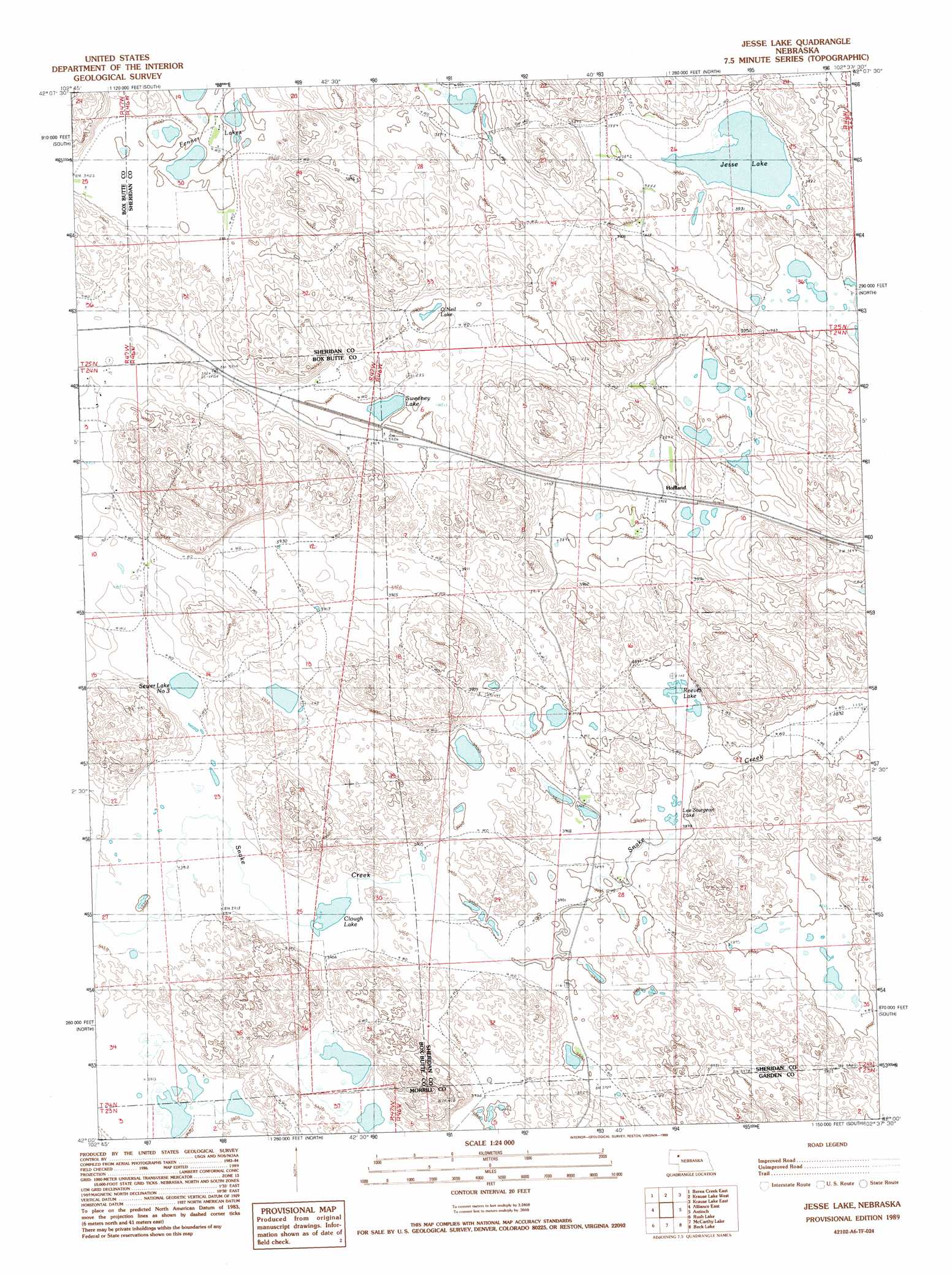
Jesse Lake Topo Map Nebraska
To zoom in, hover over the map of Jesse Lake
USGS Topo Quad 42102a6 - 1:24,000 scale
| Topo Map Name: | Jesse Lake |
| USGS Topo Quad ID: | 42102a6 |
| Print Size: | ca. 21 1/4" wide x 27" high |
| Southeast Coordinates: | 42° N latitude / 102.625° W longitude |
| Map Center Coordinates: | 42.0625° N latitude / 102.6875° W longitude |
| U.S. State: | NE |
| Filename: | O42102A6.jpg |
| Download Map JPG Image: | Jesse Lake topo map 1:24,000 scale |
| Map Type: | Topographic |
| Topo Series: | 7.5´ |
| Map Scale: | 1:24,000 |
| Source of Map Images: | United States Geological Survey (USGS) |
| Alternate Map Versions: |
Jesse Lke NE 1989, updated 1989 Download PDF Buy paper map Jesse Lake NE 2011 Download PDF Buy paper map Jesse Lake NE 2014 Download PDF Buy paper map |
1:24,000 Topo Quads surrounding Jesse Lake
Box Butte Sw |
Box Butte |
Skunk Lake Sw |
Skunk Lake |
Twin Lakes |
Berea Creek West |
Berea Creek East |
Krause Lake West |
Krause Lake East |
Peter Long Lake |
Alliance West |
Alliance East |
Jesse Lake |
Antioch |
Lakeside |
Cowboy Hill |
Rush Lake |
Mccarthy Lake |
Beck Lake |
Schoonover Lake |
Camp Lake |
Norris Lake |
Storm Lake |
Bean Lake |
Mumper |
> Back to 42102a1 at 1:100,000 scale
> Back to 42102a1 at 1:250,000 scale
> Back to U.S. Topo Maps home
Jesse Lake topo map: Gazetteer
Jesse Lake: Lakes
Clough Lake elevation 1193m 3914′Fenner Lakes elevation 1189m 3900′
Fenner Lakes elevation 1187m 3894′
Jesse Lake elevation 1180m 3871′
Lee Sturgeon Lake elevation 1202m 3943′
O'Neil Lake elevation 1189m 3900′
Reeves Lake elevation 1188m 3897′
Sewer Lake Number 3 elevation 1191m 3907′
Sweeney Lake elevation 1187m 3894′
Jesse Lake: Populated Places
Hoffland elevation 1193m 3914′Jesse Lake: Post Offices
Hoffland Post Office (historical) elevation 1193m 3914′Jesse Lake digital topo map on disk
Buy this Jesse Lake topo map showing relief, roads, GPS coordinates and other geographical features, as a high-resolution digital map file on DVD:
Eastern Wyoming & Western South Dakota
Buy digital topo maps: Eastern Wyoming & Western South Dakota