Alliance East Topo Map Nebraska
To zoom in, hover over the map of Alliance East
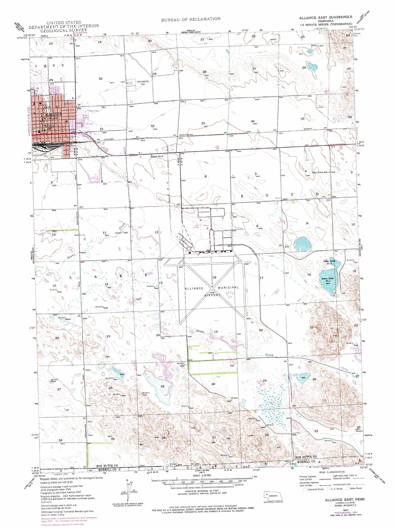
USGS Topo Quad 42102a7 - 1:24,000 scale
| Topo Map Name: | Alliance East |
| USGS Topo Quad ID: | 42102a7 |
| Print Size: | ca. 21 1/4" wide x 27" high |
| Southeast Coordinates: | 42° N latitude / 102.75° W longitude |
| Map Center Coordinates: | 42.0625° N latitude / 102.8125° W longitude |
| U.S. State: | NE |
| Filename: | O42102A7.jpg |
| Download Map JPG Image: | Alliance East topo map 1:24,000 scale |
| Map Type: | Topographic |
| Topo Series: | 7.5´ |
| Map Scale: | 1:24,000 |
| Source of Map Images: | United States Geological Survey (USGS) |
| Alternate Map Versions: |
Alliance NE 1947, updated 1967 Download PDF Buy paper map Alliance East NE 1947, updated 1977 Download PDF Buy paper map Alliance NE 1948, updated 1948 Download PDF Buy paper map Alliance East NE 2011 Download PDF Buy paper map Alliance East NE 2014 Download PDF Buy paper map |
1:24,000 Topo Quads surrounding Alliance East
Hemingford |
Box Butte Sw |
Box Butte |
Skunk Lake Sw |
Skunk Lake |
Hemingford 4 Ne |
Berea Creek West |
Berea Creek East |
Krause Lake West |
Krause Lake East |
Hemingford 4 Se |
Alliance West |
Alliance East |
Jesse Lake |
Antioch |
Angora Ne |
Cowboy Hill |
Rush Lake |
Mccarthy Lake |
Beck Lake |
Angora Se |
Camp Lake |
Norris Lake |
Storm Lake |
Bean Lake |
> Back to 42102a1 at 1:100,000 scale
> Back to 42102a1 at 1:250,000 scale
> Back to U.S. Topo Maps home
Alliance East topo map: Gazetteer
Alliance East: Airports
Alliance Municipal Airport elevation 1196m 3923′Alliance East: Lakes
Sewer Lake Number 1 elevation 1191m 3907′Sewer Lake Number 2 elevation 1191m 3907′
Alliance East: Parks
Bower Park elevation 1204m 3950′Bower-Shankland Field elevation 1204m 3950′
Bulldog Stadium elevation 1206m 3956′
Burlington Locomotive 719 Historical Marker elevation 1206m 3956′
Central Park elevation 1205m 3953′
Laing Park elevation 1207m 3959′
Sudman Field elevation 1207m 3959′
Alliance East: Populated Places
Alliance elevation 1209m 3966′Meadows Trailer Court elevation 1209m 3966′
Tower Plaza Mobile Home Park elevation 1209m 3966′
Trailerville Court elevation 1209m 3966′
Alliance East: Post Offices
Alliance Post Office elevation 1210m 3969′Alliance East: Streams
Snake Creek elevation 1194m 3917′Alliance East digital topo map on disk
Buy this Alliance East topo map showing relief, roads, GPS coordinates and other geographical features, as a high-resolution digital map file on DVD:
Eastern Wyoming & Western South Dakota
Buy digital topo maps: Eastern Wyoming & Western South Dakota