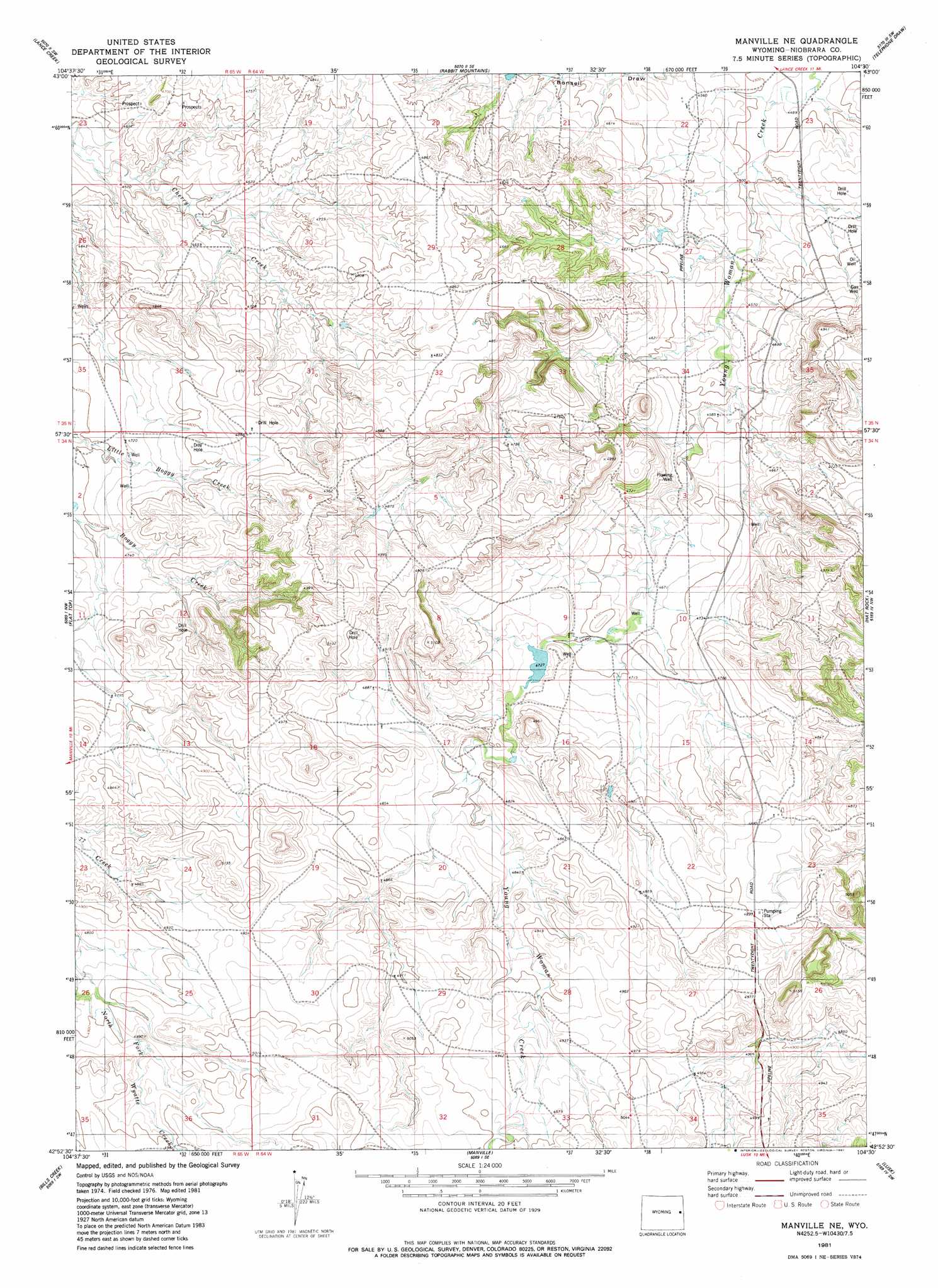
Manville Ne Topo Map Wyoming
To zoom in, hover over the map of Manville Ne
USGS Topo Quad 42104h5 - 1:24,000 scale
| Topo Map Name: | Manville Ne |
| USGS Topo Quad ID: | 42104h5 |
| Print Size: | ca. 21 1/4" wide x 27" high |
| Southeast Coordinates: | 42.875° N latitude / 104.5° W longitude |
| Map Center Coordinates: | 42.9375° N latitude / 104.5625° W longitude |
| U.S. State: | WY |
| Filename: | o42104h5.jpg |
| Download Map JPG Image: | Manville Ne topo map 1:24,000 scale |
| Map Type: | Topographic |
| Topo Series: | 7.5´ |
| Map Scale: | 1:24,000 |
| Source of Map Images: | United States Geological Survey (USGS) |
| Alternate Map Versions: |
Manville NE WY 1981, updated 1981 Download PDF Buy paper map Manville NE WY 2012 Download PDF Buy paper map Manville NE WY 2015 Download PDF Buy paper map |
1:24,000 Topo Quads surrounding Manville Ne
Mercer Draw |
Lance Creek Nw |
Funny Rock |
Buck Creek Hills |
Redbird |
Mikes Draw |
Lance Creek |
Rabbit Mountains |
Telephone Draw |
Coyote Gap |
Cooley Draw |
Flat Top |
Manville Ne |
Hat Rock |
Hat Creek |
Keeline |
Bills Creek |
Manville |
Lusk |
Signature Rock |
Prairie View School |
Lone Tree Hill |
Silver Springs |
Reynolds Spring |
Node |
> Back to 42104e1 at 1:100,000 scale
> Back to 42104a1 at 1:250,000 scale
> Back to U.S. Topo Maps home
Manville Ne topo map: Gazetteer
Manville Ne: Dams
Bast Number 1 Dam elevation 1487m 4878′Magoon Number 1 Dam elevation 1447m 4747′
Manville Ne: Reservoirs
Bast Number 1 Reservoir elevation 1487m 4878′Magoon Number 1 Reservoir elevation 1447m 4747′
Manville Ne digital topo map on disk
Buy this Manville Ne topo map showing relief, roads, GPS coordinates and other geographical features, as a high-resolution digital map file on DVD:
Eastern Wyoming & Western South Dakota
Buy digital topo maps: Eastern Wyoming & Western South Dakota