Redbird Topo Map Wyoming
To zoom in, hover over the map of Redbird
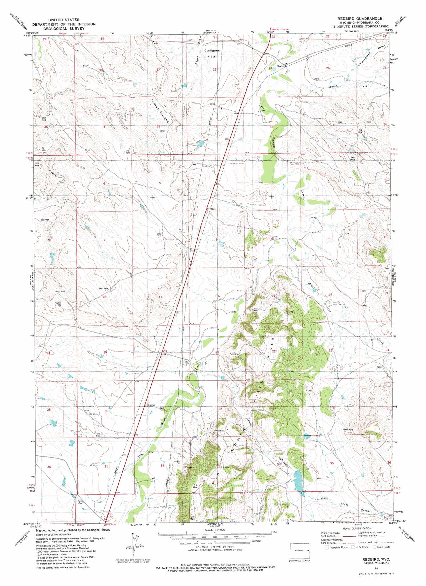
USGS Topo Quad 43104b3 - 1:24,000 scale
| Topo Map Name: | Redbird |
| USGS Topo Quad ID: | 43104b3 |
| Print Size: | ca. 21 1/4" wide x 27" high |
| Southeast Coordinates: | 43.125° N latitude / 104.25° W longitude |
| Map Center Coordinates: | 43.1875° N latitude / 104.3125° W longitude |
| U.S. State: | WY |
| Filename: | o43104b3.jpg |
| Download Map JPG Image: | Redbird topo map 1:24,000 scale |
| Map Type: | Topographic |
| Topo Series: | 7.5´ |
| Map Scale: | 1:24,000 |
| Source of Map Images: | United States Geological Survey (USGS) |
| Alternate Map Versions: |
Redbird WY 1981, updated 1981 Download PDF Buy paper map Redbird WY 2012 Download PDF Buy paper map Redbird WY 2015 Download PDF Buy paper map |
1:24,000 Topo Quads surrounding Redbird
Horseshoe Bend |
Threemile Butte |
Little Alkali Creek |
Riverview |
Twentyone Divide |
Boggy Reservoir |
Greasewood Creek |
Bowen Flat |
Mule Creek |
Mule Creek Se |
Funny Rock |
Buck Creek Hills |
Redbird |
Oat Creek Nw |
Coffee Flats |
Rabbit Mountains |
Telephone Draw |
Coyote Gap |
South Oat Creek |
Oat Creek |
Manville Ne |
Hat Rock |
Hat Creek |
Shepherds Point |
Sherrill Hills |
> Back to 43104a1 at 1:100,000 scale
> Back to 43104a1 at 1:250,000 scale
> Back to U.S. Topo Maps home
Redbird topo map: Gazetteer
Redbird: Areas
Graham Roughs elevation 1234m 4048′Redbird: Dams
Amelia Number 1 Dam elevation 1265m 4150′Clark Number 1 Dam elevation 1244m 4081′
Johnny Wasserburger Dam elevation 1226m 4022′
Leo Dam elevation 1273m 4176′
Pfister Number 1 Dam elevation 1191m 3907′
Sorem Number 1 Dam elevation 1219m 3999′
Redbird: Populated Places
Redbird elevation 1184m 3884′Redbird: Ranges
Old Woman Creek Hills elevation 1349m 4425′Redbird: Reservoirs
Amelia Number 1 Reservoir elevation 1265m 4150′Clark Number 1 Reservoir elevation 1244m 4081′
Johnny Wasserburger Reservoir elevation 1226m 4022′
Leo Reservoir elevation 1273m 4176′
Pfister Number 1 Reservoir elevation 1191m 3907′
Sorem Number 1 Reservoir elevation 1219m 3999′
Redbird: Streams
Alum Creek elevation 1219m 3999′Antelope Creek elevation 1185m 3887′
Black Tail Creek elevation 1206m 3956′
East Alum Creek elevation 1256m 4120′
Redbird: Valleys
Wheatgrass Draw elevation 1193m 3914′Redbird digital topo map on disk
Buy this Redbird topo map showing relief, roads, GPS coordinates and other geographical features, as a high-resolution digital map file on DVD:
Eastern Wyoming & Western South Dakota
Buy digital topo maps: Eastern Wyoming & Western South Dakota