Blackjack Ranch Topo Map Wyoming
To zoom in, hover over the map of Blackjack Ranch
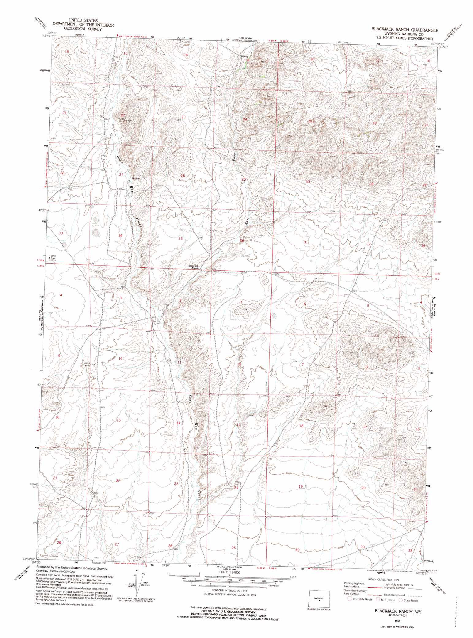
USGS Topo Quad 42107f4 - 1:24,000 scale
| Topo Map Name: | Blackjack Ranch |
| USGS Topo Quad ID: | 42107f4 |
| Print Size: | ca. 21 1/4" wide x 27" high |
| Southeast Coordinates: | 42.625° N latitude / 107.375° W longitude |
| Map Center Coordinates: | 42.6875° N latitude / 107.4375° W longitude |
| U.S. State: | WY |
| Filename: | o42107f4.jpg |
| Download Map JPG Image: | Blackjack Ranch topo map 1:24,000 scale |
| Map Type: | Topographic |
| Topo Series: | 7.5´ |
| Map Scale: | 1:24,000 |
| Source of Map Images: | United States Geological Survey (USGS) |
| Alternate Map Versions: |
Blackjack Ranch WY 1959, updated 1961 Download PDF Buy paper map Blackjack Ranch WY 1959, updated 1973 Download PDF Buy paper map Blackjack Ranch WY 1959, updated 1995 Download PDF Buy paper map Blackjack Ranch WY 2012 Download PDF Buy paper map Blackjack Ranch WY 2015 Download PDF Buy paper map |
1:24,000 Topo Quads surrounding Blackjack Ranch
Love Ranch |
Miles Ranch |
Ervay Basin |
Mcrae Gap |
Broad Mesa |
Puddle Springs |
Gas Hills |
Ervay Basin Sw |
Garfield Peak |
Stinking Water Creek |
Coyote Springs |
Mcintosh Meadows |
Blackjack Ranch |
Barlow Gap |
Saddle Rock |
Black Rock Gap |
Lankin Dome |
Lone Mountain |
Miller Spring |
Beulah Belle Lake |
Split Rock Nw |
Split Rock |
Bucklin Reservoirs |
Savage Peak |
Independence Rock |
> Back to 42107e1 at 1:100,000 scale
> Back to 42106a1 at 1:250,000 scale
> Back to U.S. Topo Maps home
Blackjack Ranch topo map: Gazetteer
Blackjack Ranch: Streams
East Fork Sage Hen Creek elevation 2070m 6791′Blackjack Ranch digital topo map on disk
Buy this Blackjack Ranch topo map showing relief, roads, GPS coordinates and other geographical features, as a high-resolution digital map file on DVD:
Eastern Wyoming & Western South Dakota
Buy digital topo maps: Eastern Wyoming & Western South Dakota