Buckhorn Topo Map Idaho
To zoom in, hover over the map of Buckhorn
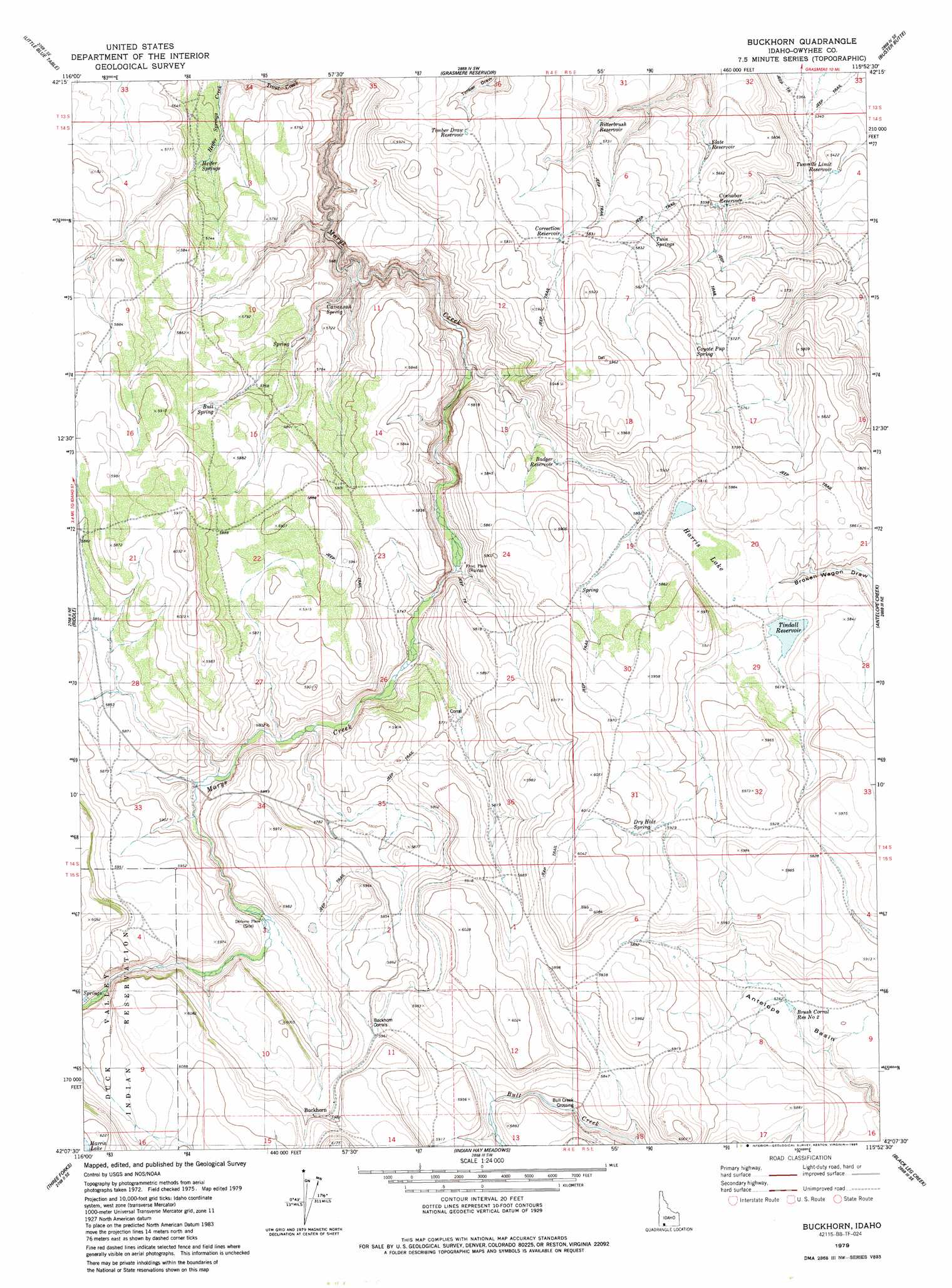
USGS Topo Quad 42115b8 - 1:24,000 scale
| Topo Map Name: | Buckhorn |
| USGS Topo Quad ID: | 42115b8 |
| Print Size: | ca. 21 1/4" wide x 27" high |
| Southeast Coordinates: | 42.125° N latitude / 115.875° W longitude |
| Map Center Coordinates: | 42.1875° N latitude / 115.9375° W longitude |
| U.S. State: | ID |
| Filename: | o42115b8.jpg |
| Download Map JPG Image: | Buckhorn topo map 1:24,000 scale |
| Map Type: | Topographic |
| Topo Series: | 7.5´ |
| Map Scale: | 1:24,000 |
| Source of Map Images: | United States Geological Survey (USGS) |
| Alternate Map Versions: |
Buckhorn ID 1979, updated 1986 Download PDF Buy paper map Buckhorn ID 2010 Download PDF Buy paper map Buckhorn ID 2013 Download PDF Buy paper map |
1:24,000 Topo Quads surrounding Buckhorn
Turner Table |
Wickahoney Point |
Grasmere |
Blackstone Reservoir |
Cave Draw |
Nichol Flat |
Little Blue Table |
Grasmere Reservoir |
Buster Butte |
Indian Hot Springs |
Flying H Ranch |
Riddle |
Buckhorn |
Antelope Creek |
Triguero Lake |
Mountain View Lake |
Three Forks |
Indian Hay Meadows |
Black Leg Creek |
Triplet Butte |
The Point |
Owyhee |
Winter Ridge |
Hicks Mountain |
Big Table |
> Back to 42115a1 at 1:100,000 scale
> Back to 42114a1 at 1:250,000 scale
> Back to U.S. Topo Maps home
Buckhorn topo map: Gazetteer
Buckhorn: Basins
Antelope Basin elevation 1760m 5774′Buckhorn: Crossings
Bull Creek Crossing elevation 1754m 5754′Buckhorn: Lakes
Harris Lake elevation 1769m 5803′Buckhorn: Populated Places
Dickens Place elevation 1773m 5816′Frost Place elevation 1725m 5659′
Buckhorn: Reservoirs
Badger Reservoir elevation 1756m 5761′Bitterbrush Reservoir elevation 1726m 5662′
Brush Corral Reservoir Number Two elevation 1757m 5764′
Cinnabar Reservoir elevation 1705m 5593′
Correction Reservoir elevation 1777m 5830′
Slate Reservoir elevation 1705m 5593′
Timber Draw Reservoir elevation 1776m 5826′
Tindall Reservoir elevation 1773m 5816′
Two Mile Limit Reservoir elevation 1649m 5410′
Buckhorn: Springs
Bull Spring elevation 1778m 5833′Cavannah Spring elevation 1737m 5698′
Coyote Pup Spring elevation 1777m 5830′
Dry Hole Spring elevation 1821m 5974′
Heifer Springs elevation 1721m 5646′
Twin Springs elevation 1769m 5803′
Buckhorn digital topo map on disk
Buy this Buckhorn topo map showing relief, roads, GPS coordinates and other geographical features, as a high-resolution digital map file on DVD: