Edgerton Ne Topo Map Minnesota
To zoom in, hover over the map of Edgerton Ne
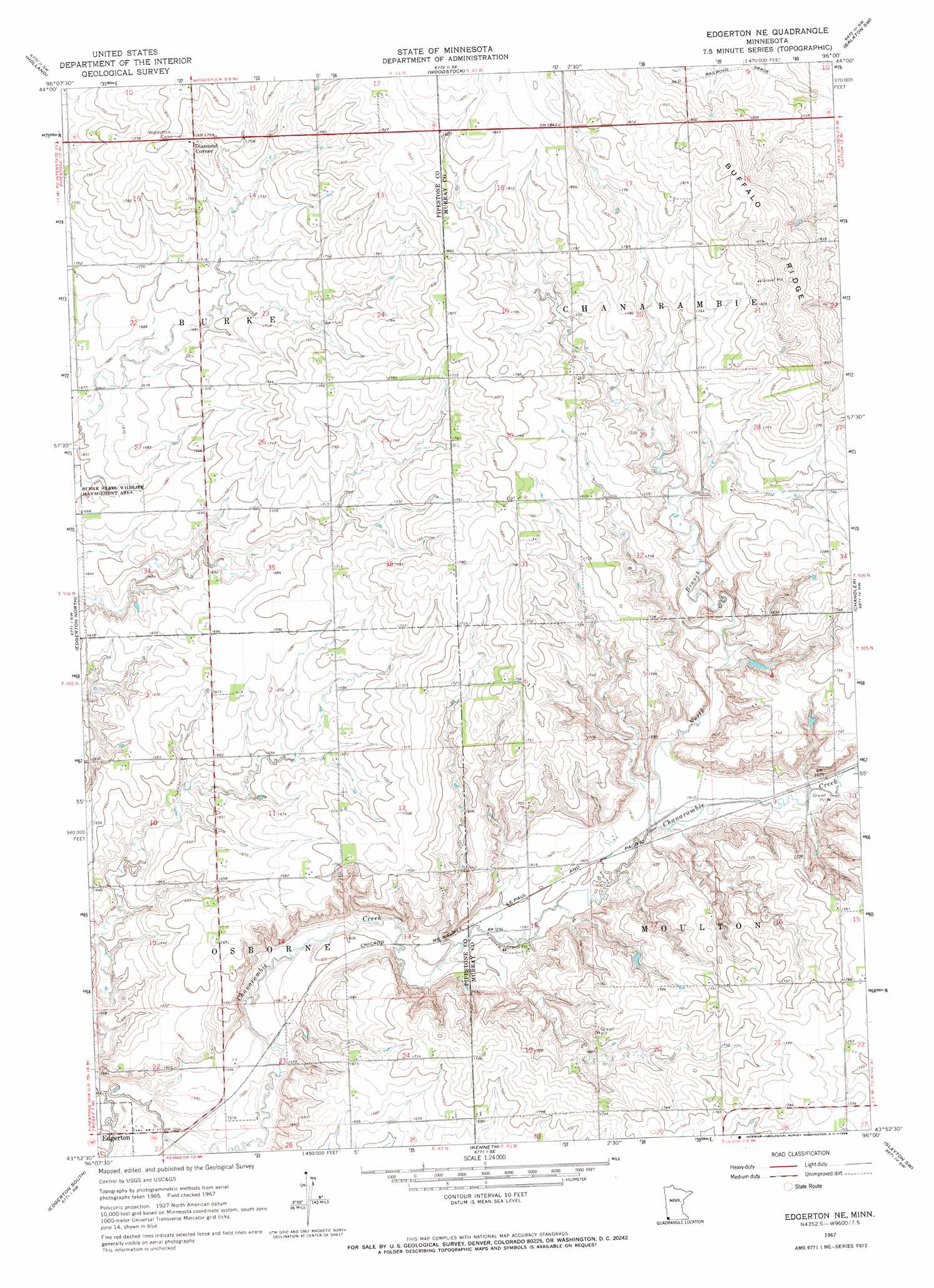
USGS Topo Quad 43096h1 - 1:24,000 scale
| Topo Map Name: | Edgerton Ne |
| USGS Topo Quad ID: | 43096h1 |
| Print Size: | ca. 21 1/4" wide x 27" high |
| Southeast Coordinates: | 43.875° N latitude / 96° W longitude |
| Map Center Coordinates: | 43.9375° N latitude / 96.0625° W longitude |
| U.S. State: | MN |
| Filename: | o43096h1.jpg |
| Download Map JPG Image: | Edgerton Ne topo map 1:24,000 scale |
| Map Type: | Topographic |
| Topo Series: | 7.5´ |
| Map Scale: | 1:24,000 |
| Source of Map Images: | United States Geological Survey (USGS) |
| Alternate Map Versions: |
Edgerton NE MN 1967, updated 1968 Download PDF Buy paper map Edgerton NE MN 2010 Download PDF Buy paper map Edgerton NE MN 2013 Download PDF Buy paper map Edgerton NE MN 2016 Download PDF Buy paper map |
1:24,000 Topo Quads surrounding Edgerton Ne
Verdi |
Ruthton Nw |
Ruthton |
Current Lake |
Balaton |
Pipestone North |
Holland |
Woodstock |
Balaton Sw |
Hadley |
Pipestone South |
Edgerton North |
Edgerton Ne |
Chandler |
Slayton |
Jasper Se |
Edgerton South |
Kenneth |
Slayton Sw |
Wilmont |
Hills Ne |
Luverne |
Magnolia |
Adrian |
Adrian Ne |
> Back to 43096e1 at 1:100,000 scale
> Back to 43096a1 at 1:250,000 scale
> Back to U.S. Topo Maps home
Edgerton Ne topo map: Gazetteer
Edgerton Ne: Populated Places
Diamond Corner elevation 546m 1791′Edgerton Ne: Ridges
Buffalo Ridge elevation 581m 1906′Edgerton Ne: Streams
North Branch Chanarambie Creek elevation 490m 1607′Edgerton Ne digital topo map on disk
Buy this Edgerton Ne topo map showing relief, roads, GPS coordinates and other geographical features, as a high-resolution digital map file on DVD:
Eastern North Dakota & Eastern South Dakota
Buy digital topo maps: Eastern North Dakota & Eastern South Dakota