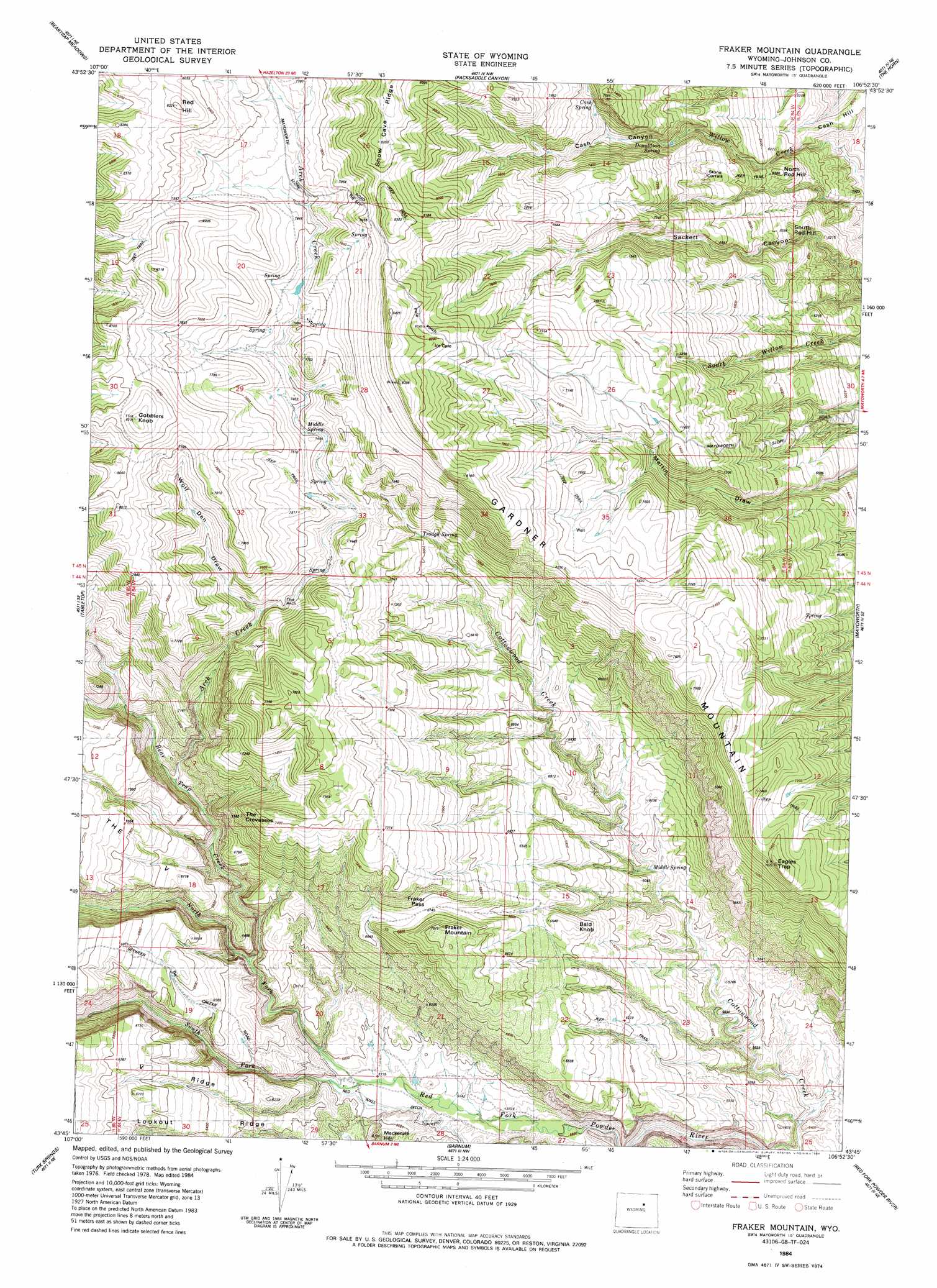
Fraker Mountain Topo Map Wyoming
To zoom in, hover over the map of Fraker Mountain
USGS Topo Quad 43106g8 - 1:24,000 scale
| Topo Map Name: | Fraker Mountain |
| USGS Topo Quad ID: | 43106g8 |
| Print Size: | ca. 21 1/4" wide x 27" high |
| Southeast Coordinates: | 43.75° N latitude / 106.875° W longitude |
| Map Center Coordinates: | 43.8125° N latitude / 106.9375° W longitude |
| U.S. State: | WY |
| Filename: | o43106g8.jpg |
| Download Map JPG Image: | Fraker Mountain topo map 1:24,000 scale |
| Map Type: | Topographic |
| Topo Series: | 7.5´ |
| Map Scale: | 1:24,000 |
| Source of Map Images: | United States Geological Survey (USGS) |
| Alternate Map Versions: |
Fraker Mountain WY 1984, updated 1984 Download PDF Buy paper map Fraker Mountain WY 2012 Download PDF Buy paper map Fraker Mountain WY 2015 Download PDF Buy paper map |
1:24,000 Topo Quads surrounding Fraker Mountain
Onion Gulch |
Hazelton Peak |
Hazelton |
Robinson Canyon |
Purdy Reservoir |
Monument Hill |
Beartrap Meadows |
Packsaddle Canyon |
The Horn |
Schlicht Draw |
Tallon Spring |
Tabletop |
Fraker Mountain |
Mayoworth |
Hibbard Draw |
Horse Butte |
Turk Springs |
Barnum |
Red Fork Powder River |
Kaycee |
Cherry Creek Hill |
Gordon Creek |
Poker Butte |
Hole-In-The-Wall |
T T T Ranch |
> Back to 43106e1 at 1:100,000 scale
> Back to 43106a1 at 1:250,000 scale
> Back to U.S. Topo Maps home
Fraker Mountain topo map: Gazetteer
Fraker Mountain: Capes
The V elevation 2116m 6942′Fraker Mountain: Gaps
Fraker Pass elevation 2058m 6751′The Slip elevation 2427m 7962′
Fraker Mountain: Ridges
Lookout Ridge elevation 1934m 6345′Snow Cave Ridge elevation 2539m 8330′
V Ridge elevation 1961m 6433′
Fraker Mountain: Slopes
Pole Patch elevation 2476m 8123′Fraker Mountain: Springs
Cash Spring elevation 2193m 7194′Donaldson Spring elevation 2074m 6804′
Middle Spring elevation 2256m 7401′
Middle Spring elevation 1792m 5879′
Trough Spring elevation 2121m 6958′
Fraker Mountain: Streams
Arch Creek elevation 1941m 6368′Beartrap Creek elevation 1793m 5882′
North Fork Red Fork Powder River elevation 1744m 5721′
South Fork Red Fork Powder River elevation 1744m 5721′
Fraker Mountain: Summits
Bald Knob elevation 1995m 6545′Cash Hill elevation 1851m 6072′
Eagles Trap elevation 2289m 7509′
Fraker Mountain elevation 2136m 7007′
Gardner Mountain elevation 2268m 7440′
Gobblers Knob elevation 2486m 8156′
Mackenzie Hill elevation 1854m 6082′
Red Hill elevation 2492m 8175′
South Red Hill elevation 1924m 6312′
Fraker Mountain: Valleys
Cash Canyon elevation 2040m 6692′The Crevasses elevation 1915m 6282′
Wolf Den Draw elevation 2172m 7125′
Fraker Mountain digital topo map on disk
Buy this Fraker Mountain topo map showing relief, roads, GPS coordinates and other geographical features, as a high-resolution digital map file on DVD:
Eastern Wyoming & Western South Dakota
Buy digital topo maps: Eastern Wyoming & Western South Dakota