Dry Mountain Topo Map Oregon
To zoom in, hover over the map of Dry Mountain
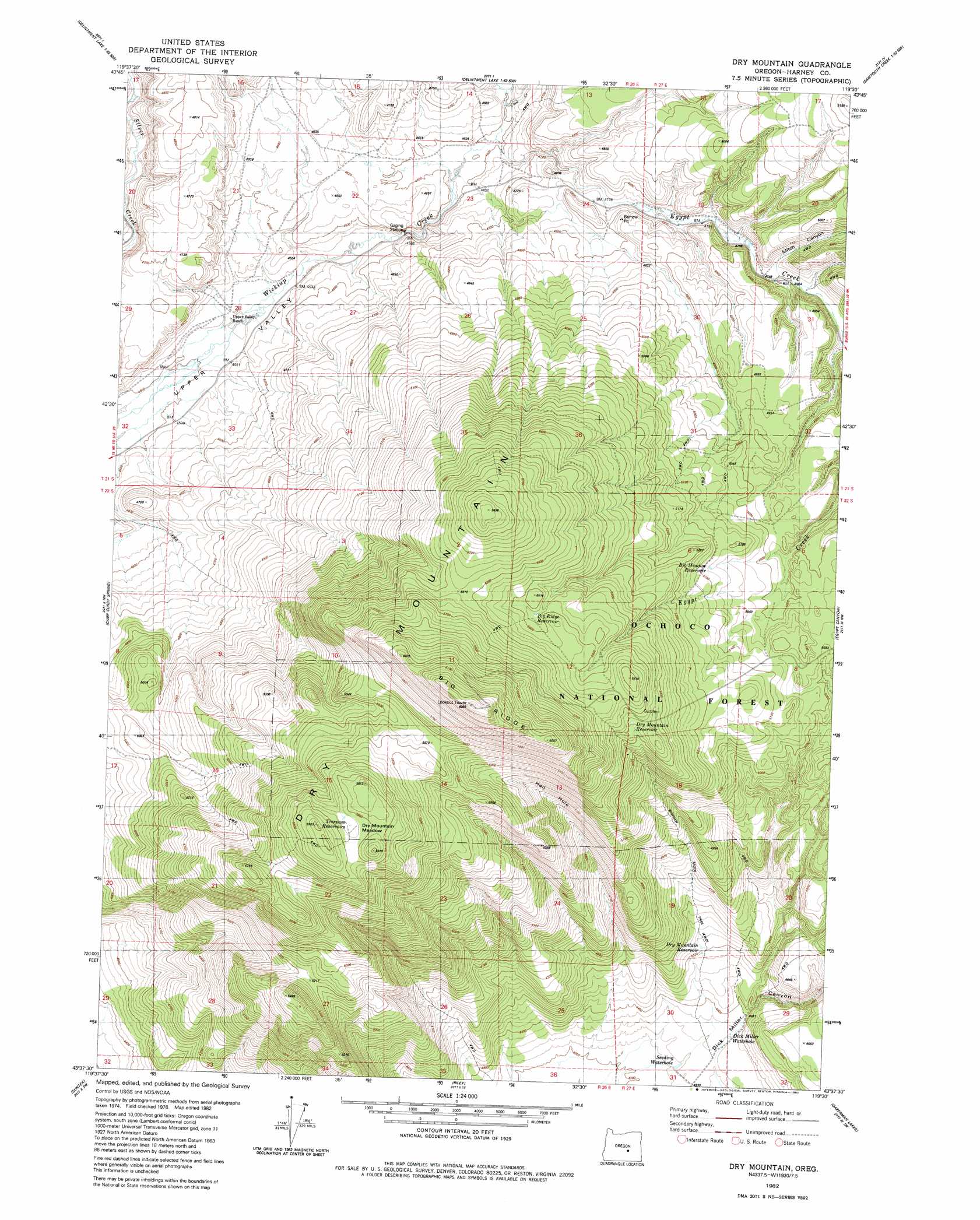
USGS Topo Quad 43119f5 - 1:24,000 scale
| Topo Map Name: | Dry Mountain |
| USGS Topo Quad ID: | 43119f5 |
| Print Size: | ca. 21 1/4" wide x 27" high |
| Southeast Coordinates: | 43.625° N latitude / 119.5° W longitude |
| Map Center Coordinates: | 43.6875° N latitude / 119.5625° W longitude |
| U.S. State: | OR |
| Filename: | o43119f5.jpg |
| Download Map JPG Image: | Dry Mountain topo map 1:24,000 scale |
| Map Type: | Topographic |
| Topo Series: | 7.5´ |
| Map Scale: | 1:24,000 |
| Source of Map Images: | United States Geological Survey (USGS) |
| Alternate Map Versions: |
Dry Mountain OR 1982, updated 1982 Download PDF Buy paper map Dry Mountain OR 1992, updated 1997 Download PDF Buy paper map Dry Mountain OR 2011 Download PDF Buy paper map Dry Mountain OR 2014 Download PDF Buy paper map |
| FStopo: | US Forest Service topo Dry Mountain is available: Download FStopo PDF Download FStopo TIF |
1:24,000 Topo Quads surrounding Dry Mountain
Twelvemile Reservoir |
Delintment Lake |
Big Mowich Mountain |
Whiskey Mountain |
Alsup Mountain |
Mackey Butte |
Buck Spring |
Donnelly Butte |
Bear Canyon Butte |
Hughet Valley |
Bulger Ridge |
Camp Currey Spring |
Dry Mountain |
Egypt Canyon |
Holmes Canyon |
Potato Hills |
Suntex |
Riley |
Oakerman Lakes |
Sage Hen Hill |
Hay Lake |
Squaw Butte |
Capehart Lake |
Moon Reservoir |
Palomino Buttes |
> Back to 43119e1 at 1:100,000 scale
> Back to 43118a1 at 1:250,000 scale
> Back to U.S. Topo Maps home
Dry Mountain topo map: Gazetteer
Dry Mountain: Reservoirs
Dry Mountain Reservoir elevation 1477m 4845′Dry Mountain: Streams
Claw Creek elevation 1404m 4606′Egypt Creek elevation 1403m 4603′
Dry Mountain: Summits
Dry Mountain elevation 1798m 5898′Dry Mountain: Valleys
Miller Canyon elevation 1325m 4347′Dry Mountain digital topo map on disk
Buy this Dry Mountain topo map showing relief, roads, GPS coordinates and other geographical features, as a high-resolution digital map file on DVD: