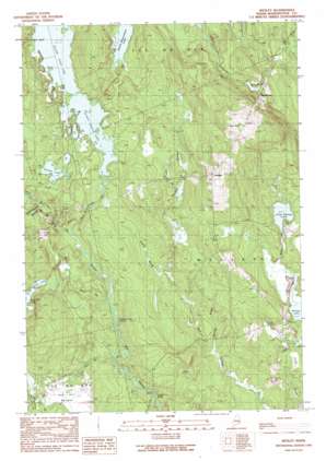
Wesley Topo Map Maine
To zoom in, hover over the map of Wesley
USGS Topo Quad 44067h6 - 1:24,000 scale
| Topo Map Name: | Wesley |
| USGS Topo Quad ID: | 44067h6 |
| Print Size: | ca. 21 1/4" wide x 27" high |
| Southeast Coordinates: | 44.875° N latitude / 67.625° W longitude |
| Map Center Coordinates: | 44.9375° N latitude / 67.6875° W longitude |
| U.S. State: | ME |
| Filename: | o44067h6.jpg |
| Download Map JPG Image: | Wesley topo map 1:24,000 scale |
| Map Type: | Topographic |
| Topo Series: | 7.5´ |
| Map Scale: | 1:24,000 |
| Source of Map Images: | United States Geological Survey (USGS) |
| Alternate Map Versions: |
Wesley ME 1990, updated 1990 Download PDF Buy paper map Wesley ME 2011 Download PDF Buy paper map Wesley ME 2014 Download PDF Buy paper map |
1:24,000 Topo Quads surrounding Wesley
> Back to 44067e1 at 1:100,000 scale
> Back to 44066a1 at 1:250,000 scale
> Back to U.S. Topo Maps home
Wesley topo map: Gazetteer
Wesley: Cliffs
Longfellow Pitch elevation 30m 98′Wesley: Dams
Chain Lake Dam elevation 70m 229′Wesley: Flats
Sam Hill Barrens elevation 75m 246′Wesley: Lakes
Grover Lake elevation 74m 242′Little Seavey Lake elevation 63m 206′
Seavey Lake elevation 51m 167′
Second Chain Lake elevation 70m 229′
South Beaverdam Lake elevation 79m 259′
Trout Lake elevation 81m 265′
Wesley: Populated Places
Wesley elevation 150m 492′Wesley: Rapids
Stinking Jam Rapids elevation 46m 150′Wesley: Reservoirs
First Chain Lake elevation 70m 229′Wesley: Streams
Chain Lake Stream elevation 51m 167′Dudley Brook elevation 44m 144′
Honeymoon Brook elevation 54m 177′
Huntley Brook elevation 32m 104′
Joe Hill Brook elevation 44m 144′
Seavey Brook elevation 51m 167′
Trout Brook elevation 47m 154′
West Branch New Stream elevation 72m 236′
Wesley: Summits
Day Hill elevation 165m 541′Wesley digital topo map on disk
Buy this Wesley topo map showing relief, roads, GPS coordinates and other geographical features, as a high-resolution digital map file on DVD:
Maine, New Hampshire, Rhode Island & Eastern Massachusetts
Buy digital topo maps: Maine, New Hampshire, Rhode Island & Eastern Massachusetts


