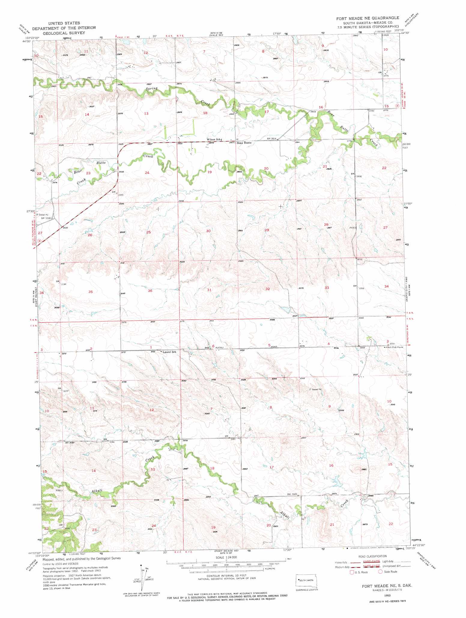
Fort Meade Ne Topo Map South Dakota
To zoom in, hover over the map of Fort Meade Ne
USGS Topo Quad 44103d3 - 1:24,000 scale
| Topo Map Name: | Fort Meade Ne |
| USGS Topo Quad ID: | 44103d3 |
| Print Size: | ca. 21 1/4" wide x 27" high |
| Southeast Coordinates: | 44.375° N latitude / 103.25° W longitude |
| Map Center Coordinates: | 44.4375° N latitude / 103.3125° W longitude |
| U.S. State: | SD |
| Filename: | o44103d3.jpg |
| Download Map JPG Image: | Fort Meade Ne topo map 1:24,000 scale |
| Map Type: | Topographic |
| Topo Series: | 7.5´ |
| Map Scale: | 1:24,000 |
| Source of Map Images: | United States Geological Survey (USGS) |
| Alternate Map Versions: |
Fort Meade NE SD 1953, updated 1955 Download PDF Buy paper map Fort Meade NE SD 1953, updated 1975 Download PDF Buy paper map Fort Meade NE SD 2012 Download PDF Buy paper map Fort Meade NE SD 2015 Download PDF Buy paper map |
1:24,000 Topo Quads surrounding Fort Meade Ne
Nisland |
Newell |
Vale Ne |
Volunteer Nw |
Volunteer Ne |
Saint Onge Se |
Vale |
Vale Se |
Volunteer |
Volunteer Se |
Sturgis |
Fort Meade |
Fort Meade Ne |
Rapid City 1 Nw |
Rapid City 1 Ne |
Deadman Mountain |
Tilford |
Fort Meade Se |
Rapid City 1 Sw |
Rapid City 1 Se |
Nemo |
Piedmont |
Blackhawk |
Rapid City Nw |
Bend |
> Back to 44103a1 at 1:100,000 scale
> Back to 44102a1 at 1:250,000 scale
> Back to U.S. Topo Maps home
Fort Meade Ne topo map: Gazetteer
Fort Meade Ne: Populated Places
Bear Butte elevation 871m 2857′Fort Meade Ne: Streams
Cottle Creek elevation 893m 2929′Spring Creek elevation 854m 2801′
Fort Meade Ne digital topo map on disk
Buy this Fort Meade Ne topo map showing relief, roads, GPS coordinates and other geographical features, as a high-resolution digital map file on DVD:
Eastern Wyoming & Western South Dakota
Buy digital topo maps: Eastern Wyoming & Western South Dakota