Deadman Lake Topo Map Montana
To zoom in, hover over the map of Deadman Lake
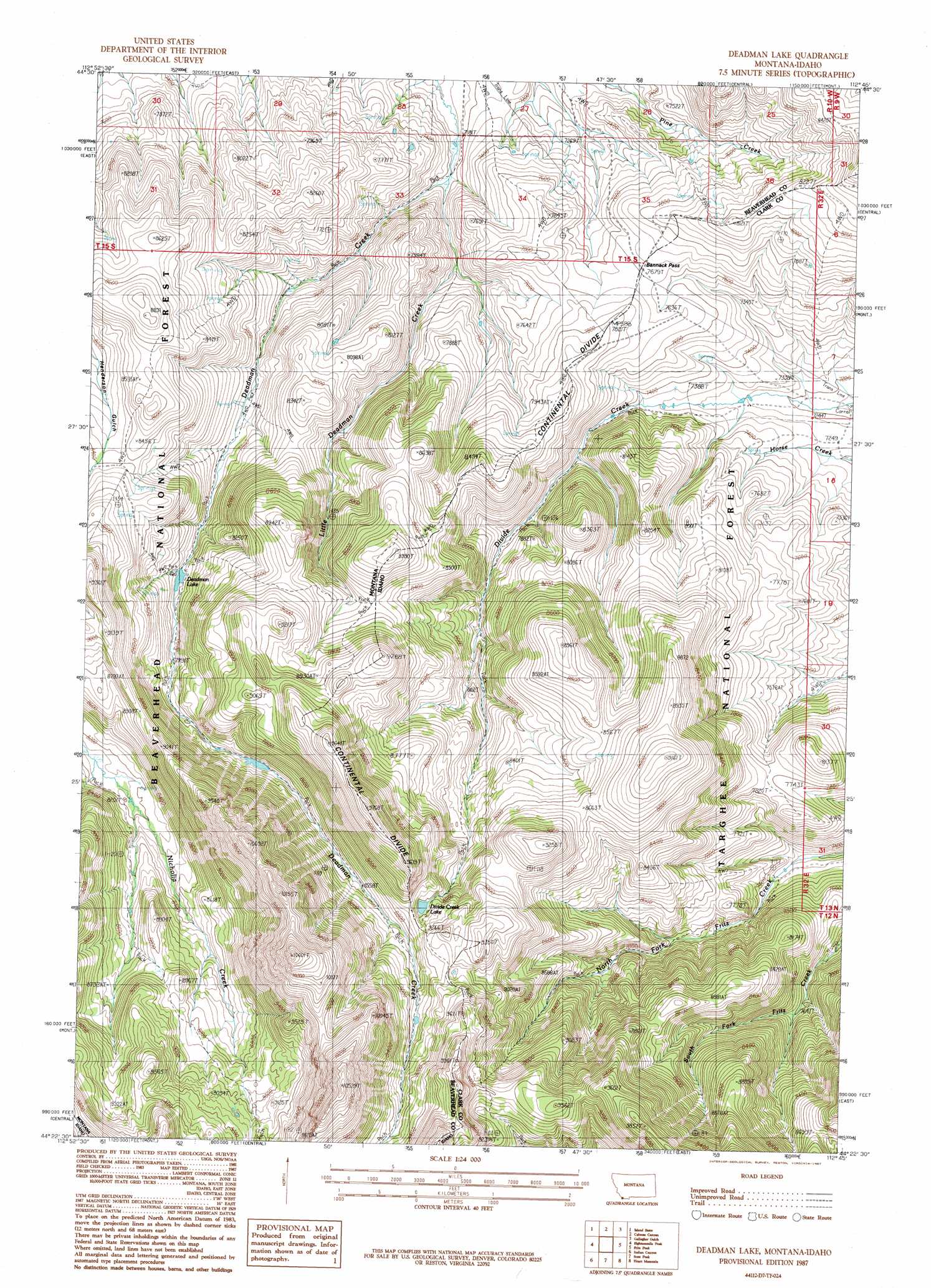
USGS Topo Quad 44112d7 - 1:24,000 scale
| Topo Map Name: | Deadman Lake |
| USGS Topo Quad ID: | 44112d7 |
| Print Size: | ca. 21 1/4" wide x 27" high |
| Southeast Coordinates: | 44.375° N latitude / 112.75° W longitude |
| Map Center Coordinates: | 44.4375° N latitude / 112.8125° W longitude |
| U.S. States: | MT, ID |
| Filename: | o44112d7.jpg |
| Download Map JPG Image: | Deadman Lake topo map 1:24,000 scale |
| Map Type: | Topographic |
| Topo Series: | 7.5´ |
| Map Scale: | 1:24,000 |
| Source of Map Images: | United States Geological Survey (USGS) |
| Alternate Map Versions: |
Deadman Lake MT 1987, updated 1987 Download PDF Buy paper map Deadman Lake MT 2011 Download PDF Buy paper map Deadman Lake MT 2014 Download PDF Buy paper map |
| FStopo: | US Forest Service topo Deadman Lake is available: Download FStopo PDF Download FStopo TIF |
1:24,000 Topo Quads surrounding Deadman Lake
Tepee Mountain |
Graphite Mountain |
Dixon Mountain |
Dell |
Lima |
Morrison Lake |
Island Butte |
Caboose Canyon |
Gallagher Gulch |
Lima Peaks |
Cottonwood Creek |
Eighteenmile Peak |
Deadman Lake |
Fritz Peak |
Edie Creek |
Nicholia |
Italian Canyon |
Scott Peak |
Heart Mountain |
Rocky Creek |
Diamond Peak |
Blue Dome |
Copper Mountain |
Shamrock Gulch |
Lidy Hot Springs |
> Back to 44112a1 at 1:100,000 scale
> Back to 44112a1 at 1:250,000 scale
> Back to U.S. Topo Maps home
Deadman Lake topo map: Gazetteer
Deadman Lake: Gaps
Bannack Pass elevation 2339m 7673′Bannack Pass elevation 2339m 7673′
Deadman Lake: Lakes
Deadman Lake elevation 2409m 7903′Divide Creek Lake elevation 2696m 8845′
Deadman Lake: Streams
Little Deadman Creek elevation 2185m 7168′Deadman Lake digital topo map on disk
Buy this Deadman Lake topo map showing relief, roads, GPS coordinates and other geographical features, as a high-resolution digital map file on DVD: