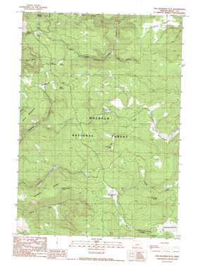
Five Hundred Flat Topo Map Oregon
To zoom in, hover over the map of Five Hundred Flat
USGS Topo Quad 44119a2 - 1:24,000 scale
| Topo Map Name: | Five Hundred Flat |
| USGS Topo Quad ID: | 44119a2 |
| Print Size: | ca. 21 1/4" wide x 27" high |
| Southeast Coordinates: | 44° N latitude / 119.125° W longitude |
| Map Center Coordinates: | 44.0625° N latitude / 119.1875° W longitude |
| U.S. State: | OR |
| Filename: | o44119a2.jpg |
| Download Map JPG Image: | Five Hundred Flat topo map 1:24,000 scale |
| Map Type: | Topographic |
| Topo Series: | 7.5´ |
| Map Scale: | 1:24,000 |
| Source of Map Images: | United States Geological Survey (USGS) |
| Alternate Map Versions: |
Five Hundred Flat OR 1990, updated 1990 Download PDF Buy paper map Five Hundred Flat OR 1998, updated 2000 Download PDF Buy paper map Five Hundred Flat OR 2011 Download PDF Buy paper map Five Hundred Flat OR 2014 Download PDF Buy paper map |
| FStopo: | US Forest Service topo Five Hundred Flat is available: Download FStopo PDF Download FStopo TIF |
1:24,000 Topo Quads surrounding Five Hundred Flat
> Back to 44119a1 at 1:100,000 scale
> Back to 44118a1 at 1:250,000 scale
> Back to U.S. Topo Maps home
Five Hundred Flat topo map: Gazetteer
Five Hundred Flat: Flats
Five Hundred Flat elevation 1767m 5797′Grasshopper Flat elevation 1708m 5603′
Smith Meadows elevation 1733m 5685′
Wymer Meadow elevation 1625m 5331′
Five Hundred Flat: Lakes
The Potholes elevation 1751m 5744′Five Hundred Flat: Ridges
Gilbert Ridge elevation 1853m 6079′Five Hundred Flat: Springs
Elk Spring elevation 1765m 5790′Gilbert Ridge Spring elevation 1750m 5741′
Last Cabin Spring elevation 1724m 5656′
Lemcke Spring elevation 1746m 5728′
McArthur Spring elevation 1716m 5629′
Mud Spring elevation 1720m 5643′
Pine Ridge Spring elevation 1667m 5469′
Pine Spring elevation 1768m 5800′
Five Hundred Flat: Streams
East Scotty Creek elevation 1608m 5275′North Scotty Creek elevation 1557m 5108′
South Scotty Creek elevation 1557m 5108′
Five Hundred Flat digital topo map on disk
Buy this Five Hundred Flat topo map showing relief, roads, GPS coordinates and other geographical features, as a high-resolution digital map file on DVD:


