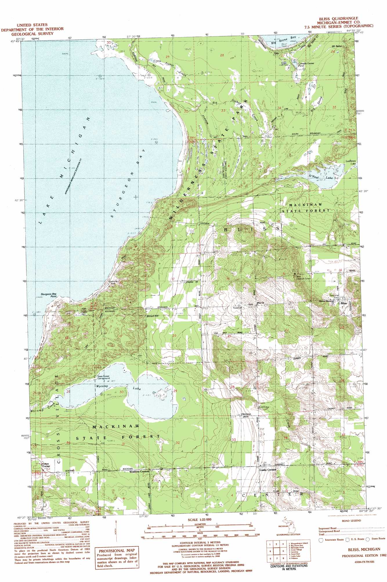
Bliss Topo Map Michigan
To zoom in, hover over the map of Bliss
USGS Topo Quad 45084f8 - 1:25,000 scale
| Topo Map Name: | Bliss |
| USGS Topo Quad ID: | 45084f8 |
| Print Size: | ca. 21 1/4" wide x 27" high |
| Southeast Coordinates: | 45.625° N latitude / 84.875° W longitude |
| Map Center Coordinates: | 45.6875° N latitude / 84.9375° W longitude |
| U.S. State: | MI |
| Filename: | l45084f8.jpg |
| Download Map JPG Image: | Bliss topo map 1:25,000 scale |
| Map Type: | Topographic |
| Topo Series: | 7.5´ |
| Map Scale: | 1:25,000 |
| Source of Map Images: | United States Geological Survey (USGS) |
| Alternate Map Versions: |
Bliss MI 1982, updated 1983 Download PDF Buy paper map |
1:24,000 Topo Quads surrounding Bliss
Pnte Aux Chenes |
Moran |
Evergreen Shores |
||
Waugoshance Island |
Big Stone Bay |
Mcgulpin Point |
Saint Ignace |
|
Cross Village |
Bliss |
Levaring |
Freedom |
|
Goodhart |
Larks Lake |
Pellston |
Indian Village |
|
Forest Beach |
Harbor Springs |
Alanson |
Burt Lake |
> Back to 45084e1 at 1:100,000 scale
> Back to 45084a1 at 1:250,000 scale
> Back to U.S. Topo Maps home
Bliss topo map: Gazetteer
Bliss: Bays
Big Stone Bay elevation 177m 580′Bliss: Capes
Sturgeon Bay Point elevation 177m 580′Bliss: Lakes
Canada Goose Pond elevation 183m 600′O'Neal Lake elevation 190m 623′
Wycamp Lake elevation 187m 613′
Bliss: Parks
Bliss Pioneer Memorial Church Historical Marker elevation 233m 764′Wilderness State Park elevation 185m 606′
Bliss: Populated Places
Bliss elevation 233m 764′Canby Corners elevation 227m 744′
Bliss: Post Offices
Bliss Post Office (historical) elevation 233m 764′Canby Post Office (historical) elevation 227m 744′
Sturgeon Bay Post Office (historical) elevation 180m 590′
Bliss: Streams
Big Stone Creek elevation 183m 600′Big Sucker Creek elevation 177m 580′
Little Sucker Creek elevation 179m 587′
Bliss: Summits
Billiau Hill elevation 207m 679′Bliss digital topo map on disk
Buy this Bliss topo map showing relief, roads, GPS coordinates and other geographical features, as a high-resolution digital map file on DVD: