Evergreen Shores Topo Map Michigan
To zoom in, hover over the map of Evergreen Shores
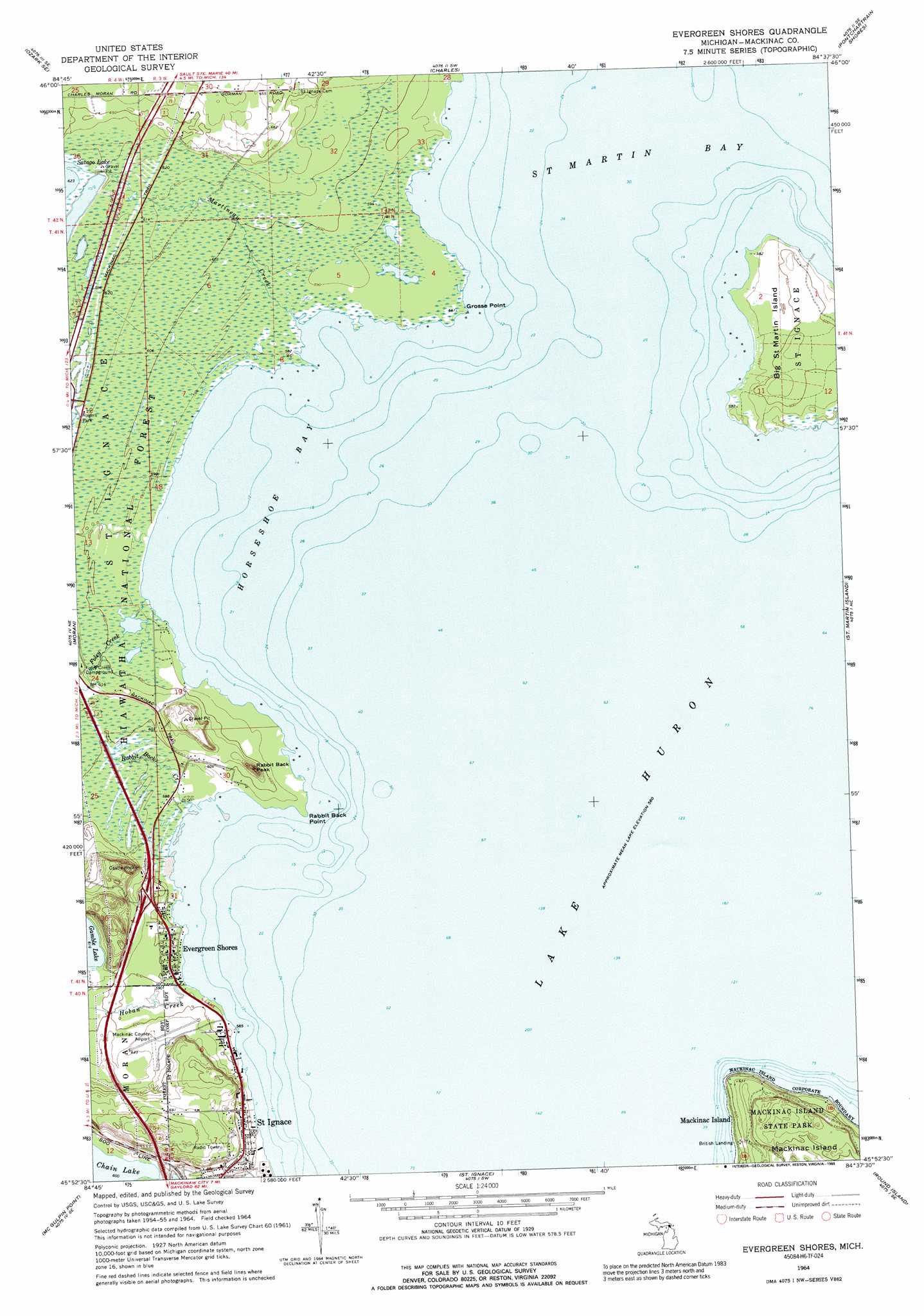
USGS Topo Quad 45084h6 - 1:24,000 scale
| Topo Map Name: | Evergreen Shores |
| USGS Topo Quad ID: | 45084h6 |
| Print Size: | ca. 21 1/4" wide x 27" high |
| Southeast Coordinates: | 45.875° N latitude / 84.625° W longitude |
| Map Center Coordinates: | 45.9375° N latitude / 84.6875° W longitude |
| U.S. State: | MI |
| Filename: | o45084h6.jpg |
| Download Map JPG Image: | Evergreen Shores topo map 1:24,000 scale |
| Map Type: | Topographic |
| Topo Series: | 7.5´ |
| Map Scale: | 1:24,000 |
| Source of Map Images: | United States Geological Survey (USGS) |
| Alternate Map Versions: |
Evergreen Shores MI 1964, updated 1966 Download PDF Buy paper map Evergreen Shores MI 1964, updated 1989 Download PDF Buy paper map Evergreen Shores MI 2011 Download PDF Buy paper map Evergreen Shores MI 2014 Download PDF Buy paper map Evergreen Shores MI 2017 Download PDF Buy paper map |
| FStopo: | US Forest Service topo Evergreen Shores is available: Download FStopo PDF Download FStopo TIF |
1:24,000 Topo Quads surrounding Evergreen Shores
Ozark |
Ozark Ne |
Fibre |
Rudyard |
Pickford Nw |
Kenneth |
Ozark Se |
Charles |
Pontchartrain Shores |
Hessel |
Pnte Aux Chenes |
Moran |
Evergreen Shores |
Saint Martin Island |
Goose Island |
Big Stone Bay |
Mcgulpin Point |
Saint Ignace |
Round Island |
Mcrae Bay |
Bliss |
Levaring |
Freedom |
Point Nipigon |
Cheboygan |
> Back to 45084e1 at 1:100,000 scale
> Back to 45084a1 at 1:250,000 scale
> Back to U.S. Topo Maps home
Evergreen Shores topo map: Gazetteer
Evergreen Shores: Airports
Mackinac County Airport elevation 191m 626′Evergreen Shores: Bays
Horseshoe Bay elevation 177m 580′Evergreen Shores: Capes
Grosse Point elevation 177m 580′Point aux Pins elevation 183m 600′
Point Saint Clair elevation 177m 580′
Rabbit Back Point elevation 178m 583′
Evergreen Shores: Crossings
Interchange 348 elevation 186m 610′Evergreen Shores: Islands
Big Saint Martin Island elevation 184m 603′Evergreen Shores: Parks
British Landing Historical Marker elevation 179m 587′Rogers Park elevation 189m 620′
Evergreen Shores: Populated Places
British Landing elevation 179m 587′Evergreen Shores elevation 181m 593′
Evergreen Shores: Streams
Foley Creek elevation 177m 580′Hoban Creek elevation 177m 580′
Martineau Creek elevation 177m 580′
Rabbit Back Creek elevation 177m 580′
Evergreen Shores: Summits
Castle Rock elevation 215m 705′Rabbit Back Peak elevation 212m 695′
Evergreen Shores: Trails
Horseshoe Bay Trail elevation 182m 597′Evergreen Shores digital topo map on disk
Buy this Evergreen Shores topo map showing relief, roads, GPS coordinates and other geographical features, as a high-resolution digital map file on DVD: