Whitney Topo Map Michigan
To zoom in, hover over the map of Whitney
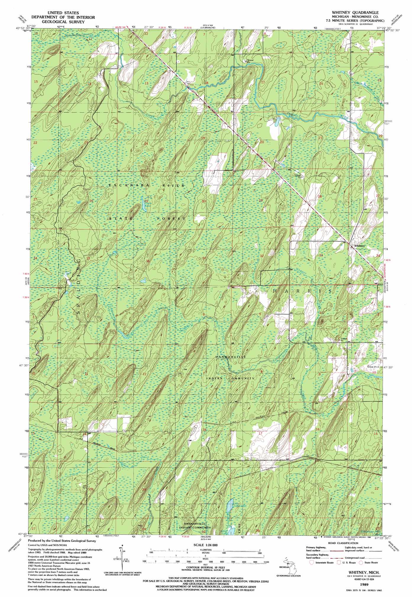
USGS Topo Quad 45087g4 - 1:24,000 scale
| Topo Map Name: | Whitney |
| USGS Topo Quad ID: | 45087g4 |
| Print Size: | ca. 21 1/4" wide x 27" high |
| Southeast Coordinates: | 45.75° N latitude / 87.375° W longitude |
| Map Center Coordinates: | 45.8125° N latitude / 87.4375° W longitude |
| U.S. State: | MI |
| Filename: | o45087g4.jpg |
| Download Map JPG Image: | Whitney topo map 1:24,000 scale |
| Map Type: | Topographic |
| Topo Series: | 7.5´ |
| Map Scale: | 1:24,000 |
| Source of Map Images: | United States Geological Survey (USGS) |
| Alternate Map Versions: |
Whitney MI 1989, updated 1989 Download PDF Buy paper map Whitney MI 2011 Download PDF Buy paper map Whitney MI 2014 Download PDF Buy paper map Whitney MI 2016 Download PDF Buy paper map |
1:24,000 Topo Quads surrounding Whitney
Alfred |
Northland |
Arnold |
Swimming Hole Creek |
Rock |
Foster City |
Helps |
La Branche |
Woodlawn |
Cornell |
Waucedah |
Vega |
Whitney |
Schaffer |
Chandler |
Cunard |
Hermansville |
Wilson |
Bark River |
Ford River |
Banat |
Nadeau |
Gourley |
Bark River Se |
Henderson Lakes |
> Back to 45087e1 at 1:100,000 scale
> Back to 45086a1 at 1:250,000 scale
> Back to U.S. Topo Maps home
Whitney topo map: Gazetteer
Whitney: Lakes
Indian Lake elevation 245m 803′Little Indian Lake elevation 246m 807′
Oliver Lake elevation 276m 905′
Whitney: Populated Places
Whitney elevation 262m 859′Whitney: Post Offices
Whitney Post Office (historical) elevation 263m 862′Whitney: Streams
Whitney Creek elevation 253m 830′Whitney digital topo map on disk
Buy this Whitney topo map showing relief, roads, GPS coordinates and other geographical features, as a high-resolution digital map file on DVD: