Alvin Sw Topo Map Wisconsin
To zoom in, hover over the map of Alvin Sw
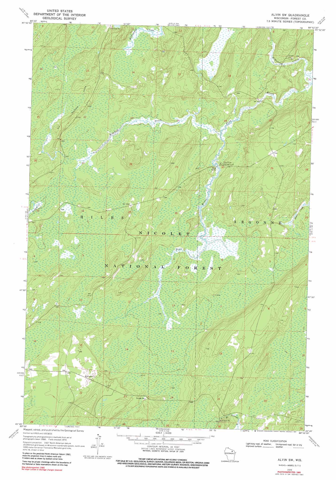
USGS Topo Quad 45088g8 - 1:24,000 scale
| Topo Map Name: | Alvin Sw |
| USGS Topo Quad ID: | 45088g8 |
| Print Size: | ca. 21 1/4" wide x 27" high |
| Southeast Coordinates: | 45.75° N latitude / 88.875° W longitude |
| Map Center Coordinates: | 45.8125° N latitude / 88.9375° W longitude |
| U.S. State: | WI |
| Filename: | o45088g8.jpg |
| Download Map JPG Image: | Alvin Sw topo map 1:24,000 scale |
| Map Type: | Topographic |
| Topo Series: | 7.5´ |
| Map Scale: | 1:24,000 |
| Source of Map Images: | United States Geological Survey (USGS) |
| Alternate Map Versions: |
Alvin SW WI 1970, updated 1972 Download PDF Buy paper map Alvin SW WI 1970, updated 1984 Download PDF Buy paper map Alvin SW WI 2011 Download PDF Buy paper map Alvin SW WI 2013 Download PDF Buy paper map Alvin SW WI 2015 Download PDF Buy paper map |
| FStopo: | US Forest Service topo Alvin SW is available: Download FStopo PDF Download FStopo TIF |
1:24,000 Topo Quads surrounding Alvin Sw
Pioneer Lake |
Phelps |
Smoky Lake |
Hagerman Lake |
Iron River |
Eagle River East |
Anvil Lake |
Alvin Nw |
Alvin |
Tipler |
Three Lakes |
Julia Lake |
Alvin Sw |
Alvin Se |
Long Lake |
Starks |
Monico Ne |
Argonne |
Crandon Ne |
Newald |
Monico |
Nashville |
Crandon |
Lake Lucerne |
Laona |
> Back to 45088e1 at 1:100,000 scale
> Back to 45088a1 at 1:250,000 scale
> Back to U.S. Topo Maps home
Alvin Sw topo map: Gazetteer
Alvin Sw: Parks
Giant White Pine Grove State Natural Area elevation 509m 1669′Alvin Sw: Streams
Kimball Creek elevation 499m 1637′McDonald Creek elevation 498m 1633′
Alvin Sw: Trails
Kimball Creek Trail elevation 524m 1719′Alvin Sw digital topo map on disk
Buy this Alvin Sw topo map showing relief, roads, GPS coordinates and other geographical features, as a high-resolution digital map file on DVD: