Dogie Butte Topo Map South Dakota
To zoom in, hover over the map of Dogie Butte
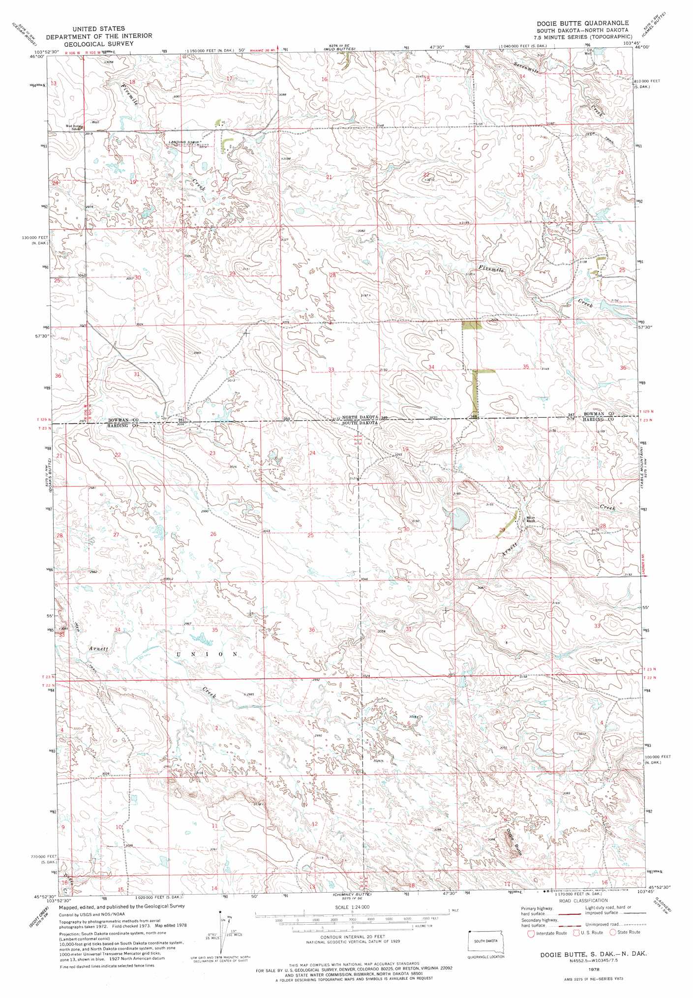
USGS Topo Quad 45103h7 - 1:24,000 scale
| Topo Map Name: | Dogie Butte |
| USGS Topo Quad ID: | 45103h7 |
| Print Size: | ca. 21 1/4" wide x 27" high |
| Southeast Coordinates: | 45.875° N latitude / 103.75° W longitude |
| Map Center Coordinates: | 45.9375° N latitude / 103.8125° W longitude |
| U.S. States: | SD, ND |
| Filename: | o45103h7.jpg |
| Download Map JPG Image: | Dogie Butte topo map 1:24,000 scale |
| Map Type: | Topographic |
| Topo Series: | 7.5´ |
| Map Scale: | 1:24,000 |
| Source of Map Images: | United States Geological Survey (USGS) |
| Alternate Map Versions: |
Dogie Butte SD 1978, updated 1978 Download PDF Buy paper map Dogie Butte SD 2011 Download PDF Buy paper map Dogie Butte SD 2012 Download PDF Buy paper map Dogie Butte SD 2015 Download PDF Buy paper map |
1:24,000 Topo Quads surrounding Dogie Butte
Webster Ne |
Kid Creek |
Cedar Hills |
Rhame |
Griffin |
Scole School |
Cedar Ridge |
Mud Buttes |
Camel Butte |
Rhame Se |
Snider Hill |
Doaks Butte |
Dogie Butte |
Table Mountain |
Ladner Ne |
Humbolt Hills |
Scott Creek |
Chimney Butte |
Ladner |
Ladner Se |
North Slick Creek |
Caroline Butte |
Gallup Creek |
Lahti Butte |
Mckenzie Butte |
> Back to 45103e1 at 1:100,000 scale
> Back to 45102a1 at 1:250,000 scale
> Back to U.S. Topo Maps home
Dogie Butte topo map: Gazetteer
Dogie Butte: Dams
Olson Dam elevation 953m 3126′Dogie Butte: Summits
Dogie Butte elevation 990m 3248′Dogie Butte digital topo map on disk
Buy this Dogie Butte topo map showing relief, roads, GPS coordinates and other geographical features, as a high-resolution digital map file on DVD:
Eastern Montana & Western North Dakota
Buy digital topo maps: Eastern Montana & Western North Dakota