Prairie Dog Creek Topo Map Montana
To zoom in, hover over the map of Prairie Dog Creek
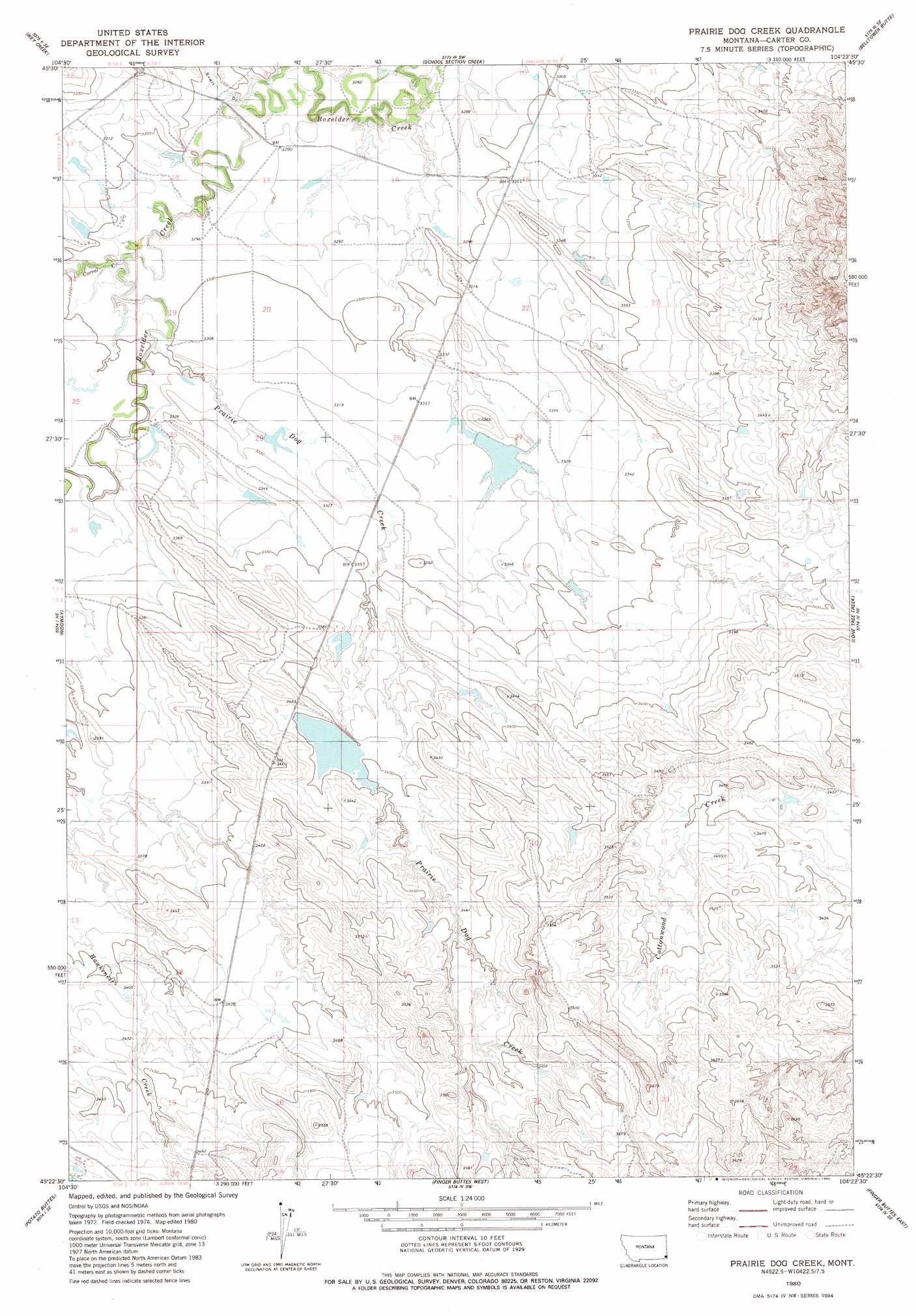
USGS Topo Quad 45104d4 - 1:24,000 scale
| Topo Map Name: | Prairie Dog Creek |
| USGS Topo Quad ID: | 45104d4 |
| Print Size: | ca. 21 1/4" wide x 27" high |
| Southeast Coordinates: | 45.375° N latitude / 104.375° W longitude |
| Map Center Coordinates: | 45.4375° N latitude / 104.4375° W longitude |
| U.S. State: | MT |
| Filename: | o45104d4.jpg |
| Download Map JPG Image: | Prairie Dog Creek topo map 1:24,000 scale |
| Map Type: | Topographic |
| Topo Series: | 7.5´ |
| Map Scale: | 1:24,000 |
| Source of Map Images: | United States Geological Survey (USGS) |
| Alternate Map Versions: |
Prairie Dog Creek MT 1980, updated 1980 Download PDF Buy paper map Prairie Dog Creek MT 2011 Download PDF Buy paper map Prairie Dog Creek MT 2014 Download PDF Buy paper map |
1:24,000 Topo Quads surrounding Prairie Dog Creek
Chalk Buttes |
Dead Boy Divide |
Taylor Hills |
Belltower |
Rustler Divide |
Dutchman Creek |
Ikey Creek |
School Section Creek |
Belltower Butte |
Timber Hill |
Whitetail Creek |
Ridgway |
Prairie Dog Creek |
Lone Tree Creek |
Capitol Nw |
Tip Top Butte |
Potato Buttes |
Finger Buttes West |
Finger Buttes East |
Cactus Creek West |
Black Point |
Black Point Ne |
Alzada Nw |
Albion |
Elkhorn Creek West |
> Back to 45104a1 at 1:100,000 scale
> Back to 45104a1 at 1:250,000 scale
> Back to U.S. Topo Maps home
Prairie Dog Creek topo map: Gazetteer
Prairie Dog Creek: Dams
Earl Krietel Number 3 Dam elevation 1011m 3316′Earl Krietel Number 4 Dam elevation 1034m 3392′
Prairie Dog Creek: Streams
Corral Creek elevation 1004m 3293′Prairie Dog Creek elevation 1006m 3300′
Sherril Creek elevation 1006m 3300′
Prairie Dog Creek: Valleys
Ewalt Draw elevation 1001m 3284′Prairie Dog Creek: Wells
19N57E10BBDC01 Well elevation 1034m 3392′Prairie Dog Creek digital topo map on disk
Buy this Prairie Dog Creek topo map showing relief, roads, GPS coordinates and other geographical features, as a high-resolution digital map file on DVD:
Eastern Montana & Western North Dakota
Buy digital topo maps: Eastern Montana & Western North Dakota