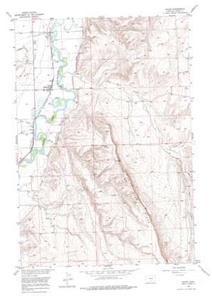
Edgar Topo Map Montana
To zoom in, hover over the map of Edgar
USGS Topo Quad 45108d7 - 1:24,000 scale
| Topo Map Name: | Edgar |
| USGS Topo Quad ID: | 45108d7 |
| Print Size: | ca. 21 1/4" wide x 27" high |
| Southeast Coordinates: | 45.375° N latitude / 108.75° W longitude |
| Map Center Coordinates: | 45.4375° N latitude / 108.8125° W longitude |
| U.S. State: | MT |
| Filename: | o45108d7.jpg |
| Download Map JPG Image: | Edgar topo map 1:24,000 scale |
| Map Type: | Topographic |
| Topo Series: | 7.5´ |
| Map Scale: | 1:24,000 |
| Source of Map Images: | United States Geological Survey (USGS) |
| Alternate Map Versions: |
Edgar MT 1956, updated 1958 Download PDF Buy paper map Edgar MT 1956, updated 1976 Download PDF Buy paper map Edgar MT 2011 Download PDF Buy paper map Edgar MT 2014 Download PDF Buy paper map |
1:24,000 Topo Quads surrounding Edgar
> Back to 45108a1 at 1:100,000 scale
> Back to 45108a1 at 1:250,000 scale
> Back to U.S. Topo Maps home
Edgar topo map: Gazetteer
Edgar: Canals
Edgar Canal elevation 1064m 3490′Edgar: Populated Places
Edgar elevation 1057m 3467′Edgar: Post Offices
Edgar Post Office elevation 1057m 3467′Edgar: Ridges
Two Bear Ridge elevation 1351m 4432′Edgar: Streams
Elbow Creek elevation 1060m 3477′Five Mile Creek elevation 1049m 3441′
Fivemile Creek elevation 1049m 3441′
Middle Fork Fivemile Creek elevation 1163m 3815′
North Fork Fivemile Creek elevation 1137m 3730′
Two Bear Creek elevation 1078m 3536′
Edgar: Wells
04S16E20CCCB01 Well elevation 1117m 3664′04S23E11CBBC01 Well elevation 1072m 3517′
04S23E13CCAA01 Well elevation 1049m 3441′
04S23E13CDAD01 Well elevation 1057m 3467′
04S23E13DBCA01 Well elevation 1062m 3484′
04S23E22DCBB01 Well elevation 1076m 3530′
04S23E23CBBB01 Well elevation 1069m 3507′
04S23E23CDDD01 Well elevation 1057m 3467′
04S23E25BCDC01 Well elevation 1057m 3467′
04S23E27DADA01 Well elevation 1062m 3484′
04S23E35CACD01 Well elevation 1061m 3480′
05S23E03AABA01 Well elevation 1062m 3484′
05S23E10AABB01 Well elevation 1066m 3497′
Edgar digital topo map on disk
Buy this Edgar topo map showing relief, roads, GPS coordinates and other geographical features, as a high-resolution digital map file on DVD:


