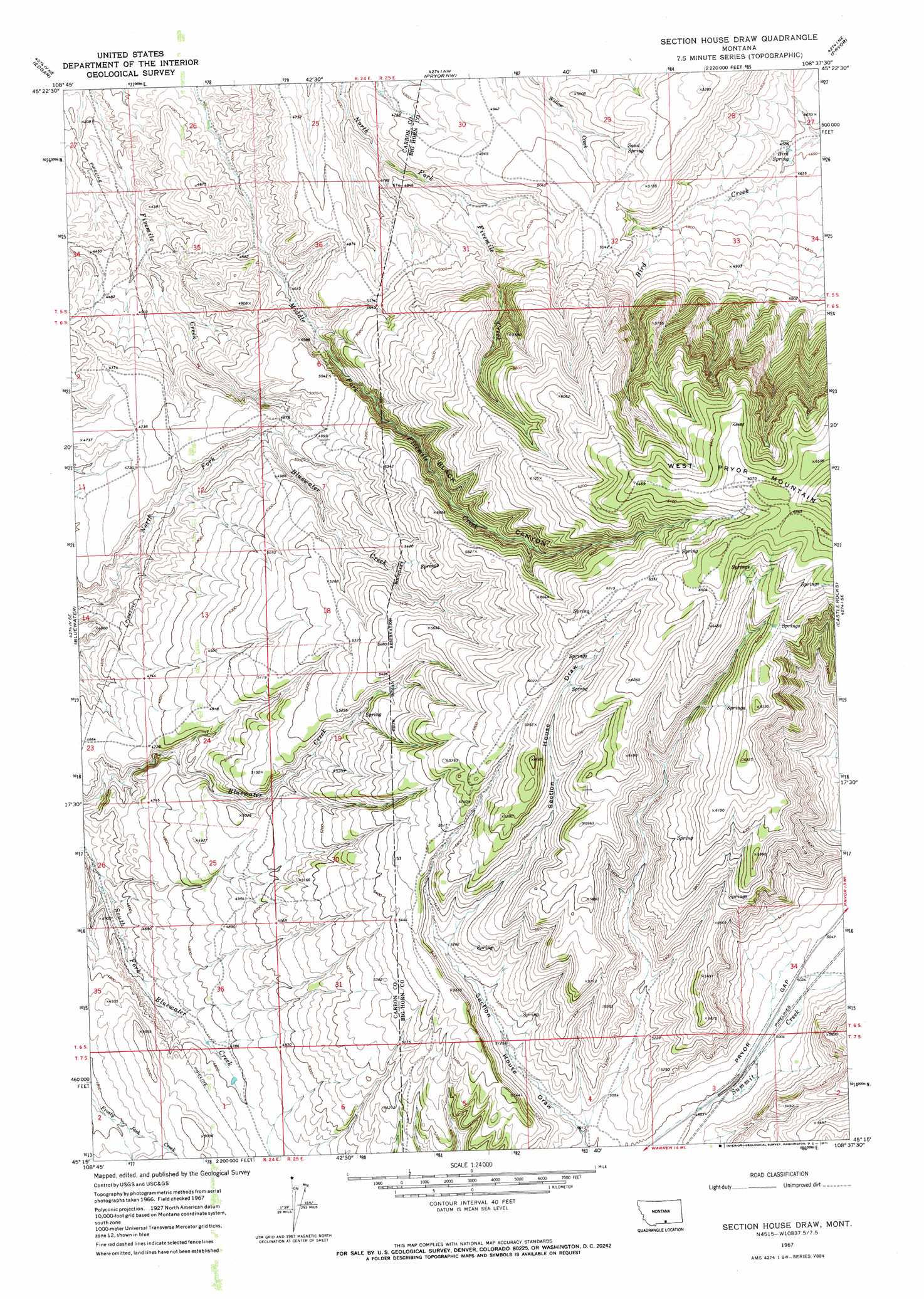
Section House Draw Topo Map Montana
To zoom in, hover over the map of Section House Draw
USGS Topo Quad 45108c6 - 1:24,000 scale
| Topo Map Name: | Section House Draw |
| USGS Topo Quad ID: | 45108c6 |
| Print Size: | ca. 21 1/4" wide x 27" high |
| Southeast Coordinates: | 45.25° N latitude / 108.625° W longitude |
| Map Center Coordinates: | 45.3125° N latitude / 108.6875° W longitude |
| U.S. State: | MT |
| Filename: | o45108c6.jpg |
| Download Map JPG Image: | Section House Draw topo map 1:24,000 scale |
| Map Type: | Topographic |
| Topo Series: | 7.5´ |
| Map Scale: | 1:24,000 |
| Source of Map Images: | United States Geological Survey (USGS) |
| Alternate Map Versions: |
Section House Draw MT 1967, updated 1971 Download PDF Buy paper map Section House Draw MT 2011 Download PDF Buy paper map Section House Draw MT 2014 Download PDF Buy paper map |
1:24,000 Topo Quads surrounding Section House Draw
Montaqua |
Silesia |
Mossmain Sw |
Stratford Hill |
Vale Creek Ranch |
Fromberg |
Edgar |
Pryor Nw |
Pryor |
Deep Creek |
Bridger |
Bluewater |
Section House Draw |
Castle Rocks |
Deep Creek Sw |
Hatcher Pass |
Wade |
Bowler |
Indian Spring |
Big Ice Cave |
Long Draw |
Hunters Creek |
Warren |
Bear Canyon |
Red Pryor Mountain |
> Back to 45108a1 at 1:100,000 scale
> Back to 45108a1 at 1:250,000 scale
> Back to U.S. Topo Maps home
Section House Draw topo map: Gazetteer
Section House Draw: Springs
Bird Spring elevation 1396m 4580′Sand Spring elevation 1550m 5085′
Section House Draw: Valleys
Black Canyon elevation 1388m 4553′Section House Draw digital topo map on disk
Buy this Section House Draw topo map showing relief, roads, GPS coordinates and other geographical features, as a high-resolution digital map file on DVD: