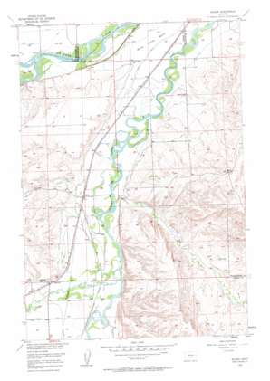
Silesia Topo Map Montana
To zoom in, hover over the map of Silesia
USGS Topo Quad 45108e7 - 1:24,000 scale
| Topo Map Name: | Silesia |
| USGS Topo Quad ID: | 45108e7 |
| Print Size: | ca. 21 1/4" wide x 27" high |
| Southeast Coordinates: | 45.5° N latitude / 108.75° W longitude |
| Map Center Coordinates: | 45.5625° N latitude / 108.8125° W longitude |
| U.S. State: | MT |
| Filename: | o45108e7.jpg |
| Download Map JPG Image: | Silesia topo map 1:24,000 scale |
| Map Type: | Topographic |
| Topo Series: | 7.5´ |
| Map Scale: | 1:24,000 |
| Source of Map Images: | United States Geological Survey (USGS) |
| Alternate Map Versions: |
Silesia MT 1956, updated 1958 Download PDF Buy paper map Silesia MT 2011 Download PDF Buy paper map Silesia MT 2014 Download PDF Buy paper map |
1:24,000 Topo Quads surrounding Silesia
> Back to 45108e1 at 1:100,000 scale
> Back to 45108a1 at 1:250,000 scale
> Back to U.S. Topo Maps home
Silesia topo map: Gazetteer
Silesia: Benches
White Horse Bench elevation 1027m 3369′Silesia: Canals
Big Ditch elevation 1013m 3323′Big Ditch elevation 1013m 3323′
Free Silver Ditch elevation 1073m 3520′
Glennwood Ditch elevation 1032m 3385′
Mason Canal elevation 1019m 3343′
Smith Ditch elevation 1061m 3480′
White Horse Canal elevation 1035m 3395′
Silesia: Populated Places
Mount Aqua Trailer Court elevation 1061m 3480′Rockvale elevation 1061m 3480′
Silesia elevation 1035m 3395′
Silesia: Post Offices
Rockvale Post Office (historical) elevation 1061m 3480′Silesia Post Office (historical) elevation 1034m 3392′
Silesia: Streams
Cottonwood Creek elevation 1028m 3372′Farewell Creek elevation 1025m 3362′
Little Cottonwood Creek elevation 1076m 3530′
Rock Creek elevation 1037m 3402′
Silesia: Summits
Round Butte elevation 1241m 4071′Silesia: Wells
02S24E28CCCD01 Well elevation 1012m 3320′02S24E31BDCA01 Well elevation 1020m 3346′
02S24E32DCAC01 Well elevation 1012m 3320′
02S24E33AAAB01 Well elevation 1002m 3287′
03S23E13DBBD01 Well elevation 1025m 3362′
03S23E23DAAA01 Well elevation 1037m 3402′
03S23E23DCAB01 Well elevation 1049m 3441′
03S23E24DACA01 Well elevation 1031m 3382′
03S23E26DACC01 Well elevation 1048m 3438′
03S23E26DCCA01 Well elevation 1053m 3454′
03S23E36CAAA01 Well elevation 1040m 3412′
03S24E05ADAB01 Well elevation 1012m 3320′
03S24E06BAAA01 Well elevation 1034m 3392′
03S24E06DACC01 Well elevation 1017m 3336′
03S24E06DDAA01 Well elevation 1014m 3326′
03S24E06DDCD01 Well elevation 1016m 3333′
03S24E07AAAB01 Well elevation 1016m 3333′
03S24E07CBBA01 Well elevation 1022m 3353′
03S24E08BBBA01 Well elevation 1015m 3330′
03S24E08BBBA02 Well elevation 1014m 3326′
03S24E18CDAC01 Well elevation 1030m 3379′
04S23E01BACC01 Well elevation 1045m 3428′
Silesia digital topo map on disk
Buy this Silesia topo map showing relief, roads, GPS coordinates and other geographical features, as a high-resolution digital map file on DVD:


