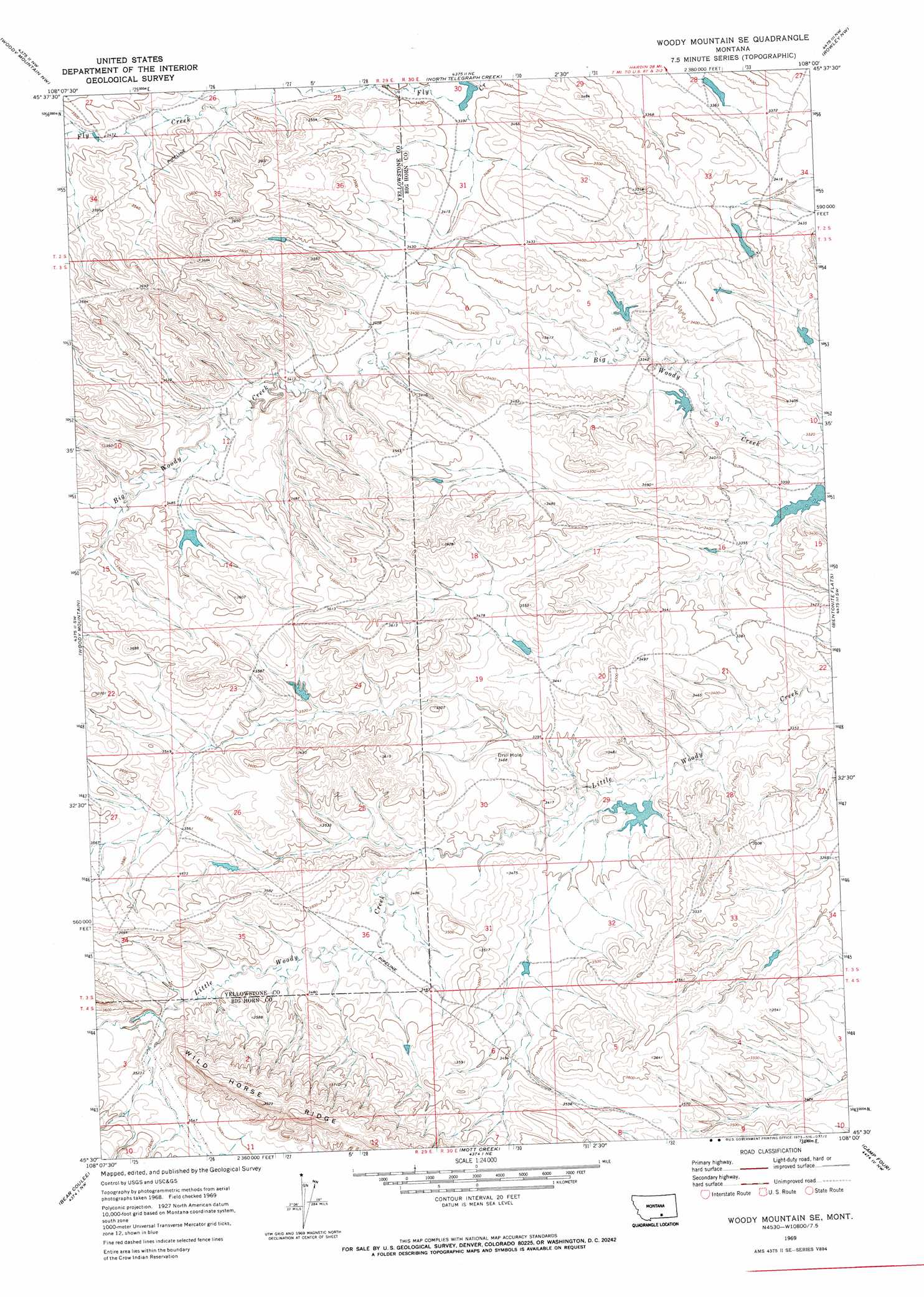
Woody Mountain Se Topo Map Montana
To zoom in, hover over the map of Woody Mountain Se
USGS Topo Quad 45108e1 - 1:24,000 scale
| Topo Map Name: | Woody Mountain Se |
| USGS Topo Quad ID: | 45108e1 |
| Print Size: | ca. 21 1/4" wide x 27" high |
| Southeast Coordinates: | 45.5° N latitude / 108° W longitude |
| Map Center Coordinates: | 45.5625° N latitude / 108.0625° W longitude |
| U.S. State: | MT |
| Filename: | o45108e1.jpg |
| Download Map JPG Image: | Woody Mountain Se topo map 1:24,000 scale |
| Map Type: | Topographic |
| Topo Series: | 7.5´ |
| Map Scale: | 1:24,000 |
| Source of Map Images: | United States Geological Survey (USGS) |
| Alternate Map Versions: |
Woody Mountain SE MT 1969, updated 1973 Download PDF Buy paper map Woody Mountain SE MT 2011 Download PDF Buy paper map Woody Mountain SE MT 2014 Download PDF Buy paper map |
1:24,000 Topo Quads surrounding Woody Mountain Se
Cottonwood Creek |
Indian Arrow |
Gails Coulee |
Corinth |
Blue Spring |
Badbaby Coulee |
Woody Mountain Nw |
North Telegraph Creek |
Rowley Nw |
Rowley |
Soda Springs |
Woody Mountain |
Woody Mountain Se |
Bentonite Flats |
Woody Creek Camp |
Chilkoot Coulee |
Bear Coulee |
Mott Creek |
Camp Four |
Lemonade Springs |
Deep Creek Se |
Bear Coulee Sw |
Grapevine Dome |
Yellowtail Dam |
Mountain Pocket Creek |
> Back to 45108e1 at 1:100,000 scale
> Back to 45108a1 at 1:250,000 scale
> Back to U.S. Topo Maps home
Woody Mountain Se topo map: Gazetteer
Woody Mountain Se: Dams
Crow Number 19 Dam elevation 1023m 3356′Crow Number 26 Dam elevation 1025m 3362′
Crow Number 27 Dam elevation 1030m 3379′
Crow Number 28 Dam elevation 1016m 3333′
Crow Number 31 Dam elevation 1013m 3323′
Crow Number 35 Dam elevation 1012m 3320′
Crow Number 41 Dam elevation 1027m 3369′
Crow Number 88 Dam elevation 1060m 3477′
Crow Number 89 Dam elevation 1065m 3494′
Vale Creek Number 1 Dam elevation 1036m 3398′
Woody Mountain Se digital topo map on disk
Buy this Woody Mountain Se topo map showing relief, roads, GPS coordinates and other geographical features, as a high-resolution digital map file on DVD: