Mckay Reservoir Topo Map Oregon
To zoom in, hover over the map of Mckay Reservoir
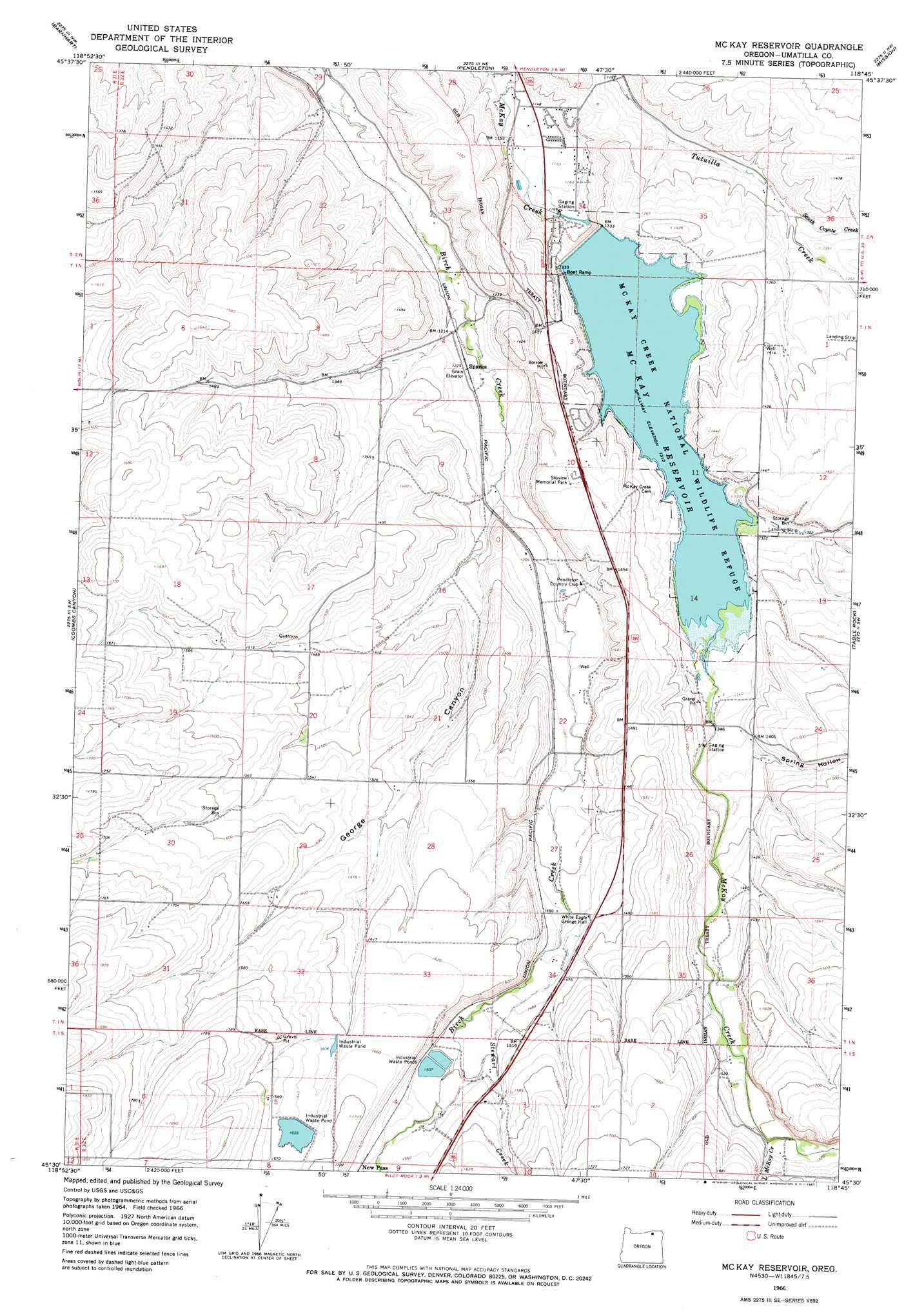
USGS Topo Quad 45118e7 - 1:24,000 scale
| Topo Map Name: | Mckay Reservoir |
| USGS Topo Quad ID: | 45118e7 |
| Print Size: | ca. 21 1/4" wide x 27" high |
| Southeast Coordinates: | 45.5° N latitude / 118.75° W longitude |
| Map Center Coordinates: | 45.5625° N latitude / 118.8125° W longitude |
| U.S. State: | OR |
| Filename: | o45118e7.jpg |
| Download Map JPG Image: | Mckay Reservoir topo map 1:24,000 scale |
| Map Type: | Topographic |
| Topo Series: | 7.5´ |
| Map Scale: | 1:24,000 |
| Source of Map Images: | United States Geological Survey (USGS) |
| Alternate Map Versions: |
Mc Kay Reservoir OR 1966, updated 1967 Download PDF Buy paper map McKay Reservoir OR 2011 Download PDF Buy paper map McKay Reservoir OR 2014 Download PDF Buy paper map |
1:24,000 Topo Quads surrounding Mckay Reservoir
Stanfield Se |
Holdman |
Holdman Se |
Helix |
Adams |
Nolin |
Barnhart |
Pendleton |
Mission |
Cayuse |
Echo Se |
Coombs Canyon |
Mckay Reservoir |
Table Rock |
Cabbage Hill |
Vinson |
Nye |
Pilot Rock |
Sevenmile Creek |
Bassey Creek |
Gurdane |
Carney Butte |
Granite Meadows |
Tamarack Gulch |
Bally Mountain |
> Back to 45118e1 at 1:100,000 scale
> Back to 45118a1 at 1:250,000 scale
> Back to U.S. Topo Maps home
Mckay Reservoir topo map: Gazetteer
Mckay Reservoir: Airports
Horne Airfield elevation 425m 1394′Mckay Reservoir: Benches
Stewart Bench elevation 515m 1689′Mckay Reservoir: Dams
McKay Dam elevation 378m 1240′Oregon Fibre Products Dam Number One elevation 507m 1663′
Mckay Reservoir: Parks
McKay Creek National Wildlife Refuge elevation 401m 1315′Mckay Reservoir: Populated Places
Green Meadows elevation 351m 1151′Mckay Reservoir: Post Offices
McKay Dam Post Office (historical) elevation 371m 1217′Salisbury Post Office (historical) elevation 401m 1315′
Mckay Reservoir: Reservoirs
McKay Reservoir elevation 378m 1240′Mckay Reservoir: Streams
Little McKay Creek elevation 456m 1496′South Coyote Creek elevation 396m 1299′
Stewart Creek elevation 414m 1358′
Mckay Reservoir: Valleys
George Canyon elevation 381m 1250′Spring Hollow elevation 418m 1371′
Mckay Reservoir digital topo map on disk
Buy this Mckay Reservoir topo map showing relief, roads, GPS coordinates and other geographical features, as a high-resolution digital map file on DVD: