Harvey Topo Map Michigan
To zoom in, hover over the map of Harvey
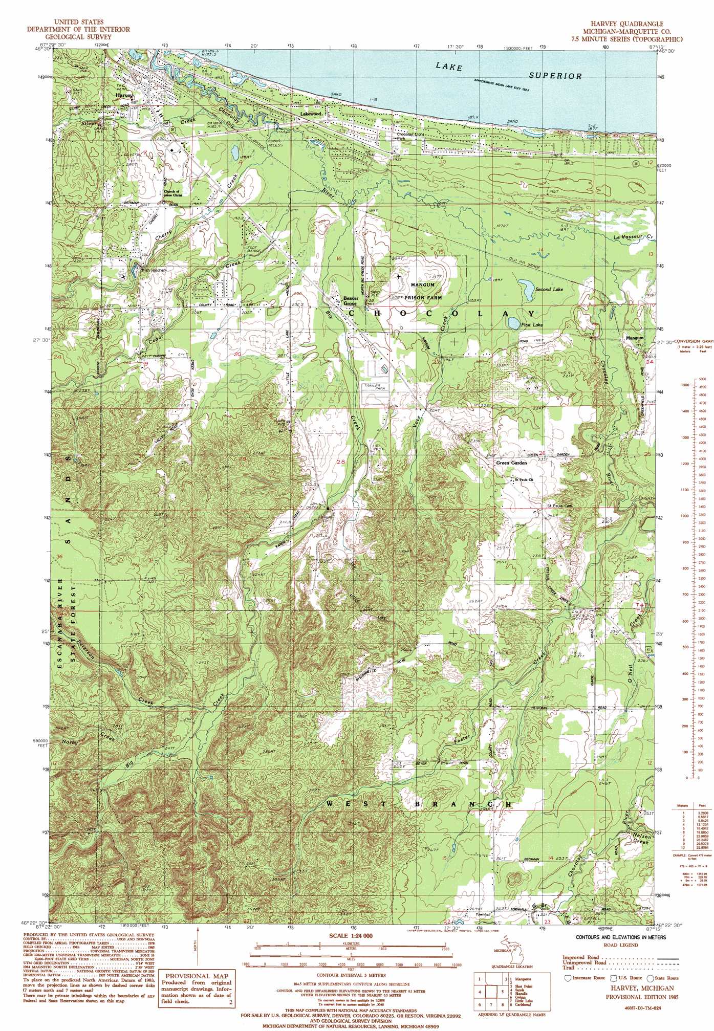
USGS Topo Quad 46087d3 - 1:24,000 scale
| Topo Map Name: | Harvey |
| USGS Topo Quad ID: | 46087d3 |
| Print Size: | ca. 21 1/4" wide x 27" high |
| Southeast Coordinates: | 46.375° N latitude / 87.25° W longitude |
| Map Center Coordinates: | 46.4375° N latitude / 87.3125° W longitude |
| U.S. State: | MI |
| Filename: | o46087d3.jpg |
| Download Map JPG Image: | Harvey topo map 1:24,000 scale |
| Map Type: | Topographic |
| Topo Series: | 7.5´ |
| Map Scale: | 1:24,000 |
| Source of Map Images: | United States Geological Survey (USGS) |
| Alternate Map Versions: |
Harvey MI 1985, updated 1985 Download PDF Buy paper map Harvey MI 2011 Download PDF Buy paper map Harvey MI 2014 Download PDF Buy paper map Harvey MI 2017 Download PDF Buy paper map |
1:24,000 Topo Quads surrounding Harvey
Buckroe |
Marquette Nw |
|||
Negaunee |
Marquette |
Shot Point |
||
Palmer |
Sands |
Harvey |
Skandia |
Sand River |
Cataract Basin |
Gwinn |
Little Lake |
Carlshend |
Ladoga |
Northland Ne |
Anderson Lake |
Helena |
Mcfarland |
Diffin |
> Back to 46087a1 at 1:100,000 scale
> Back to 46086a1 at 1:250,000 scale
> Back to U.S. Topo Maps home
Harvey topo map: Gazetteer
Harvey: Airports
Southfork Airport elevation 206m 675′Harvey: Lakes
First Lake elevation 190m 623′Second Lake elevation 190m 623′
Harvey: Populated Places
Beaver Grove elevation 191m 626′Green Garden elevation 251m 823′
Harvey elevation 199m 652′
Lakewood elevation 186m 610′
Mangum elevation 196m 643′
Pine Acres Trailer Court elevation 187m 613′
Silver Creek Estates elevation 201m 659′
Harvey: Post Offices
Greengarden Post Office (historical) elevation 251m 823′Harvey Post Office (historical) elevation 198m 649′
Mangum Post Office (historical) elevation 194m 636′
Harvey: Streams
Big Creek elevation 190m 623′Cedar Creek elevation 190m 623′
Cherry Creek elevation 190m 623′
East Branch Chocolay River elevation 250m 820′
Foster Creek elevation 200m 656′
LeVasseur Creek elevation 190m 623′
Nelson Creek elevation 240m 787′
Norby Creek elevation 249m 816′
O'Neil Creek elevation 204m 669′
Peterson Creek elevation 237m 777′
Silver Creek elevation 190m 623′
Voce Creek elevation 190m 623′
West Branch Chocolay River elevation 249m 816′
Harvey digital topo map on disk
Buy this Harvey topo map showing relief, roads, GPS coordinates and other geographical features, as a high-resolution digital map file on DVD: