Amnicon Point Topo Map Wisconsin
To zoom in, hover over the map of Amnicon Point
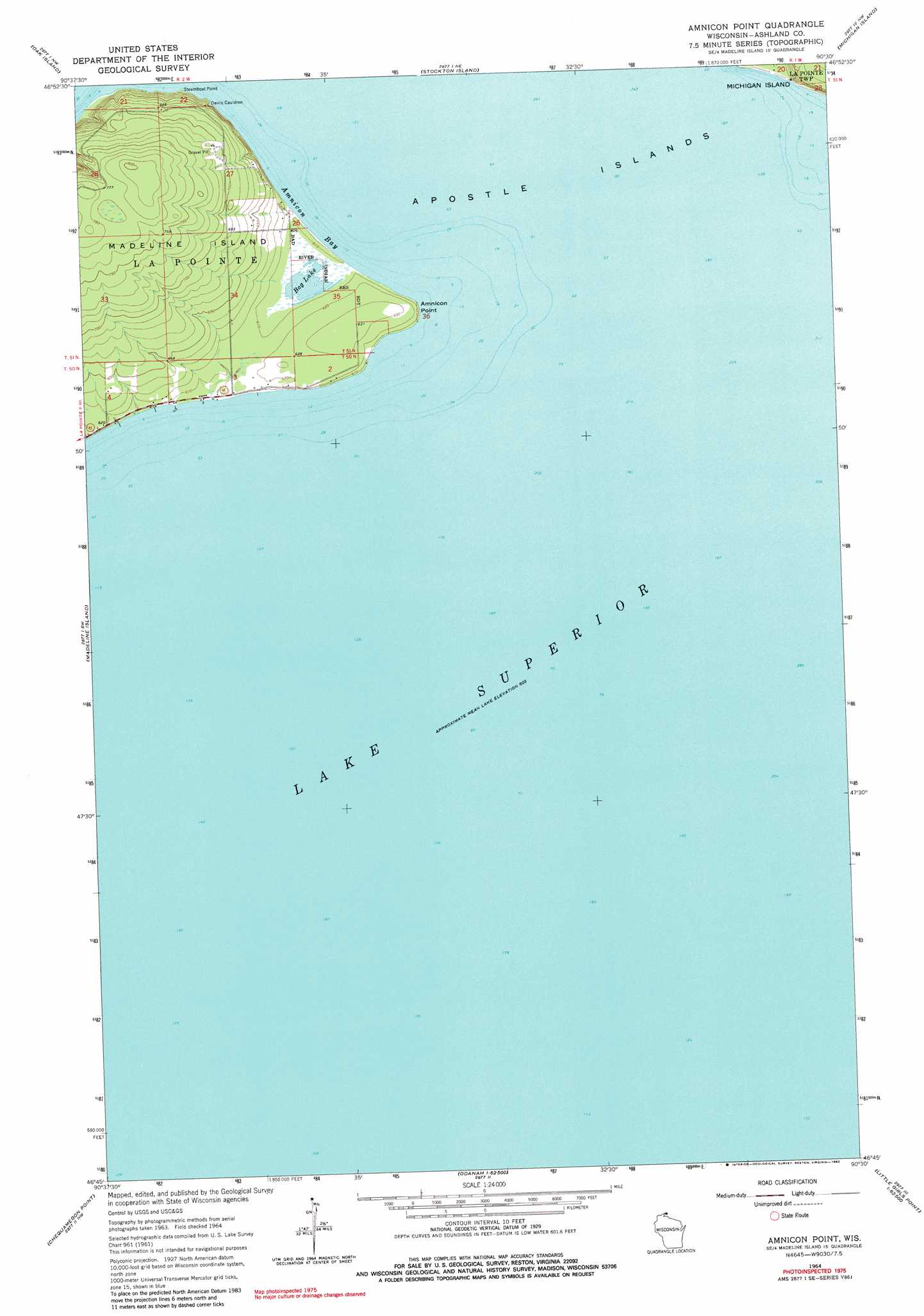
USGS Topo Quad 46090g5 - 1:24,000 scale
| Topo Map Name: | Amnicon Point |
| USGS Topo Quad ID: | 46090g5 |
| Print Size: | ca. 21 1/4" wide x 27" high |
| Southeast Coordinates: | 46.75° N latitude / 90.5° W longitude |
| Map Center Coordinates: | 46.8125° N latitude / 90.5625° W longitude |
| U.S. State: | WI |
| Filename: | o46090g5.jpg |
| Download Map JPG Image: | Amnicon Point topo map 1:24,000 scale |
| Map Type: | Topographic |
| Topo Series: | 7.5´ |
| Map Scale: | 1:24,000 |
| Source of Map Images: | United States Geological Survey (USGS) |
| Alternate Map Versions: |
Amnicon Point WI 1964, updated 1965 Download PDF Buy paper map Amnicon Point WI 1964, updated 1982 Download PDF Buy paper map Amnicon Point WI 2010 Download PDF Buy paper map Amnicon Point WI 2013 Download PDF Buy paper map Amnicon Point WI 2015 Download PDF Buy paper map |
1:24,000 Topo Quads surrounding Amnicon Point
Bear Island |
Rocky Island |
Cat Island |
Outer Island |
|
York Island |
Oak Island |
Stockton Island |
Michigan Island |
|
Bayfield |
Madeline Island |
Amnicon Point |
||
Long Island |
Chequamegon Point |
|||
Ashland East |
Odanah |
Cedar |
Oronto Bay |
Little Girls Point |
> Back to 46090e1 at 1:100,000 scale
> Back to 46090a1 at 1:250,000 scale
> Back to U.S. Topo Maps home
Amnicon Point topo map: Gazetteer
Amnicon Point: Bays
Amnicon Bay elevation 184m 603′Devils Cauldron elevation 184m 603′
Amnicon Point: Capes
Amnicon Point elevation 189m 620′Steamboat Point elevation 185m 606′
Amnicon Point: Lakes
Bog Lake elevation 184m 603′Amnicon Point digital topo map on disk
Buy this Amnicon Point topo map showing relief, roads, GPS coordinates and other geographical features, as a high-resolution digital map file on DVD: