Oulu Topo Map Wisconsin
To zoom in, hover over the map of Oulu
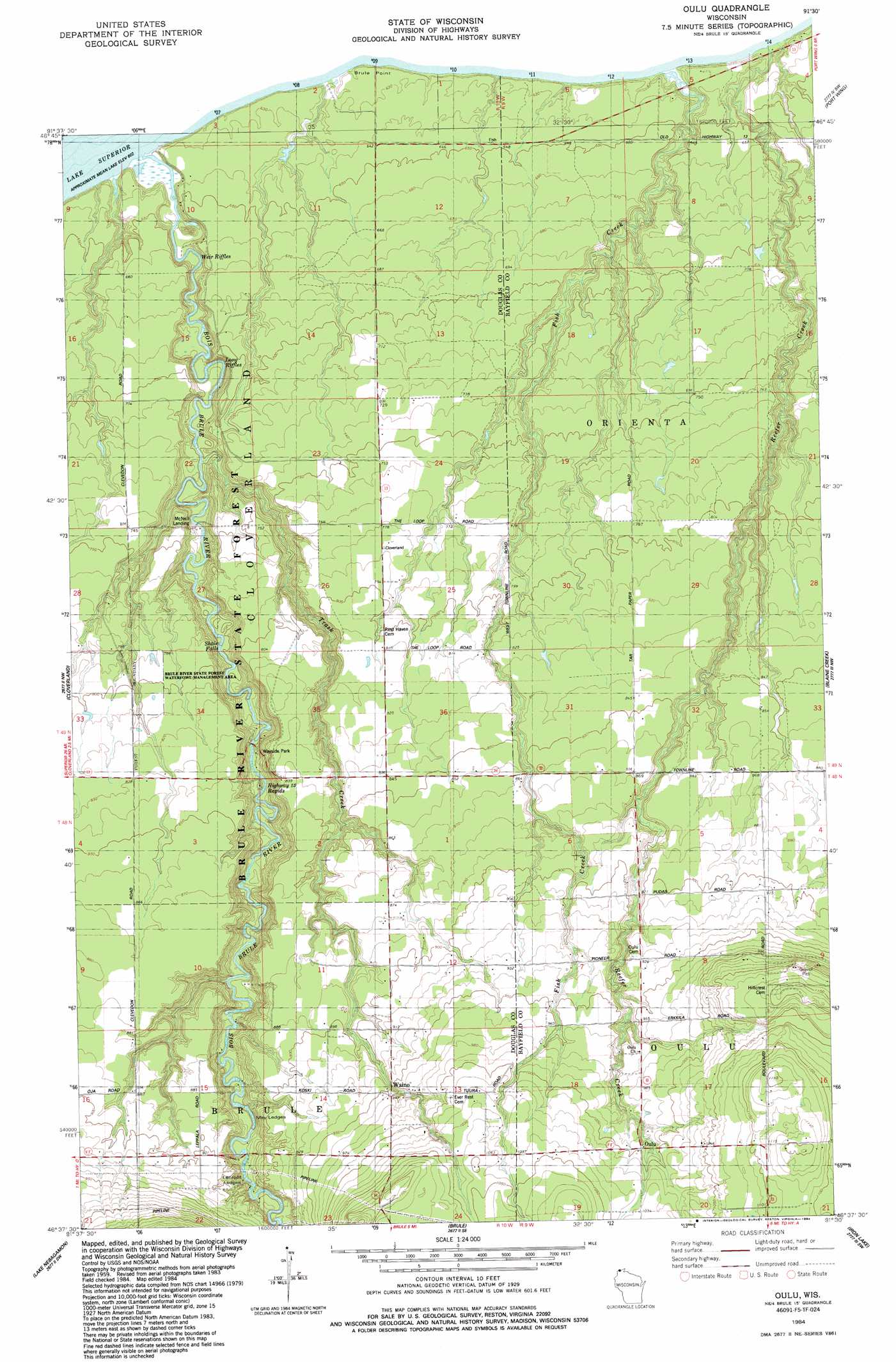
USGS Topo Quad 46091f5 - 1:24,000 scale
| Topo Map Name: | Oulu |
| USGS Topo Quad ID: | 46091f5 |
| Print Size: | ca. 21 1/4" wide x 27" high |
| Southeast Coordinates: | 46.625° N latitude / 91.5° W longitude |
| Map Center Coordinates: | 46.6875° N latitude / 91.5625° W longitude |
| U.S. State: | WI |
| Filename: | o46091f5.jpg |
| Download Map JPG Image: | Oulu topo map 1:24,000 scale |
| Map Type: | Topographic |
| Topo Series: | 7.5´ |
| Map Scale: | 1:24,000 |
| Source of Map Images: | United States Geological Survey (USGS) |
| Alternate Map Versions: |
Oulu WI 1984, updated 1984 Download PDF Buy paper map Oulu WI 2010 Download PDF Buy paper map Oulu WI 2013 Download PDF Buy paper map Oulu WI 2015 Download PDF Buy paper map |
1:24,000 Topo Quads surrounding Oulu
Knife River |
||||
Port Wing |
Herbster |
|||
Poplar Ne |
Cloverland |
Oulu |
Blaine Creek |
Iron Lake Ne |
Poplar |
Lake Nebagamon |
Brule |
Iron Lake |
Hart Lake |
Bennett |
Lake Minnesuing |
Island Lake |
Drummond Nw |
Delta |
> Back to 46091e1 at 1:100,000 scale
> Back to 46090a1 at 1:250,000 scale
> Back to U.S. Topo Maps home
Oulu topo map: Gazetteer
Oulu: Falls
Shale Falls elevation 211m 692′Oulu: Parks
Brule River Boreal Forest State Natural Area elevation 196m 643′Brule River State Forest Waterfowl Management Area elevation 242m 793′
Oulu: Populated Places
Oulu elevation 304m 997′Waino elevation 290m 951′
Oulu: Rapids
Highway Thirteen Rapids elevation 220m 721′Lenroot Ledges elevation 253m 830′
Long Riffles elevation 195m 639′
May Ledges elevation 242m 793′
Weir Riffles elevation 186m 610′
Oulu: Streams
Bois Brule River elevation 183m 600′Trask Creek elevation 201m 659′
Oulu digital topo map on disk
Buy this Oulu topo map showing relief, roads, GPS coordinates and other geographical features, as a high-resolution digital map file on DVD: