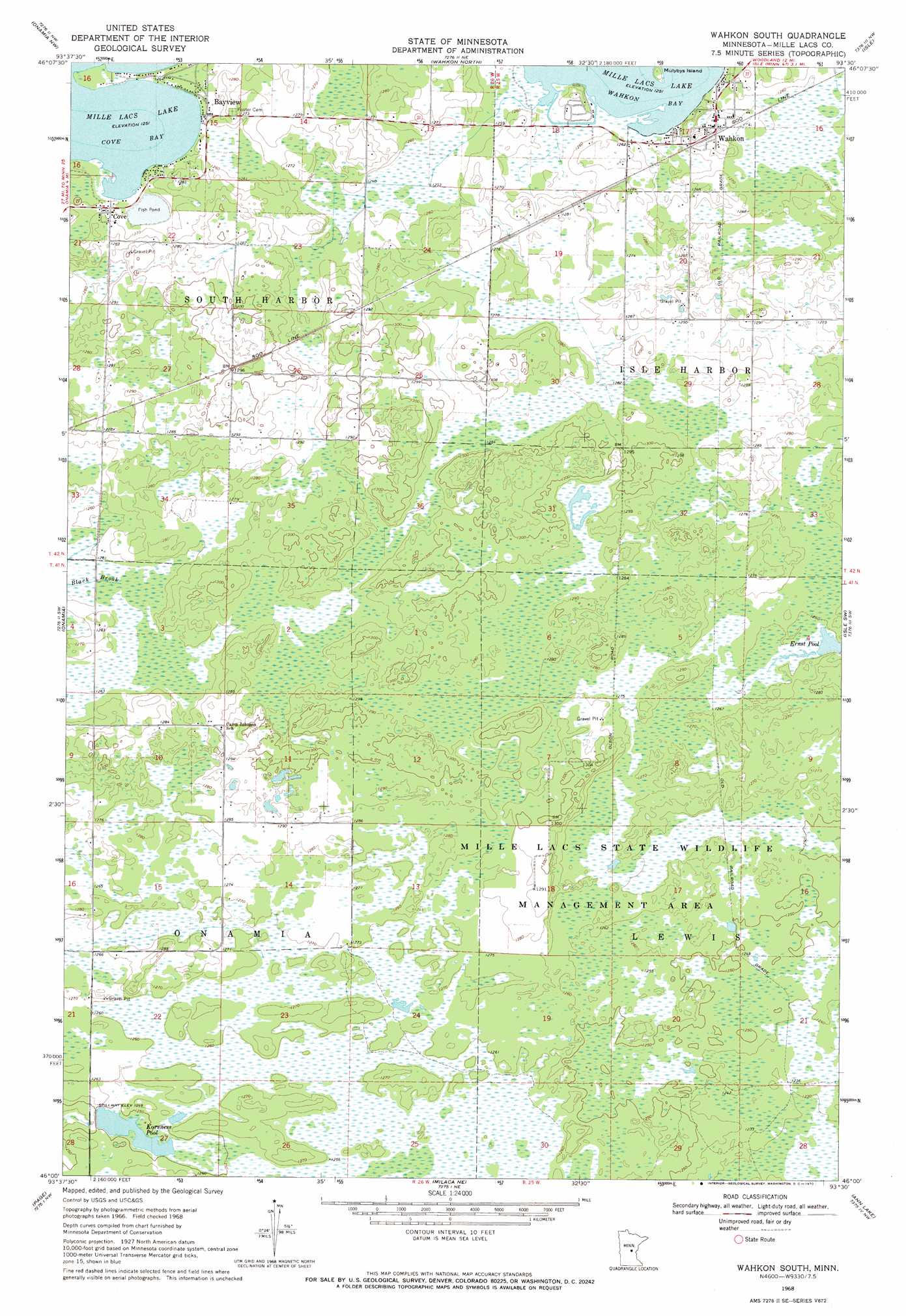
Wahkon South Topo Map Minnesota
To zoom in, hover over the map of Wahkon South
USGS Topo Quad 46093a5 - 1:24,000 scale
| Topo Map Name: | Wahkon South |
| USGS Topo Quad ID: | 46093a5 |
| Print Size: | ca. 21 1/4" wide x 27" high |
| Southeast Coordinates: | 46° N latitude / 93.5° W longitude |
| Map Center Coordinates: | 46.0625° N latitude / 93.5625° W longitude |
| U.S. State: | MN |
| Filename: | o46093a5.jpg |
| Download Map JPG Image: | Wahkon South topo map 1:24,000 scale |
| Map Type: | Topographic |
| Topo Series: | 7.5´ |
| Map Scale: | 1:24,000 |
| Source of Map Images: | United States Geological Survey (USGS) |
| Alternate Map Versions: |
Wahkon South MN 1968, updated 1970 Download PDF Buy paper map Wahkon South MN 2010 Download PDF Buy paper map Wahkon South MN 2013 Download PDF Buy paper map Wahkon South MN 2016 Download PDF Buy paper map |
1:24,000 Topo Quads surrounding Wahkon South
Garrison |
Wealthwood |
Malmo |
Thor Sw |
Thor Se |
Vineland |
Onamia Nw |
Wahkon North |
Isle |
Mcgrath |
Hillman Se |
Onamia |
Wahkon South |
Isle Sw |
Warman |
Ramey Ne |
Page |
Milaca Ne |
Ann Lake |
Mora North |
Rum River |
Milaca |
Bock |
Ogilvie |
Mora South |
> Back to 46093a1 at 1:100,000 scale
> Back to 46092a1 at 1:250,000 scale
> Back to U.S. Topo Maps home
Wahkon South topo map: Gazetteer
Wahkon South: Bays
Cove Bay elevation 381m 1250′Wahkon South: Dams
Korsness Pool Dam elevation 380m 1246′Wahkon South: Islands
Mulybys Island elevation 385m 1263′Wahkon South: Populated Places
Bayview elevation 383m 1256′Cove elevation 385m 1263′
Wahkon elevation 388m 1272′
Wahkon South: Reservoirs
Korness Pool elevation 380m 1246′Korsness Pool elevation 378m 1240′
Wahkon South digital topo map on disk
Buy this Wahkon South topo map showing relief, roads, GPS coordinates and other geographical features, as a high-resolution digital map file on DVD: