Timber Buttes South Topo Map Montana
To zoom in, hover over the map of Timber Buttes South
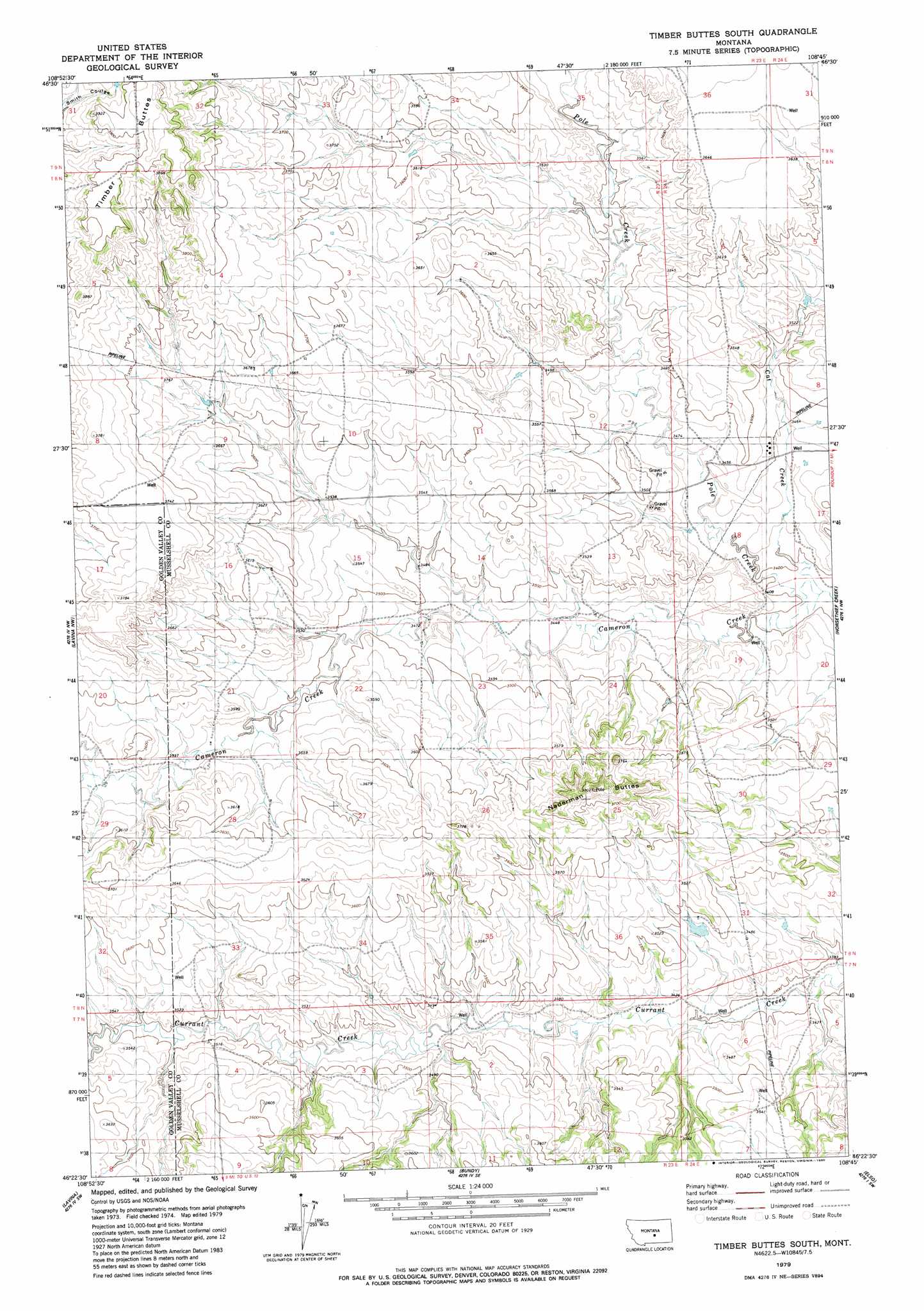
USGS Topo Quad 46108d7 - 1:24,000 scale
| Topo Map Name: | Timber Buttes South |
| USGS Topo Quad ID: | 46108d7 |
| Print Size: | ca. 21 1/4" wide x 27" high |
| Southeast Coordinates: | 46.375° N latitude / 108.75° W longitude |
| Map Center Coordinates: | 46.4375° N latitude / 108.8125° W longitude |
| U.S. State: | MT |
| Filename: | o46108d7.jpg |
| Download Map JPG Image: | Timber Buttes South topo map 1:24,000 scale |
| Map Type: | Topographic |
| Topo Series: | 7.5´ |
| Map Scale: | 1:24,000 |
| Source of Map Images: | United States Geological Survey (USGS) |
| Alternate Map Versions: |
Timber Buttes South MT 1979, updated 1980 Download PDF Buy paper map Timber Buttes South MT 2011 Download PDF Buy paper map Timber Buttes South MT 2014 Download PDF Buy paper map |
1:24,000 Topo Quads surrounding Timber Buttes South
Sahara Hill |
Devils Hole Lake |
Pender Coulee |
Lake Mason Nw |
Lake Mason Ne |
Sahara Hill Se |
Emory School |
Timber Buttes North |
Lake Mason |
Lake Mason Se |
Cushman Ne |
Lavina Nw |
Timber Buttes South |
Horse Thief Creek |
Roundup |
Cushman |
Lavina |
Bundy |
Elso |
Harper Coulee |
Eagle Point |
Belmont |
Broadview Ne |
Hay Basin North |
Hay Basin Ne |
> Back to 46108a1 at 1:100,000 scale
> Back to 46108a1 at 1:250,000 scale
> Back to U.S. Topo Maps home
Timber Buttes South topo map: Gazetteer
Timber Buttes South: Streams
Cameron Creek elevation 1033m 3389′Cat Creek elevation 1033m 3389′
Pole Creek elevation 1033m 3389′
Timber Buttes South: Summits
Naderman Buttes elevation 1159m 3802′Timber Buttes elevation 1204m 3950′
Timber Buttes South: Valleys
Twin Coulee elevation 1079m 3540′Timber Buttes South: Wells
08N23E12DBC_01 Well elevation 1061m 3480′08N23E21CDCA01 Well elevation 1073m 3520′
08N23E23CCCC01 Well elevation 1099m 3605′
08N24E19ACDD01 Well elevation 1040m 3412′
09N23E33DDAB01 Well elevation 1103m 3618′
Timber Buttes South digital topo map on disk
Buy this Timber Buttes South topo map showing relief, roads, GPS coordinates and other geographical features, as a high-resolution digital map file on DVD: