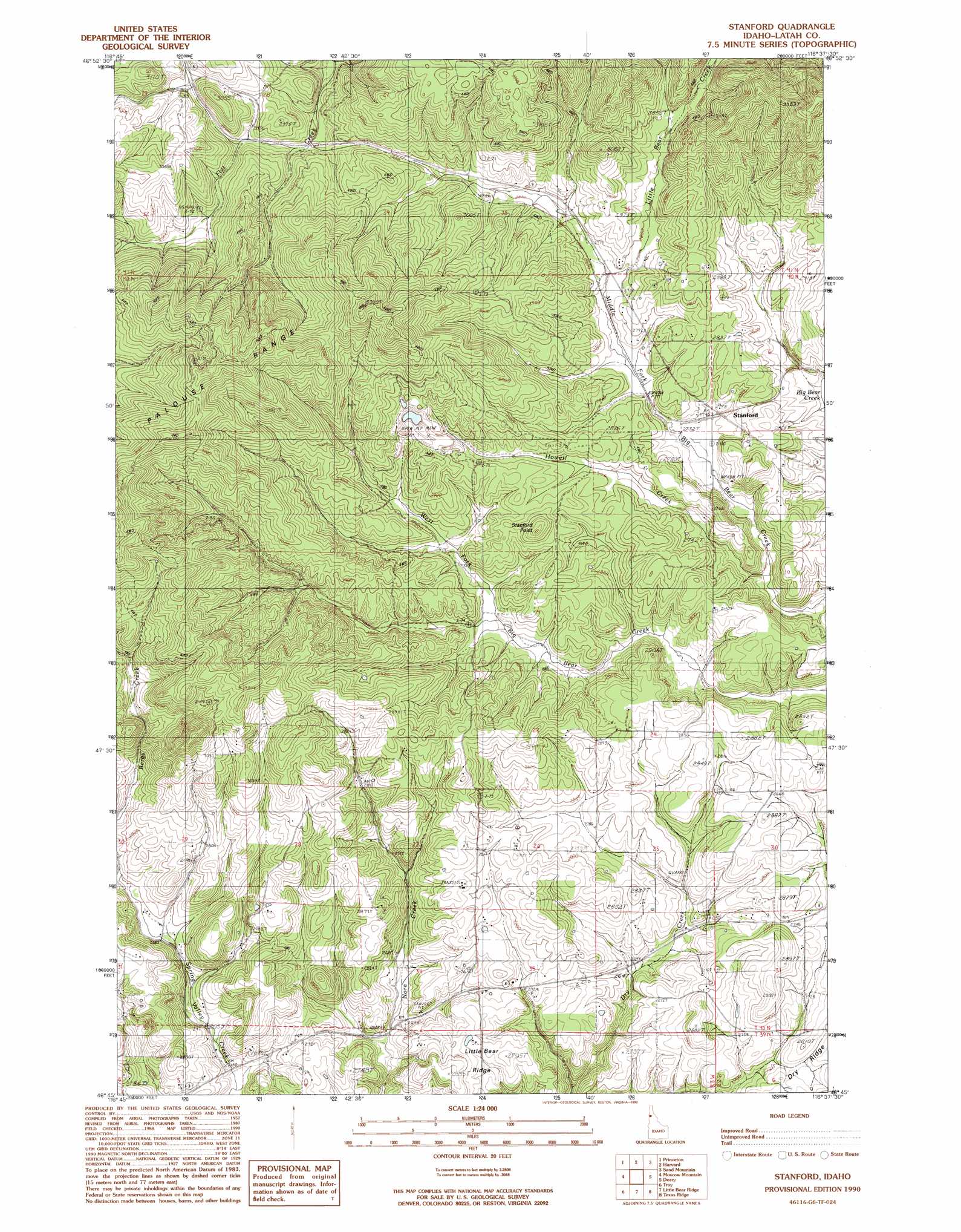
Stanford Topo Map Idaho
To zoom in, hover over the map of Stanford
USGS Topo Quad 46116g6 - 1:24,000 scale
| Topo Map Name: | Stanford |
| USGS Topo Quad ID: | 46116g6 |
| Print Size: | ca. 21 1/4" wide x 27" high |
| Southeast Coordinates: | 46.75° N latitude / 116.625° W longitude |
| Map Center Coordinates: | 46.8125° N latitude / 116.6875° W longitude |
| U.S. State: | ID |
| Filename: | o46116g6.jpg |
| Download Map JPG Image: | Stanford topo map 1:24,000 scale |
| Map Type: | Topographic |
| Topo Series: | 7.5´ |
| Map Scale: | 1:24,000 |
| Source of Map Images: | United States Geological Survey (USGS) |
| Alternate Map Versions: |
Stanford ID 1990, updated 1990 Download PDF Buy paper map Stanford ID 1994, updated 1997 Download PDF Buy paper map Stanford ID 2011 Download PDF Buy paper map Stanford ID 2014 Download PDF Buy paper map |
| FStopo: | US Forest Service topo Stanford is available: Download FStopo PDF Download FStopo TIF |
1:24,000 Topo Quads surrounding Stanford
Mission Mountain |
Sanders |
West Dennis |
Emida |
Fernwood |
Potlatch |
Princeton |
Harvard |
Sand Mountain |
Abes Knob |
Robinson Lake |
Moscow Mountain |
Stanford |
Deary |
Bovill |
Moscow East |
Troy |
Little Bear Ridge |
Texas Ridge |
Park |
Genesee |
Green Knob |
Juliaetta |
Lenore |
Southwick |
> Back to 46116e1 at 1:100,000 scale
> Back to 46116a1 at 1:250,000 scale
> Back to U.S. Topo Maps home
Stanford topo map: Gazetteer
Stanford: Populated Places
Nora elevation 814m 2670′Stanford elevation 845m 2772′
Yale (historical) elevation 877m 2877′
Stanford: Streams
East Fork Little Hawk Creek elevation 851m 2791′Howell Creek elevation 825m 2706′
Little Bear Creek elevation 843m 2765′
Little Hawk Creek elevation 839m 2752′
West Fork Little Hawk Creek elevation 852m 2795′
Stanford: Summits
Stanford Point elevation 899m 2949′Stanford digital topo map on disk
Buy this Stanford topo map showing relief, roads, GPS coordinates and other geographical features, as a high-resolution digital map file on DVD: